Marlow, Oklahoma
| Marlow, Oklahoma | |
|---|---|
| City | |
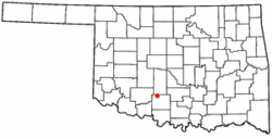 Location of Marlow, Oklahoma | |
| Coordinates: 34°38′36″N 97°57′32″W / 34.64333°N 97.95889°WCoordinates: 34°38′36″N 97°57′32″W / 34.64333°N 97.95889°W | |
| Country | United States |
| State | Oklahoma |
| County | Stephens |
| Area | |
| • Total | 7.1 sq mi (18.4 km2) |
| • Land | 7.1 sq mi (18.4 km2) |
| • Water | 0.0 sq mi (0.0 km2) |
| Elevation | 1,312 ft (400 m) |
| Population (2000) | |
| • Total | 4,662 |
| • Density | 657/sq mi (253/km2) |
| Time zone | Central (CST) (UTC-6) |
| • Summer (DST) | CDT (UTC-5) |
| ZIP code | 73055 |
| Area code(s) | 580 |
| FIPS code | 40-46600[1] |
| GNIS feature ID | 1095149[2] |
Marlow is a city in Stephens County, Oklahoma, United States. The population was 4,662 at the 2010 census.
Geography
Marlow is located in northern Stephens County, Oklahoma, in the southern part of the state, at 34°38′36″N 97°57′32″W / 34.64333°N 97.95889°W (34.643410, -97.958806).[3]
According to the United States Census Bureau, the city has a total area of 7.1 square miles (18 km2), of which, 7.1 square miles (18 km2) of it is land and 0.14% is water.
Demographics
| Historical population | |||
|---|---|---|---|
| Census | Pop. | %± | |
| 1900 | 1,016 | — | |
| 1910 | 1,965 | 93.4% | |
| 1920 | 2,276 | 15.8% | |
| 1930 | 3,084 | 35.5% | |
| 1940 | 2,899 | −6.0% | |
| 1950 | 3,399 | 17.2% | |
| 1960 | 4,027 | 18.5% | |
| 1970 | 3,995 | −0.8% | |
| 1980 | 5,017 | 25.6% | |
| 1990 | 4,416 | −12.0% | |
| 2000 | 4,592 | 4.0% | |
| 2010 | 4,662 | 1.5% | |
| Est. 2015 | 4,594 | [4] | −1.5% |
As of the census of 2010, there were 4,662 people, 1,862 households, and 1,257 families residing in the city.[6] The population density was 657 people per square mile (253/km²). There were 2,119 housing units at an average density of 298.5 per square mile (115/km²). The racial makeup of the city was 87.2% white, 0.2% African American, 5.2% Native American, 0.2% Asian, 1.6% from other races, and 5.6% from two or more races.[6] Hispanics or Latinos were 4.4% of the population, having doubled since 2000.
There were 1,862 households out of which half (50.1%) were married couples, a third (34.3%) included children under the age of 18, 12.6% had a female householder with no husband present, and 32.5% were non-families.[6] Less than a third (28.9) of households were made up of individuals; 14.5% of households had someone living alone who was 65 years of age or older.[6] The average household size was 2.44 and the average family size was 3.[6]
In the city the population was spread out with 25.8% under the age of 18, 7.5% from 18 to 24, 23.7% from 25 to 44, 24.4% from 45 to 64, and 18.6% who were 65 years of age or older.[6] The median age was 38.8 years.[6] For every 100 females there were 88 males.[6] For every 100 females age 18 and over, there were 82 males.[6]
The median income for a household in the city was $43,221, and the median income for a family was $57,713.[7] Males had a median income of $34,325 versus $29,21 for females.[7] The per capita income for the city was $20,299.[7] An estimated 10.7% of families and 15.2% of the population were below the poverty line, including 16.3% of those under age 18 and 12.7% of those age 65 or over.[7]
Entertainment
Entertainment in Marlow includes:
- Redbud Park located in the eastern part of the town that includes; the Hideout (a large playground), a trail through the park, a stage for concerts, and the Outlaw cave (the cave where the Marlows often hid out)
- The Life Center, a church funded recreational center that includes a basketball court, a walking track, and several rooms that can be rented
- Miller Park in the western part of the town that includes the public pool, Miller Pond, and the Mile trail
Sports
Marlow's sports team is the Outlaws. Though Formerly the Grey Wolves
Education
The City of Marlow is serviced by the Marlow Public School District
Central High is also located in Marlow, Oklahoma.
Notable residents
- Terry Brown, former NFL defensive back for Minnesota Vikings
- Ross Coyle, gridiron football player
- Joe Dial, former world record-holder in the pole vault and 2011 inductee into the Pole Vault Hall of Fame
- Cady Groves, singer-songwriter
- Sonny Liles, American football player
- Paul Sparks, actor, Boardwalk Empire
- Sam Hinkie, general manager of the Philadelphia 76ers
- Michael Lightner, 2001 NCAA Div-1 National Wrestling Champion, for the University of Oklahoma. Current Associate Head Coach, for the University of Oklahoma.
- Ray Miller, 1993 NCAA Div-1 National Wrestling Champion, for Arizona State University.
- Shawn Bateman, 1996 NCAA Div-2 National Wrestling Champion, for The University of Central Oklahoma.
References
- ↑ "American FactFinder". United States Census Bureau. Retrieved 2008-01-31.
- ↑ "US Board on Geographic Names". United States Geological Survey. 2007-10-25. Retrieved 2008-01-31.
- ↑ "US Gazetteer files: 2010, 2000, and 1990". United States Census Bureau. 2011-02-12. Retrieved 2011-04-23.
- ↑ "Annual Estimates of the Resident Population for Incorporated Places: April 1, 2010 to July 1, 2015". Retrieved July 2, 2016.
- ↑ "Census of Population and Housing". Census.gov. Retrieved June 4, 2015.
- 1 2 3 4 5 6 7 8 9 2010 Demographic Profile for Marlow, American FactFinder (accessed November 6, 2013)
- 1 2 3 4 2007-2011 American Community Survey 5-Year Estimates, American FactFinder (accessed November 6, 2013)
Municipalities and communities of Stephens County, Oklahoma, United States | ||
|---|---|---|
| Cities | 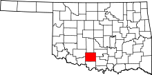 | |
| Towns | ||
| CDP | ||
| Unincorporated communities | ||
| Ghost town | ||