Maxfield Township, Bremer County, Iowa
| Maxfield Township, Bremer County | |
|---|---|
| Township | |
 | |
| Coordinates: 42°41′16″N 092°15′19″W / 42.68778°N 92.25528°WCoordinates: 42°41′16″N 092°15′19″W / 42.68778°N 92.25528°W | |
| Country |
|
| State |
|
| County | Bremer |
| Area | |
| • Total | 36.41 sq mi (94.3 km2) |
| • Land | 36.41 sq mi (94.3 km2) |
| • Water | 0 sq mi (0 km2) |
| Elevation[1] | 1,010 ft (308 m) |
| Population (2010) | |
| • Total | 1,314 |
| • Density | 36.1/sq mi (13.9/km2) |
| Time zone | Central (UTC-6) |
| • Summer (DST) | Central (UTC-5) |
| FIPS code | 19-92898[2] |
| GNIS feature ID | 0468369 |
Maxfield Township is one of fourteen townships in Bremer County, Iowa, USA. As of the 2000 census, its population was 1,314.[3]
Geography
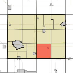
Maxfield Township covers an area of 36.41 square miles (94.3 km2) and contains one incorporated settlement, Readlyn. According to the USGS, it contains six cemeteries: Emanuel Evangelical Lutheran, Saint Johns Lutheran, Saint Mathews Lutheran, Saint Pauls (two cemeteries of this name) and Zions.
References
- ↑ "US Board on Geographic Names". United States Geological Survey. 2007-10-25. Retrieved 2008-01-31.
- ↑ "American FactFinder". United States Census Bureau. Retrieved 2008-01-31.
- ↑ "IA - Maxfield township". United States Census Bureau. Retrieved March 17, 2013.
External links
Municipalities and communities of Bremer County, Iowa, United States | ||
|---|---|---|
| Cities | ||
| Townships | ||
| Unincorporated communities |
| |
| Footnotes | ‡This populated place also has portions in an adjacent county or counties | |
This article is issued from Wikipedia - version of the 7/30/2014. The text is available under the Creative Commons Attribution/Share Alike but additional terms may apply for the media files.