Maysan Road
| Malinta–Maysan–Paso de Blas–Bagbaguin Road | |
 Maysan Road in Malinta | |
| Length | 4.5 km (2.8 mi) |
|---|---|
| Location | Valenzuela |
| West end | MacArthur Highway in Malinta |
| Major junctions |
T. Santiago Street North Luzon Expressway |
| East end | A. Mariano Street in Bagbaguin |
Maysan Road is one of the main east-west thoroughfares of Valenzuela, Philippines. It is a narrow street with only one lane in each direction making it one of the most congested streets in northern Metro Manila. It runs for approximately 4.5 kilometres (2.8 mi) from MacArthur Highway in Malinta village, past the North Luzon Expressway intersection, into North Caloocan. The road connects the central Valenzuela villages of Malinta, Maysan, Paso de Blas and Bagbaguin. It was the main access road for vehicles going to Valenzuela and the Manila North Harbor from the North Luzon Expressway prior to the construction of Mindanao Avenue Extension (NLEX Segment 9/NLEX-Karuhatan Link) which parallels it to the south.[1]
Name
The street is named for the village it passes near MacArthur Highway. Maysan, in turn, comes from the Filipino word "maisan" which means "corn field."[2] It is also known by several different names depending on the area it goes through (e.g., Paso de Blas Road in Paso de Blas and Bagbaguin Road in Bagbaguin). It is also sometimes called Malinta Road being the road that originates in the village of Malinta that goes to and from the North Luzon Expressway Malinta Interchange (now called Paso De Blas Interchange).
Route description
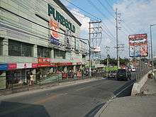
Maysan Road commences at MacArthur Highway in downtown Valenzuela where the Valenzuela City Hall, the Pamantasan ng Lungsod ng Valenzuela and the old Valenzuela railway station are located. It heads east and enters the village of Maysan where it passes St. Louis College of Valenzuela, Tierra Santa Memorial Park and Maysan Elementary School. At Paso de Blas village, the road intersects with T. Santiago Street and heads for the Valenzuela Interchange of the North Luzon Expressway (NLEX). Located near this interchange is Puregold Paso de Blas (former Royal Family Mall). Between the East Service Road of NLEX and G. Molina Street, the road marks the border between Paso de Blas and Canumay East. Maysan Road terminates at the intersection with ITC Compound Road by Valenzuela's border with North Caloocan where it continues as General Luis Street all the way to Quirino Highway in Novaliches, Quezon City.
References
- ↑ "MNTC opens new NLEx segment". Philippine Daily Inquirer. Retrieved 10 May 2015.
- ↑ "Maysan". City Government of Valenzuela. Retrieved 10 May 2015.
Coordinates: 14°41′39″N 120°58′09″E / 14.6941667°N 120.969166°E