McCord Bend, Missouri
| McCord Bend, Missouri | |
|---|---|
| Village | |
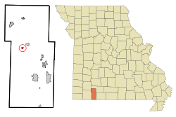 Location of McCord Bend, Missouri | |
| Coordinates: 36°47′14″N 93°30′14″W / 36.78722°N 93.50389°WCoordinates: 36°47′14″N 93°30′14″W / 36.78722°N 93.50389°W | |
| Country | United States |
| State | Missouri |
| County | Stone |
| Area[1] | |
| • Total | 0.32 sq mi (0.83 km2) |
| • Land | 0.29 sq mi (0.75 km2) |
| • Water | 0.03 sq mi (0.08 km2) |
| Elevation | 968 ft (295 m) |
| Population (2010)[2] | |
| • Total | 297 |
| • Estimate (2012[3]) | 286 |
| • Density | 1,024.1/sq mi (395.4/km2) |
| Time zone | Central (CST) (UTC-6) |
| • Summer (DST) | CDT (UTC-5) |
| FIPS code | 29-44829[4] |
| GNIS feature ID | 1669611[5] |
McCord Bend is a village in Stone County, Missouri, United States. The population was 297 at the 2010 census. It is part of the Branson, Missouri Micropolitan Statistical Area.
Geography
McCord Bend is located at 36°47′14″N 93°30′14″W / 36.78722°N 93.50389°W (36.787284, -93.503906).[6]
According to the United States Census Bureau, the village has a total area of 0.32 square miles (0.83 km2), of which, 0.29 square miles (0.75 km2) of it is land and 0.03 square miles (0.08 km2) is water.[1]
Demographics
| Historical population | |||
|---|---|---|---|
| Census | Pop. | %± | |
| 2000 | 292 | — | |
| 2010 | 297 | 1.7% | |
| Est. 2015 | 275 | [7] | −7.4% |
2010 census
As of the census[2] of 2010, there were 297 people, 114 households, and 78 families residing in the village. The population density was 1,024.1 inhabitants per square mile (395.4/km2). There were 155 housing units at an average density of 534.5 per square mile (206.4/km2). The racial makeup of the village was 96.0% White, 0.3% African American, 0.7% Native American, 0.3% Asian, and 2.7% from two or more races. Hispanic or Latino of any race were 2.7% of the population.
There were 114 households of which 31.6% had children under the age of 18 living with them, 53.5% were married couples living together, 11.4% had a female householder with no husband present, 3.5% had a male householder with no wife present, and 31.6% were non-families. 27.2% of all households were made up of individuals and 9.7% had someone living alone who was 65 years of age or older. The average household size was 2.61 and the average family size was 3.19.
The median age in the village was 41.3 years. 24.2% of residents were under the age of 18; 8.9% were between the ages of 18 and 24; 21.7% were from 25 to 44; 28.9% were from 45 to 64; and 16.5% were 65 years of age or older. The gender makeup of the village was 48.8% male and 51.2% female.
2000 census
As of the census[4] of 2000, there were 292 people, 115 households, and 84 families residing in the village. The population density was 1,033.0 people per square mile (402.6/km²). There were 155 housing units at an average density of 548.3 per square mile (213.7/km²). The racial makeup of the village was 96.92% White, 1.03% Native American, 0.34% Asian, and 1.71% from two or more races. Hispanic or Latino of any race were 1.03% of the population.
There were 115 households out of which 27.0% had children under the age of 18 living with them, 57.4% were married couples living together, 13.9% had a female householder with no husband present, and 26.1% were non-families. 21.7% of all households were made up of individuals and 11.3% had someone living alone who was 65 years of age or older. The average household size was 2.54 and the average family size was 2.94.
In the village the population was spread out with 24.7% under the age of 18, 7.2% from 18 to 24, 24.3% from 25 to 44, 26.4% from 45 to 64, and 17.5% who were 65 years of age or older. The median age was 40 years. For every 100 females there were 102.8 males. For every 100 females age 18 and over, there were 93.0 males.
The median income for a household in the village was $27,143, and the median income for a family was $28,750. Males had a median income of $25,625 versus $17,500 for females. The per capita income for the village was $11,703. About 24.7% of families and 25.5% of the population were below the poverty line, including 46.8% of those under the age of eighteen and 8.9% of those sixty five or over.
References
- 1 2 "US Gazetteer files 2010". United States Census Bureau. Archived from the original on January 24, 2012. Retrieved 2012-07-08.
- 1 2 "American FactFinder". United States Census Bureau. Retrieved 2012-07-08.
- ↑ "Population Estimates". United States Census Bureau. Archived from the original on June 17, 2013. Retrieved 2013-05-30.
- 1 2 "American FactFinder". United States Census Bureau. Archived from the original on September 11, 2013. Retrieved 2008-01-31.
- ↑ "US Board on Geographic Names". United States Geological Survey. 2007-10-25. Retrieved 2008-01-31.
- ↑ "US Gazetteer files: 2010, 2000, and 1990". United States Census Bureau. 2011-02-12. Retrieved 2011-04-23.
- ↑ "Annual Estimates of the Resident Population for Incorporated Places: April 1, 2010 to July 1, 2015". Retrieved July 2, 2016.
- ↑ "Census of Population and Housing". Census.gov. Archived from the original on May 11, 2015. Retrieved June 4, 2015.
Municipalities and communities of Stone County, Missouri, United States | ||
|---|---|---|
| Cities | 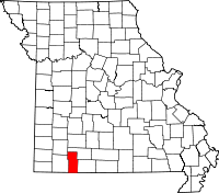 | |
| Villages | ||
| CDP | ||
| Unincorporated communities | ||
| Footnotes | ‡This populated place also has portions in an adjacent county or counties | |