Menno, South Dakota
| Menno, South Dakota | |
|---|---|
| City | |
 Location in Hutchinson County and the state of South Dakota | |
| Coordinates: 43°14′16″N 97°34′39″W / 43.23778°N 97.57750°WCoordinates: 43°14′16″N 97°34′39″W / 43.23778°N 97.57750°W | |
| Country | United States |
| State | South Dakota |
| County | Hutchinson |
| Incorporated | 1910[1] |
| Area[2] | |
| • Total | 0.52 sq mi (1.35 km2) |
| • Land | 0.52 sq mi (1.35 km2) |
| • Water | 0 sq mi (0 km2) |
| Elevation | 1,329 ft (405 m) |
| Population (2010)[3] | |
| • Total | 608 |
| • Estimate (2015)[4] | 595 |
| • Density | 1,169.2/sq mi (451.4/km2) |
| Time zone | Central (CST) (UTC-6) |
| • Summer (DST) | CDT (UTC-5) |
| ZIP code | 57045 |
| Area code(s) | 605 |
| FIPS code | 46-41980[5] |
| GNIS feature ID | 1256434[6] |
| Website | http://www.mennosd.org/ |
Menno is a city in Hutchinson County, South Dakota, United States. The population was 608 at the 2010 census.
Menno was laid out in 1879.[7]
Geography
Menno is located at 43°14′16″N 97°34′39″W / 43.23778°N 97.57750°W (43.237840, -97.577440).[8]
According to the United States Census Bureau, the city has a total area of 0.52 square miles (1.35 km2), all of it land.[2]
Menno has been assigned the ZIP code 57045 and the FIPS place code 41980.
Demographics
| Historical population | |||
|---|---|---|---|
| Census | Pop. | %± | |
| 1880 | 52 | — | |
| 1890 | 413 | 694.2% | |
| 1900 | 556 | 34.6% | |
| 1910 | 621 | 11.7% | |
| 1920 | 918 | 47.8% | |
| 1930 | 909 | −1.0% | |
| 1940 | 966 | 6.3% | |
| 1950 | 868 | −10.1% | |
| 1960 | 837 | −3.6% | |
| 1970 | 796 | −4.9% | |
| 1980 | 793 | −0.4% | |
| 1990 | 768 | −3.2% | |
| 2000 | 729 | −5.1% | |
| 2010 | 608 | −16.6% | |
| Est. 2015 | 595 | [9] | −2.1% |
| U.S. Decennial Census[10] 2015 Estimate[4] | |||
2010 census
As of the census[3] of 2010, there were 608 people, 285 households, and 173 families residing in the city. The population density was 1,169.2 inhabitants per square mile (451.4/km2). There were 327 housing units at an average density of 628.8 per square mile (242.8/km2). The racial makeup of the city was 98.7% White, 0.5% Native American, and 0.8% from two or more races. Hispanic or Latino of any race were 0.8% of the population.
There were 285 households of which 17.5% had children under the age of 18 living with them, 54.4% were married couples living together, 4.2% had a female householder with no husband present, 2.1% had a male householder with no wife present, and 39.3% were non-families. 37.2% of all households were made up of individuals and 21.4% had someone living alone who was 65 years of age or older. The average household size was 1.96 and the average family size was 2.53.
The median age in the city was 57.1 years. 15% of residents were under the age of 18; 3.9% were between the ages of 18 and 24; 14.3% were from 25 to 44; 26.5% were from 45 to 64; and 40.3% were 65 years of age or older. The gender makeup of the city was 46.2% male and 53.8% female.
2000 census
As of the census[5] of 2000, there were 729 people, 317 households, and 199 families residing in the city. The population density was 1,435.8 people per square mile (551.9/km²). There were 358 housing units at an average density of 705.1 per square mile (271.0/km²). The racial makeup of the city was 98.77% White, 0.14% African American, 0.41% Native American, and 0.69% from two or more races.
There were 317 homes out of which 22.1% had children under the age of 18 living with them, 56.2% were married couples living together, 4.4% had a female householder with no husband present, and 37.2% were non-families. 35.3% of all households were made up of individuals, and 25.2% had someone living alone who was 65 years of age or older. The average household size was 2.15 and the average family size was 2.77.
In the city the population was spread out with 20.3% under the age of 18, 4.0% from 18 to 24, 18.1% from 25 to 44, 17.8% from 45 to 64, and 39.8% who were 65 years of age or older. The median age was 52 years. For every 100 females there were 90.8 males. For every 100 females age 18 and over, there were 81.0 males.
The median income for a household in the city was $26,750, and the median income for a family was $38,125. Males had a median income of $23,194 versus $18,750 for females. The per capita income for the city was $14,668. About 7.7% of families and 9.0% of the population were below the poverty line, including 7.8% of those under age 18 and 11.4% of those age 65 or over.
Climate
Humid continental climate is a climatic region typified by large seasonal temperature differences, with warm to hot (and often humid) summers and cold (sometimes severely cold) winters. Precipitation is relatively well distributed year-round in many areas with this climate. The Köppen Climate Classification subtype for this climate is "Dfa". (Hot Summer Continental Climate).[11]
| Climate data for Menno, South Dakota | |||||||||||||
|---|---|---|---|---|---|---|---|---|---|---|---|---|---|
| Month | Jan | Feb | Mar | Apr | May | Jun | Jul | Aug | Sep | Oct | Nov | Dec | Year |
| Average high °C (°F) | 29 (−2) |
33 (1) |
45 (7) |
62 (17) |
73 (23) |
82 (28) |
88 (31) |
86 (30) |
78 (26) |
65 (18) |
46 (8) |
32 (0) |
59.9 (15.6) |
| Average low °C (°F) | 7 (−14) |
11 (−12) |
23 (−5) |
35 (2) |
47 (8) |
58 (14) |
62 (17) |
60 (16) |
50 (10) |
38 (3) |
24 (−4) |
12 (−11) |
35.6 (2) |
| Average precipitation mm (inches) | 0.5 (13) |
0.7 (18) |
1.4 (36) |
2.3 (58) |
3.3 (84) |
3.9 (99) |
3.1 (79) |
2.8 (71) |
2.4 (61) |
1.6 (41) |
1.0 (25) |
0.6 (15) |
23.7 (602) |
| Average precipitation days | 4 | 5 | 6 | 8 | 9 | 9 | 8 | 7 | 6 | 5 | 4 | 5 | 76 |
| Source: Weatherbase [12] | |||||||||||||
References
- ↑ "SD Towns" (PDF). South Dakota State Historical Society. Retrieved 2010-02-14.
- 1 2 "US Gazetteer files 2010". United States Census Bureau. Retrieved 2012-06-21.
- 1 2 "American FactFinder". United States Census Bureau. Retrieved 2012-06-21.
- 1 2 "Population Estimates". United States Census Bureau. Retrieved June 13, 2016.
- 1 2 "American FactFinder". United States Census Bureau. Retrieved 2008-01-31.
- ↑ "US Board on Geographic Names". United States Geological Survey. 2007-10-25. Retrieved 2008-01-31.
- ↑ Federal Writers' Project (1940). South Dakota place-names, v.1-3. University of South Dakota. p. 50.
- ↑ "US Gazetteer files: 2010, 2000, and 1990". United States Census Bureau. 2011-02-12. Retrieved 2011-04-23.
- ↑ "Annual Estimates of the Resident Population for Incorporated Places: April 1, 2010 to July 1, 2015". Retrieved July 2, 2016.
- ↑ United States Census Bureau. "Census of Population and Housing". Retrieved June 13, 2016.
- ↑ Climate Summary for Menno
- ↑ "Weatherbase.com". Weatherbase. 2013. Retrieved on June 19, 2013.
External links
Municipalities and communities of Hutchinson County, South Dakota, United States | ||
|---|---|---|
| Cities | 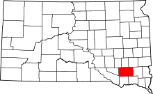 | |
| Towns | ||
| CDPs | ||