Minkler, California
| Minkler | |
|---|---|
| census-designated place | |
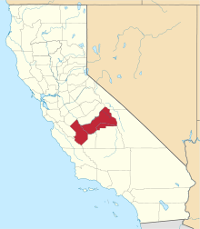
 Minkler Location in California | |
| Coordinates: 36°43′26″N 119°27′29″W / 36.72389°N 119.45806°WCoordinates: 36°43′26″N 119°27′29″W / 36.72389°N 119.45806°W | |
| Country |
|
| State |
|
| County | Fresno |
| Area[1] | |
| • Total | 5.864 sq mi (15.187 km2) |
| • Land | 5.864 sq mi (15.187 km2) |
| • Water | 0 sq mi (0 km2) 0% |
| Elevation[2] | 397 ft (121 m) |
| Population (2010) | |
| • Total | 1,003 |
| • Density | 170/sq mi (66/km2) |
| Time zone | Pacific (PST) (UTC-8) |
| • Summer (DST) | PDT (UTC-7) |
| GNIS feature IDs | 228804; 2583082 |
| U.S. Geological Survey Geographic Names Information System: Minkler, California; U.S. Geological Survey Geographic Names Information System: Minkler, California | |
Minkler is a census-designated place[3] in eastern Fresno County, California.[2] It is located on Highway 180, 2.25 miles (3.6 km) east-southeast of Centerville,[4] at an elevation of 397 feet (121 m).[2] It has a population of 1,003 people. The town is named for Charles O. Minkler, a local farmer.[4]
Minkler made headlines in February 2010 for a police shootout that took the lives of Fresno County Sheriff's Deputy Joel Whalenmair and Reedley Police Department officer Javier Bejar, as well as the shooter, Rick Liles.[5]
Demographics
The 2010 United States Census[6] reported that Minkler had a population of 1,003. The population density was 171.1 people per square mile (66.0/km²). The racial makeup of Minkler was 818 (81.6%) White, 4 (0.4%) African American, 20 (2.0%) Native American, 23 (2.3%) Asian, 0 (0.0%) Pacific Islander, 108 (10.8%) from other races, and 30 (3.0%) from two or more races. Hispanic or Latino of any race were 302 persons (30.1%).
The Census reported that 1,003 people (100% of the population) lived in households, 0 (0%) lived in non-institutionalized group quarters, and 0 (0%) were institutionalized.
There were 383 households, out of which 103 (26.9%) had children under the age of 18 living in them, 225 (58.7%) were opposite-sex married couples living together, 22 (5.7%) had a female householder with no husband present, 18 (4.7%) had a male householder with no wife present. There were 19 (5.0%) unmarried opposite-sex partnerships, and 4 (1.0%) same-sex married couples or partnerships. 96 households (25.1%) were made up of individuals and 44 (11.5%) had someone living alone who was 65 years of age or older. The average household size was 2.62. There were 265 families (69.2% of all households); the average family size was 3.09.
The population was spread out with 205 people (20.4%) under the age of 18, 81 people (8.1%) aged 18 to 24, 180 people (17.9%) aged 25 to 44, 329 people (32.8%) aged 45 to 64, and 208 people (20.7%) who were 65 years of age or older. The median age was 47.6 years. For every 100 females there were 95.5 males. For every 100 females age 18 and over, there were 97.5 males.
There were 427 housing units at an average density of 72.8 per square mile (28.1/km²), of which 277 (72.3%) were owner-occupied, and 106 (27.7%) were occupied by renters. The homeowner vacancy rate was 3.1%; the rental vacancy rate was 14.4%. 692 people (69.0% of the population) lived in owner-occupied housing units and 311 people (31.0%) lived in rental housing units.
References
- ↑ "2010 Census U.S. Gazetteer Files – Places – California". United States Census Bureau.
- 1 2 3 U.S. Geological Survey Geographic Names Information System: Minkler, California
- ↑ U.S. Geological Survey Geographic Names Information System: Minkler, California
- 1 2 Durham, David L. (1998). California's Geographic Names: A Gazetteer of Historic and Modern Names of the State. Clovis, Calif.: Word Dancer Press. p. 1073. ISBN 1-884995-14-4.
- ↑ http://www.fresnobee.com/2010/02/25/1836634/officer-involved-shooting-reported.html
- ↑ "2010 Census Interactive Population Search: CA - Minkler CDP". U.S. Census Bureau. Retrieved July 12, 2014.