Monaragala District
This article is about the district in Sri Lanka. For the town, see Monaragala.
| Monaragala District මොණරාගල දිස්ත්රික්කය மொணராகலை மாவட்டம் | |
|---|---|
| Administrative District | |
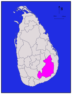 Map of Sri Lanka with Monaragala District highlighted | |
| Coordinates: 6°40′N 81°20′E / 6.667°N 81.333°ECoordinates: 6°40′N 81°20′E / 6.667°N 81.333°E | |
| Country |
|
| Province | Uva Province |
| Largest Town | Monaragala |
| Area | |
| • Total | 5,636 km2 (2,176 sq mi) |
| • Land | 5,508 km2 (2,127 sq mi) |
| • Water | 131 km2 (51 sq mi) |
| Population (2012)[1] | |
| • Total | 448,194 |
| • Density | 80/km2 (210/sq mi) |
| Time zone | Sri Lanka (UTC+05:30) |
| ISO 3166 code | LK-82 |
| Website |
www |
Monaragala (Sinhalese: මොණරාගල දිස්ත්රික්කය, Tamil: மொணராகலை மாவட்டம்) is a district in Uva Province of Sri Lanka. It is the 2nd largest of the 25 districts of Sri Lanka, with an area of 5,636 km².[2]
Towns
- Monaragala
- Bibile
- Wellawaya
- Kataragama
- Siyambalanduwa
- Buttala
- Tanamalwila
- Badalkumbura
- Madulla
- Okkampitiya
Statistics
| population | Land Area | Schools | Total Students |
|---|---|---|---|
| 429,803 | 282,200 Hectare | 262 | 97,721 |
| Division | population |
|---|---|
| Bibila | 38,386 |
| Madulla | 30,672 |
| Medagama | 35,116 |
| Siyambalanduwa | 51,309 |
| Monaragala | 45,922 |
| Badalkumbura | 39,786 |
| Wellawaya | 54,911 |
| Buttala | 51,186 |
| Kataragama | 17,627 |
| Tanamalwila | 25,063 |
| Sevanagala | 39,825 |
| Sinhala | Sri Lankan Tamil | Indian Tamil | Sri Lankan Moor |
|---|---|---|---|
| 94.5% | 1.4% | 1.9% | 2.0% |
In 2008 - Source[3]
Natural parks
Major reservoirs
- Senanayake Reservoir
- Muthukandiya Reservoir
Rivers
- Menik Ganga
- Gal oya
- Heda oya
- Wila oya
- Kumbukkan Oya
- Kirindi oya
- ranwanna oya
Maps
See also
References
- ↑ "POPULATION OF SRI LANKA BY DISTRICT" (PDF). Census of Population and Housing 2011. Department of Census and Statistics. 2012-04-20. Retrieved 2013-02-06.
- ↑ "Area of Sri Lanka by province and district" (PDF). Department of Census and Statistics. 2010. Retrieved 2013-02-06.
- ↑ Article from Lakbima Newspaper
External links
| ||
This article is issued from Wikipedia - version of the 7/14/2016. The text is available under the Creative Commons Attribution/Share Alike but additional terms may apply for the media files.