Kandy District
This article is about the district in Sri Lanka. For the town, see Kandy.
| Kandy District මහනුවර දිස්ත්රික්කය கண்டி மாவட்டம் | |
|---|---|
| Administrative District | |
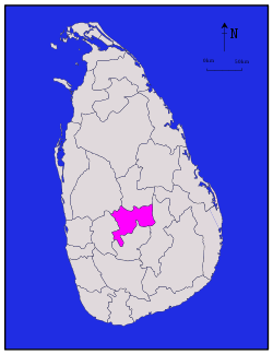 Map of Sri Lanka with Kandy District highlighted | |
| Coordinates: 7°15′N 80°45′E / 7.250°N 80.750°ECoordinates: 7°15′N 80°45′E / 7.250°N 80.750°E | |
| Country | Sri Lanka |
| Province | Central Province |
| Largest city | Kandy |
| Divisions |
List
|
| Government | |
| • District Secretary | Gotabaya Jayarathna |
| • Local |
List
|
| Area | |
| • Total | 1,940 km2 (750 sq mi) |
| • Land | 1,917 km2 (740 sq mi) |
| • Water | 23 km2 (9 sq mi) |
| Population (2001) | |
| • Total | 1,279,028 |
| • Density | 660/km2 (1,700/sq mi) |
| Time zone | Sri Lanka (UTC+05:30) |
| ISO 3166 code | LK-21 |
| Website | ds.gov.lk/dist_kandy |
Kandy District (Sinhalese: මහනුවර දිස්ත්රික්කය, Tamil: கண்டி மாவட்டம்) is a district of the Central Province of Sri Lanka. Its area is 1906.3 km².[1] The capital of the district is Kandy.
Ethic Group & Religion

Religion in Kandy District (2011)[2]
Major Cities
- Kandy municipal council
Suburbs of city of Kandy
Big Towns
- Gampola urban council
- Nawalapitiya UC
Other Towns
- Akurana
- Alawatugoda
- Ambatenna
- Daskara
- Daulagala
- Galagedara
- Galhinna
- Hanguranketa
- Hapugastalawa
- Kadugannawa UC
- Kundasale
- Madawala
- Menikdiwela
- Pilimatalawa
- Pussellawa
- Talatuoya
- Teldeniya
- Ulapane
- Watadeniya
- Wattegama UC
- Welamboda
References
- ↑ Kandy District Secretariat
- ↑ Department of Census and Statistics,The Census of Population and Housing of Sri Lanka-2011
| ||
This article is issued from Wikipedia - version of the 10/23/2016. The text is available under the Creative Commons Attribution/Share Alike but additional terms may apply for the media files.