Montgomery, Indiana
| Montgomery, Indiana | |
|---|---|
| Town | |
|
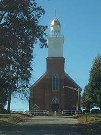
Catholic Church of Montgomery | |
 Location of Montgomery in the state of Indiana | |
| Coordinates: 38°39′48″N 87°2′50″W / 38.66333°N 87.04722°WCoordinates: 38°39′48″N 87°2′50″W / 38.66333°N 87.04722°W | |
| Country | United States |
| State | Indiana |
| County | Daviess |
| Township | Barr |
| Area[1] | |
| • Total | 0.24 sq mi (0.62 km2) |
| • Land | 0.24 sq mi (0.62 km2) |
| • Water | 0 sq mi (0 km2) |
| Elevation | 528 ft (161 m) |
| Population (2010)[2] | |
| • Total | 343 |
| • Estimate (2012[3]) | 339 |
| • Density | 1,429.2/sq mi (551.8/km2) |
| Time zone | Eastern(EST) (UTC-5) |
| • Summer (DST) | EDT (UTC-4) |
| ZIP code | 47558 |
| Area code(s) | 812 |
| FIPS code | 18-50688[4] |
| GNIS feature ID | 0439359[5] |
Montgomery is a town in Barr Township, Daviess County, Indiana, United States. The population was 343 at the 2010 census.
History
Montgomery was laid out in 1865 by Valentine B. Montgomery. Montgomery was a station and shipping point on the Ohio and Mississippi Railway.[6]
Geography
Montgomery is located at 38°39′48″N 87°2′50″W / 38.66333°N 87.04722°W (38.663427, -87.047099).[7]
According to the 2010 census, Montgomery has a total area of 0.24 square miles (0.62 km2), all land.[1]
Demographics
| Historical population | |||
|---|---|---|---|
| Census | Pop. | %± | |
| 1870 | 135 | — | |
| 1880 | 155 | 14.8% | |
| 1890 | 415 | 167.7% | |
| 1900 | 616 | 48.4% | |
| 1910 | 511 | −17.0% | |
| 1920 | 576 | 12.7% | |
| 1930 | 445 | −22.7% | |
| 1940 | 510 | 14.6% | |
| 1950 | 538 | 5.5% | |
| 1960 | 446 | −17.1% | |
| 1970 | 411 | −7.8% | |
| 1980 | 390 | −5.1% | |
| 1990 | 351 | −10.0% | |
| 2000 | 368 | 4.8% | |
| 2010 | 343 | −6.8% | |
| Est. 2015 | 349 | [8] | 1.7% |
2010 census
As of the census[2] of 2010, there were 343 people, 137 households, and 95 families residing in the town. The population density was 1,429.2 inhabitants per square mile (551.8/km2). There were 157 housing units at an average density of 654.2 per square mile (252.6/km2). The racial makeup of the town was 99.4% White and 0.6% from two or more races. Hispanic or Latino of any race were 0.6% of the population.
There were 137 households of which 34.3% had children under the age of 18 living with them, 55.5% were married couples living together, 8.0% had a female householder with no husband present, 5.8% had a male householder with no wife present, and 30.7% were non-families. 27.0% of all households were made up of individuals and 14.6% had someone living alone who was 65 years of age or older. The average household size was 2.50 and the average family size was 3.06.
The median age in the town was 36.6 years. 25.4% of residents were under the age of 18; 7.8% were between the ages of 18 and 24; 26.3% were from 25 to 44; 29.3% were from 45 to 64; and 11.1% were 65 years of age or older. The gender makeup of the town was 50.4% male and 49.6% female.
2000 census
As of the census[4] of 2000, there were 368 people, 140 households, and 100 families residing in the town. The population density was 1,527.7 people per square mile (592.0/km²). There were 153 housing units at an average density of 635.1 per square mile (246.1/km²). The racial makeup of the town was 99.18% White, 0.27% African American, 0.27% Native American, and 0.27% from two or more races. Hispanic or Latino of any race were 0.82% of the population.
There were 140 households out of which 35.0% had children under the age of 18 living with them, 57.9% were married couples living together, 10.7% had a female householder with no husband present, and 27.9% were non-families. 23.6% of all households were made up of individuals and 10.7% had someone living alone who was 65 years of age or older. The average household size was 2.61 and the average family size was 3.11.
In the town the population was spread out with 25.8% under the age of 18, 10.1% from 18 to 24, 31.8% from 25 to 44, 19.6% from 45 to 64, and 12.8% who were 65 years of age or older. The median age was 34 years. For every 100 females there were 101.1 males. For every 100 females age 18 and over, there were 96.4 males.
The median income for a household in the town was $36,944, and the median income for a family was $44,205. Males had a median income of $29,107 versus $17,206 for females. The per capita income for the town was $15,156. About 5.8% of families and 10.8% of the population were below the poverty line, including 13.6% of those under age 18 and 14.9% of those age 65 or over.
Gasthof Village
The town has a sizable Amish population. Local Catholics run the Gasthof Amish Village. The village features various shops offering furniture, blankets, and other handmade goods created by the Amish. A large antique mall called the Blue Door is also run by the village. Wagon rides and tours of the nearby Amish farms are offered to the public. Visitors can also stay at the Amish Inn and eat at the restaurant.
Notable people
- Harry Endicott Indy car driver
- Bill Endicott Indy car driver
References
- 1 2 "G001 - Geographic Identifiers - 2010 Census Summary File 1". United States Census Bureau. Retrieved 2015-07-17.
- 1 2 "American FactFinder". United States Census Bureau. Retrieved 2012-12-11.
- ↑ "Population Estimates". United States Census Bureau. Retrieved 2013-06-25.
- 1 2 "American FactFinder". United States Census Bureau. Retrieved 2008-01-31.
- ↑ "US Board on Geographic Names". United States Geological Survey. 2007-10-25. Retrieved 2008-01-31.
- ↑ History of Knox and Daviess Counties, Indiana: From the Earliest Time to the Present. Goodspeed Publishing Company. 1886. p. 702.
- ↑ "US Gazetteer files: 2010, 2000, and 1990". United States Census Bureau. 2011-02-12. Retrieved 2011-04-23.
- ↑ "Annual Estimates of the Resident Population for Incorporated Places: April 1, 2010 to July 1, 2015". Retrieved July 2, 2016.
- ↑ "Census of Population and Housing". Census.gov. Retrieved June 4, 2015.
External links
Municipalities and communities of Daviess County, Indiana, United States | ||
|---|---|---|
| City | ||
| Towns | ||
| Townships | ||
| CDP | ||
| Other unincorporated communities | ||