Montverde, Florida
| Montverde, Florida | |
|---|---|
| Town | |
|
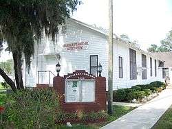
Montverde town hall | |
 Location in Lake County and the state of Florida | |
| Coordinates: 28°35′58″N 81°40′34″W / 28.59944°N 81.67611°WCoordinates: 28°35′58″N 81°40′34″W / 28.59944°N 81.67611°W | |
| Country |
|
| State |
|
| County |
|
| Area | |
| • Total | 1.8 sq mi (4.6 km2) |
| • Land | 1.6 sq mi (4.1 km2) |
| • Water | 0.2 sq mi (0.5 km2) |
| Elevation | 108 ft (33 m) |
| Population (2000) | |
| • Total | 882 |
| • Density | 490/sq mi (191.7/km2) |
| Time zone | Eastern (EST) (UTC-5) |
| • Summer (DST) | EDT (UTC-4) |
| ZIP code | 34756 |
| Area code(s) | 407 |
| FIPS code | 12-46525[1] |
| GNIS feature ID | 0287081[2] |
| Website | http://www.mymontverde.com/ |
Montverde is a town in Lake County, Florida, United States. The population was 882 at the 2000 census. As of 2004, the population recorded by the U.S. Census Bureau is 942. It is part of the Orlando–Kissimmee–Sanford Metropolitan Statistical Area.
Geography
Montverde is located at 28°35′58″N 81°40′34″W / 28.599476°N 81.676221°W.[3]
According to the United States Census Bureau, the town has a total area of 1.8 square miles (4.7 km2), of which, 1.6 square miles (4.1 km2) of it is land and 0.2 square miles (0.52 km2) of it (11.80%) is water.
Demographics
| Historical population | |||
|---|---|---|---|
| Census | Pop. | %± | |
| 1930 | 297 | — | |
| 1940 | 312 | 5.1% | |
| 1950 | 293 | −6.1% | |
| 1960 | 374 | 27.6% | |
| 1970 | 308 | −17.6% | |
| 1980 | 397 | 28.9% | |
| 1990 | 890 | 124.2% | |
| 2000 | 882 | −0.9% | |
| 2010 | 1,463 | 65.9% | |
| Est. 2015 | 1,607 | [4] | 9.8% |
As of the census[1] of 2000, there were 882 people, 351 households, and 272 families residing in the town. The population density was 561.5 people per square mile (216.9/km²). There were 410 housing units at an average density of 261.0 per square mile (100.8/km²). The racial makeup of the town was 96.49% White, 1.59% African American, 0.23% Native American, 0.45% Asian, 0.11% from other races, and 1.13% from two or more races. Hispanic or Latino of any race were 2.61% of the population.
There were 351 households out of which 27.6% had children under the age of 18 living with them, 66.4% were married couples living together, 8.5% had a female householder with no husband present, and 22.5% were non-families. 19.7% of all households were made up of individuals and 5.7% had someone living alone who was 65 years of age or older. The average household size was 2.51 and the average family size was 2.89.
In the town the population was spread out with 22.3% under the age of 18, 6.8% from 18 to 24, 29.9% from 25 to 44, 27.0% from 45 to 64, and 13.9% who were 65 years of age or older. The median age was 41 years. For every 100 females there were 97.3 males. For every 100 females age 18 and over, there were 94.6 males.
The median income for a household in the town was $45,341, and the median income for a family was $46,813. Males had a median income of $35,774 versus $26,944 for females. The per capita income for the town was $20,504. About 4.5% of families and 5.3% of the population were below the poverty line, including 7.1% of those under age 18 and 12.0% of those age 65 or over.
Notable residents
Ruben Wyatt Harper, pioneer citrus grower and community leader. Mr. Harper is listed as a Great Floridian 2000 by the State of Florida. The historic Harper House is listed on the National Register of Historic Places.
References
- 1 2 "American FactFinder". United States Census Bureau. Retrieved 2008-01-31.
- ↑ "US Board on Geographic Names". United States Geological Survey. 2007-10-25. Retrieved 2008-01-31.
- ↑ "US Gazetteer files: 2010, 2000, and 1990". United States Census Bureau. 2011-02-12. Retrieved 2011-04-23.
- ↑ "Annual Estimates of the Resident Population for Incorporated Places: April 1, 2010 to July 1, 2015". Retrieved July 2, 2016.
- ↑ "Census of Population and Housing". Census.gov. Retrieved June 4, 2015.
Municipalities and communities of Lake County, Florida, United States | ||
|---|---|---|
| Cities | 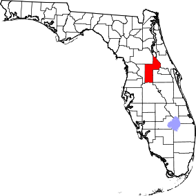 | |
| Towns | ||
| CDPs | ||
| Unincorporated communities |
| |
| Footnotes | ‡This populated place also has portions in an adjacent county or counties | |