Four Corners, Florida
| Four Corners, Florida Citrus Ridge | |
|---|---|
|
Unincorporated area; Census-designated place | |
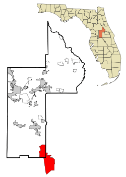 Location in Lake County and the state of Florida | |
 U.S. Census Bureau map showing CDP boundaries | |
| Coordinates: 28°20′1″N 81°38′33″W / 28.33361°N 81.64250°WCoordinates: 28°20′1″N 81°38′33″W / 28.33361°N 81.64250°W | |
| Country | United States |
| State | Florida |
| County | Lake, Polk, Osceola, Orange |
| Area | |
| • Total | 50.1 sq mi (129.8 km2) |
| • Land | 46.4 sq mi (120.1 km2) |
| • Water | 3.7 sq mi (9.7 km2) |
| Population (2010) | |
| • Total | 26,116 |
| • Density | 520/sq mi (200/km2) |
| Time zone | Eastern (EST) (UTC-5) |
| • Summer (DST) | EDT (UTC-4) |
| ZIP code | 32966, 32968, 32969 |
| FIPS code | 12-12435[1] |
Four Corners, also known as Citrus Ridge, is an unincorporated area and census-designated place (CDP) in the U.S. state of Florida, located at a quadripoint formed by Lake, Orange, Osceola and Polk counties. The population of the Four Corners CDP was 26,116 at the 2010 census.[2]
The Lake, Orange, and Osceola County portions of Four Corners are part of the Orlando–Kissimmee–Sanford, Florida Metropolitan Statistical Area, while the Polk County portion is part of the Lakeland–Winter Haven Metropolitan Statistical Area.
Geography
Four Corners is located at 28°20′1″N 81°38′33″W / 28.33361°N 81.64250°W (28.333701, -81.642451).[3]
According to the United States Census Bureau, the Four Corners CDP has a total area of 50.1 square miles (129.8 km2), of which 46.4 square miles (120.1 km2) is land and 3.7 square miles (9.7 km2), or 7.49%, is water.[4]
The United States Census Bureau area is based on census tracts. The complete area of Four Corners is larger and can be described as north along US 27 to Lake Louisa State Park (4 miles north of US 192), south along US 27 to Heart of Florida Hospital (3 miles south of I-4), west to SR 33, and east to Walt Disney World and Celebration. Four Corners has a total area of 180 square miles (470 km2). Four Corners is the only community in Florida to be located in four counties.
Although the Four Corners area is termed a quadripoint, an analysis of the official borders shows that what is called a quadripoint is actually two sets of tripoints. Lake County, Orange County and Osceola County share a border near the westbound lane of the Space Coast Parkway. Lake County, Polk County and Osceola County share a border just south of the eastbound lane of the Space Coast Parkway. Polk County, Florida and Orange County, Florida do not actually border each other but are located approximately 60 feet apart.[5]
Demographics
As of the census[1] of 2000, there were 12,015 people, 4,909 households, and 3,485 families residing in the CDP. The population density was 256.5 people per square mile (99.0/km²). There were 8,278 housing units at an average density of 176.7/sq mi (68.2/km²). The racial makeup of the CDP was 86.90% White, 3.57% African American, 0.32% Native American, 2.29% Asian, 0.08% Pacific Islander, 4.12% from other races, and 2.72% from two or more races. Hispanic or Latino of any race were 15.60% of the population.
There were 4,909 households out of which 25.1% had children under the age of 18 living with them, 60.7% were married couples living together, 7.0% had a female householder with no husband present, and 29.0% were non-families. 20.2% of all households were made up of individuals and 4.4% had someone living alone who was 65 years of age or older. The average household size was 2.45 and the average family size was 2.82.
In the CDP the population was spread out with 19.9% under the age of 18, 7.8% from 18 to 24, 33.5% from 25 to 44, 25.1% from 45 to 64, and 13.7% who were 65 years of age or older. The median age was 37 years. For every 100 females there were 98.4 males. For every 100 females age 18 and over, there were 96.8 males.
The median income for a household in the CDP was $44,855, and the median income for a family was $48,125. Males had a median income of $30,725 versus $26,073 for females. The per capita income for the CDP was $20,565. About 3.8% of families and 5.2% of the population were below the poverty line, including 7.1% of those under age 18 and 3.0% of those age 65 or over.
As of 2010, the estimated population for Four Corners, based on the larger described area above, is 100,000 people.
Transportation
The Four Corners area is served by U.S. Routes 27 and 192, which intersect one mile west of the quadripoint.
The area is served by two Lynx bus routes, which terminate at Legacy Boulevard on US 192.[6] Link 55 travels east on US 192, and link 427 travels south on US 27.
References
- 1 2 "American FactFinder". United States Census Bureau. Retrieved 2008-01-31.
- ↑ "Profile of General Population and Housing Characteristics: 2010 Demographic Profile Data (DP-1): Four Corners CDP, Florida". U.S. Census Bureau, American Factfinder. Retrieved September 21, 2012.
- ↑ "US Gazetteer files: 2010, 2000, and 1990". United States Census Bureau. 2011-02-12. Retrieved 2011-04-23.
- ↑ "Geographic Identifiers: 2010 Demographic Profile Data (G001): Four Corners CDP, Florida". U.S. Census Bureau, American Factfinder. Retrieved September 21, 2012.
- ↑ "Bing Maps". www.bing.com. Retrieved 2016-10-17.
- ↑ LYNX website
Municipalities and communities of Lake County, Florida, United States | ||
|---|---|---|
| Cities |  | |
| Towns | ||
| CDPs | ||
| Unincorporated communities |
| |
| Footnotes | ‡This populated place also has portions in an adjacent county or counties | |
Municipalities and communities of Orange County, Florida, United States | ||
|---|---|---|
| Cities | 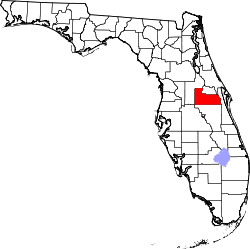 | |
| Towns | ||
| CDPs |
| |
| Unincorporated communities | ||
| Footnotes | ‡This populated place also has portions in an adjacent county or counties | |
Municipalities and communities of Osceola County, Florida, United States | ||
|---|---|---|
| Cities | 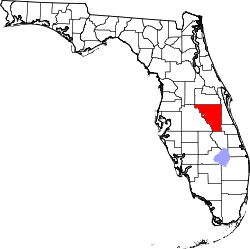 | |
| CDPs | ||
| Unincorporated communities |
| |
| Footnotes | ‡This populated place also has portions in an adjacent county or counties | |
Municipalities and communities of Polk County, Florida, United States | ||
|---|---|---|
| Cities | 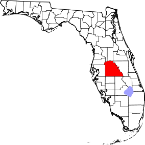 | |
| Towns | ||
| Village | ||
| CDPs | ||
| Unincorporated communities | ||
| Ghost town | ||
| Footnotes | ‡This populated place also has portions in an adjacent county or counties | |
| Attractions |
|  |
|---|---|---|
| Colleges and universities | ||
| Media |
| |
| Airports | ||
| Counties | ||
| Cities and towns 25k+ | ||
| Cities and towns 10k–25k | ||
‡ This populated place is included in the Orlando–Deltona–Daytona Beach, FL Combined Statistical Area. See also: | ||