Morningside, South Dakota
| Morningside, South Dakota | |
|---|---|
| Census-designated place | |
 Morningside | |
| Coordinates: 44°22′0″N 98°11′10″W / 44.36667°N 98.18611°WCoordinates: 44°22′0″N 98°11′10″W / 44.36667°N 98.18611°W | |
| Country | United States |
| State | South Dakota |
| County | Beadle |
| Area | |
| • Total | 0 sq mi (1.3 km2) |
| • Land | 0 sq mi (1.3 km2) |
| • Water | 0 sq mi (0 km2) |
| Elevation | 1,275 ft (389 m) |
| Population (2010) | |
| • Total | 105 |
| • Density | 204/sq mi (78.7/km2) |
| Time zone | Central (CST) (UTC-6) |
| • Summer (DST) | CDT (UTC-5) |
| Area code(s) | 605 |
| FIPS code | 46-43780[1] |
| GNIS feature ID | 1256539[2] |
Morningside is a census-designated place (CDP) in Beadle County, South Dakota, United States. The population was 105 at the 2010 census.[3]
Geography
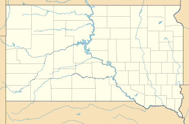
Morningside is located on the east side of the city of Huron, the Beadle County seat. The James River forms the western edge of Morningside and separates it from the center of Huron. An eastern extension of the city borders Morningside to the south. U.S. Route 14 forms the northern edge of Morningside and leads west into Huron and east 31 miles (50 km) to De Smet.
According to the United States Census Bureau, the Morningside CDP has a total area of 0.50 square miles (1.3 km2), all of it land.[3]
References
- ↑ "American FactFinder". United States Census Bureau. Retrieved 2008-01-31.
- ↑ "US Board on Geographic Names". United States Geological Survey. 2007-10-25. Retrieved 2008-01-31.
- 1 2 "Geographic Identifiers: 2010 Demographic Profile Data (G001): Morningside CDP, South Dakota". U.S. Census Bureau, American Factfinder. Retrieved April 7, 2014.
Municipalities and communities of Beadle County, South Dakota, United States | ||
|---|---|---|
| Cities | 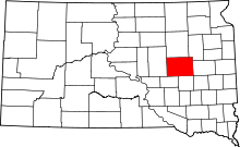 | |
| Towns | ||
| Townships |
| |
| CDP | ||
| Unincorporated communities |
| |
| Footnotes | ‡This populated place also has portions in an adjacent county or counties | |
This article is issued from Wikipedia - version of the 10/4/2016. The text is available under the Creative Commons Attribution/Share Alike but additional terms may apply for the media files.