Mount Arvon
| Mount Arvon | |
|---|---|
|
Mount Arvon summit sign and log book | |
| Highest point | |
| Elevation | 1,979 ft (603 m) NGVD 29[1] |
| Prominence | 948 ft (289 m) [1] |
| Listing | U.S. state high point 38th |
| Coordinates | 46°45′21″N 88°09′20″W / 46.755813°N 88.155434°WCoordinates: 46°45′21″N 88°09′20″W / 46.755813°N 88.155434°W [2] |
| Geography | |
 Mount Arvon | |
| Parent range | Huron Mountains |
| Topo map | USGS Skanee South |


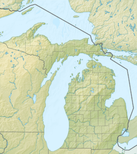
Mount Arvon, elevation 1,979 feet (603 m), located in L'Anse Township, Baraga County, is the highest natural point in the U.S. state of Michigan. Like nearby Arvon Township, Mount Arvon takes its name from the deposits of slate in the area which were reminiscent of those around Caernarfon in Wales. Mount Arvon is part of the Huron Mountains. It rises about eight miles (13 km) south of Lake Superior (elevation 591 ft, 180 m). On the list of highest natural points in each U.S. state, Mount Arvon ranks 38th.[3]
Mount Arvon is a few miles from Mount Curwood, which for years had been designated as Michigan's highest spot until a resurvey in 1982 with modern technology determined that Mount Arvon is one foot (0.30 m) taller than Mount Curwood. Mount Arvon is about 12 miles (19 km) east of L'Anse, although it is about a 26-mile (42 km) drive from the city as much of it lies on winding logging roads.
The property is owned by the MeadWestvaco paper company but public access is allowed.
See also
 Michigan portal
 Mountains portal
- Outline of Michigan
- Index of Michigan-related articles
- List of U.S. states by elevation
References
- 1 2 "Mount Arvon, Michigan". Peakbagger.com. Retrieved November 8, 2012.
- ↑ "Mount Arvon". Geographic Names Information System. United States Geological Survey. Retrieved November 8, 2012.
- ↑ "Map and List of U.S. State Highpoints". In Ice Axe We Trust. Retrieved January 28, 2014.
External links
 Media related to Mount Arvon at Wikimedia Commons
- "Mt. Arvon" (PDF). Baraga County Tourism. Archived from the original (PDF) on July 25, 2011.
| Central cities | |
|---|---|
| Counties | |
| Geography | |
| Transportation | |
| Economy | |