Mount Miyama
| Mount Miyama | |
|---|---|
| 深山 | |
 Miyama Shrine on the top of Mount Miyama | |
| Highest point | |
| Elevation | 790.5 m (2,594 ft) |
| Listing | List of mountains and hills of Japan by height |
| Coordinates | 35°24′N 134°38′E / 35.400°N 134.633°E |
| Naming | |
| Pronunciation | [mijama] |
| Geography | |
| Location | Nose, Osaka and Nantan, Kyoto, Japan |
| Parent range | Hokusetsu Mountains |
| Geology | |
| Mountain type | fault-block |
Mount Miyama (深山 Miyama) is a 790.5 m (2,594 ft) mountain, located on the border of Nose, Osaka and Nantan, Kyoto, Japan.
Outline
Mount Miyama is the tallest mountain of Hokusetsu Mountains. This mountain is one of Osaka 50 mountains, and a part of Hokusetsu Natural Park.
Route
There are three major routes to the top of this mountain. One is from Okururi Valley and it takes one hour and 50 minutes to the top of the mountain. Second one is from Hirono, and it takes two hours 50 minutes. The last one is from Fukuzumi, in Sasayama, Hyōgo and it takes two and half hours.
Access
- Okururikei Bus Stop of Chukyo Bus
- Hirono Bus Stop of Chukyo Bus
- Fukuzumi Bus Stop of Shinki Bus
Gallery
- Miyama Shrine on the top of Mount Miyama (02/2009)
 A weather station on the top of Mount Miyama (02/2009)
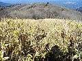 At the top of Mount Miyama (02/2009)
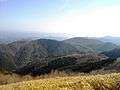 Mount Yokoo and Mount Kenpi from the top of Mount Miyama (02/2009)
 Mount Funadani and Taki Mountains from the top of Mount Miyama (02/2009)
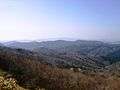 Rokko Mountains from the top of Mount Miyama (02/2009)
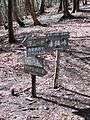 Kurasawa Pass (02/2009)
 A religious object in Mount Miyama (02/2009)
References
- Hokusetsu, Kyoto Nishiyama, Shobunsha, 2007
- Official Home Page of the Geographical Survey Institute in Japan
This article is issued from Wikipedia - version of the 5/5/2015. The text is available under the Creative Commons Attribution/Share Alike but additional terms may apply for the media files.