Mullakkodi
| Mullakkodi | |
|---|---|
| village | |
|
Vettakkarumakan Temple | |
| Coordinates: 12°0′30″N 75°24′40″E / 12.00833°N 75.41111°ECoordinates: 12°0′30″N 75°24′40″E / 12.00833°N 75.41111°E | |
| Country |
|
| State | Kerala |
| District | Kannur |
| Languages | |
| • Official | Malayalam, English |
| Time zone | IST (UTC+5:30) |
| PIN | 670602 |
| Telephone code | 04602 |
| ISO 3166 code | IN-KL |
| Lok Sabha constituency | Kannur |
| Climate | Tropical monsoon (Köppen) |
| Avg. summer temperature | 35 °C (95 °F) |
| Avg. winter temperature | 20 °C (68 °F) |
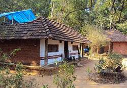
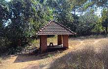
Mullakkodi [1] is a village in Mayyil Gram Panchayat of Kannur District situated on the East Bank of Valapattanam river. Mullakkodi known for its backwaters, paddy fields and for its community festival called the Ayar Munamba Manna Maqam Urooz.
Educational Institutions
- Mullakkodi AUP School
- Mullakkodi Mappila ALP School
- Arimbra English Medium School
- Izzathul Islam Madrasa.
Cultural Organisations
- Mullakkodi C R C Vayanashala & Grandalayam
- Navodaya Kalasamithi
- Islamic Cultural Society
- CRC Sports Club and Nehru Yuva Kendra
- Love Star Sports club,Mullakkodi
- Balasangham, Kudumba Sree Mullakkodi Unit
Festivals
- Ayar Munamba Manna Maqam Urooz
Transportation
The national highway passes through Valapattanam town. Goa and Mumbai can be accessed on the northern side and Cochin and Thiruvananthapuram can be accessed on the southern side. The road to the east of Iritty connects to Mysore and Bangalore. The nearest railway station is Kannur on Mangalore-Palakkad line. Trains are available to almost all parts of India subject to advance booking over the internet. There are airports at Mattanur, Mangalore and Calicut. All of them are international airports but direct flights are available only to Middle Eastern countries.
References
| Wikimedia Commons has media related to Mullakkodi. |