Kannur district

| Kannur District കണ്ണൂർ ജില്ല | |
|---|---|
| District | |
|
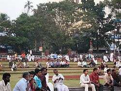
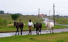
Kannur people | |
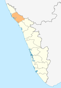 Location in Kerala | |
| Coordinates: 11°52′08″N 75°21′20″E / 11.8689°N 75.35546°ECoordinates: 11°52′08″N 75°21′20″E / 11.8689°N 75.35546°E | |
| Country |
|
| State | Kerala |
| Headquarters | Kannur |
| Government | |
| • District Collector | Mir Mohamad Ali IAS |
| • District Police Chief | Kori Sanjaykumar Gurudin IPS |
| Area | |
| • Total | 2,966 km2 (1,145 sq mi) |
| Population | |
| • Total | 2,412,365 |
| • Density | 813/km2 (2,110/sq mi) |
| Languages | |
| • Official | Malayalam, English |
| Time zone | IST (UTC+5:30) |
| ISO 3166 code | IN-KL-KNR, IN-KL |
| Vehicle registration | KL-13,KL-58,KL-59 |
| Sex ratio | 1090 ♂/♀ |
| Literacy | 92.80% |
| Website |
www |
.jpg)

Kannur District is one of the 14 districts along the west coast in the state of Kerala, India. The town of Kannur is the district headquarters and gives the district its name. The old name, Cannanore is the anglicised form of the Malayalam name "Kannur". Kannur district is bounded by Kasaragod District to the north, Kozhikode district to the south and Wayanad District to the southeast. To the east the district is bounded by the Western Ghats, which forms the border with the state of Karnataka (Kodagu district). The Arabian Sea lies to the west. The district was established in 1957.
Kannur is the sixth-most urbanized district in Kerala, with more than 50% of its residents living in urban areas. Kannur has an urban population of 1,212,898, which is the second largest in Kerala after Ernakulam district.[1][2]
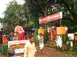
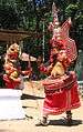
Kannur District is known as the land of looms and lores, because of the loom industries and ritualistic festivals held here in temples. The district is a major centre of Theyyam, a ritual dance of northern Kerala. Small shrines known as kavus, associated with the Theyyam, dot the district.
The proposed Kannur International Airport will be the fourth international airport in Kerala and is situated 26-km away from Kannur.
Etymology
There are many myths and legends associated with the name Kannur. It is said to be a portmanteau derived from two Malayalam words, ‘Kannan’ (Krishna, a Hindu deity), and ‘Ur’ (place), making it the place of Lord Krishna. One theory supporting this theory is that the deity of the Kadalayi Srikrishna Temple was originally installed in a shrine at Kadalayi Kotta in the southeastern part of the present Kannur town. During the British Raj, the city was known as Cannanore, the Portuguese version of its ancient name, 'Kannanore'.It was the capital of the only Muslim kingdom, Arakkal Sulthanate, in the state of Kerala.
History
Kannur was an important trading center in the 12th century with active business connections with Persia and Arabia. It served as the British military headquarters on India's west coast until 1887. In conjunction with her sister city, Tellicherry, it was the third largest city on the western coast of British India in the 18th century after Bombay and Karachi. St. Angelo Fort was built in 1505 by Dom Francisco de Almeida, the first Portuguese Viceroy of India.The Dutch captured the fort from the Portuguese in 1663. They modernised the fort and built the bastions Hollandia, Zeelandia and Frieslandia that are the major features of the present structure. The original Portuguese fort was pulled down later. A painting of this fort and the fishing ferry behind it can be seen in the Rijksmuseum Amsterdam. The Dutch sold the fort to king Ali Raja of Arakkal in 1772. The British conquered it in 1790 and used it as one of their major military stations on the Malabar Coast. During the 17th century, Kannur was the capital city of the only Muslim Sultanate in the malabar region, known as Arakkal.[3] During the British Raj, Kannur was part of the Madras province in the North Malabar District.

The guerrilla war by Pazhassi Raja, the ruler of Kottayam province, against the British had a huge impact in the history of Kannur. Changes in the socio-economic and political sectors in Kerala during the initial decades of 20th century created conditions congenial for the growth of the Communist Party. Extension of English education initiated by Christian missionaries in 1906 and later carried forward by government, rebellion for wearing a cloth to cover upper parts of body, installing an idol at Aruvippuram in 1888, Malayali Memorial in 1891, establishment of SNDP Yogam in 1903, activities, struggles etc. became factors helpful to accelerate changes in Kerala society during a short time. Movements for liberation from the colonial rule of British imperialism and struggles launched by these movements grew with them.
Very soon, ideas about socialism and Soviet Revolution reached Kerala. Such ideas got propagated in Kerala through the works of Swadeshabhimani Ramakrishna Pillai, Sahodaran Ayyappan, P. Kesavadev and others.By the beginning of the 1930s some other useful developments were taking place. Important among them was Nivarthana Agitation in Travancore. That was the demand of people suppressed so far as untouchables and weaker sections for participation in government. This brought to the forefront struggles like proportional representation in government and reservation of jobs. This imparted a new enthusiasm among oppressed masses.[4]
.JPG)
Government and politics
Kannur was once the nurturing ground and think tank of the Communist movement in Kerala, and was home of the famous communist leaders A.K. Gopalan, Azhikodan Raghavan and E. K. Nayanar. The former Chief Minister of Kerala. K. Karunakaran, a Congress leader, also hails from Kannur.
Communist parties have a strong base in this district. The Communist Party of India (Marxist)-led Left Democratic Front (LDF) governs five of six municipalities in Kannur district. Around 70% of the panchayats are governed by LDF.
In 2014, Kannur elected PK Sreemathy as its Member of Parliament (MP), trouncing former MP K Sudhakaran in a closely fought contest. However. the Legislative Constituency continues to be represented by AP Abdullakutty, a former communist turned INC activist. The parliamentary victory of the CPIM in 2014 election here is touted as a sign of it returning to dominate the district politics -- which it was overshadowed by INC.
Panoor, Kuthuparamba and Mattanur areas of Thalassery Taluk in the district have been a hub of political violence between the Communist Party of India (Marxist) (CPI(M)) and the BJP-led Rashtriya Swayamsevak Sangh (RSS) combine. Clashes in 2008 left seven people killed and many have been injured. The High Court of Kerala called this manslaughter a “compelling sport” and suggested permanent deployment of Central forces in the affected areas.[5]
Geography and climate
Geography
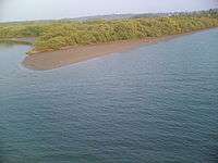
The district lies between latitudes 11° 40' to 12° 48' North and longitudes 74° 52' to 76° 07' East and covers an area of 2,996 km2. Kannur can be geographically divided into highland, midland and lowland regions. Highlands are the mountainous region forming part of the Western Ghats and are covered by rainforests, plantations of coffee, tea and different types of spices like cardamom. There are also timber plantations in this region. The midland region lies between the highlands and lowlands and is made up of undulating hills and valleys. The lowland is the narrow stretch containing rivers, deltas and the coastal region. Six rivers drain Kannur, the longest being the Valapattanam river with a length of 110 km. Other rivers flowing through Kannur district are Kuppam, Mahe River, Anjarakandi, Thalassery, Ramapuram and Perumba. The highest place in the district is Elapeedika (2,500–3,200 ft.), near to Peravoor.
Climate
The district has a humid climate with an oppressive hot season from March to the end of May. This is followed by the South-West monsoon which continues till the end of September. October and November from the post-monsoon [North-East Monsoon] or retreating monsoon season.
During the months of April and May, the mean daily maximum temperature is about 35 °C. Temperature is low in December and January and the minimum temperature is about 20 °C. On certain days the night temperature may go down to 16 °C, although this is extremely rare. The annual average rainfall is 3438 mm and more than 80% of it occurs during the period of South-West monsoon. The rainfall during July is very heavy and the district receives 68% of the annual rainfall during this season.
Kannur Town and Kannur City
.jpg)
- Kannur city, formerly known as Cannanore, is a town and the administrative headquarters of Kannur District.
- Ayikkara City is a part of the Kannur city. This area was the actual downtown in the olden times but is now mostly a residential area dominated by Muslim fishermen. Most locals call this area 'the city'.
Towns in Kannur district
Kannur district has numerous townships spread across the district with several of it being administrated by municipalities.
- Thalassery (Municipality)
- Mattanur (Municipality)
- Payyanur (Municipality)
- Kuthuparamba (Municipality)
- Taliparamba (Municipality)
- Sreekandapuram (Municipality)
- Iritty (Municipality)
- Anthoor (Municipality)
- Panoor (Municipality)
- Cherukunnu Thara (Panchayath)
- Peravoor (Panchayath)
- Kelakam (Panchayath)
- Valapattanam (Panchayath)
- Pazhayangadi (Panchayath)
- Chakkarakkal (Panchayath)
- Puthiyatheru (Panchayath)
- Pilathara (Panchayath)
- Alakode (Panchayath)
- Pappinisseri (Panchayath)
Economy
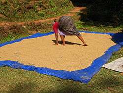
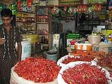
A majority of the population of the district is dependent directly or indirectly on agriculture for their livelihood. The main crops grown in the district are paddy, coconut, pepper, cashew, tapioca, arecanut and plantation crops like rubber. Asia's largest cinnamon estate producing cinnamon spice established by Lord Brown of British East India company in the year CE 1767 is located at Anjarakandy in Kannur district
Paddy occupies the largest area among annual crops. Under the high yielding variety programme, substantial increase in paddy production has been achieved, even though the percentage of area sown under paddy is decreasing year after year, due to conversion of paddy fields to other purposes. The average yield of paddy is recorded as 2146 kg. per hectare. Next to paddy, coconut is the most important crop in the district. Coconut is extensively grown throughout the district. An important cash crop grown in the district is cashewnut. The district plays a unique role in its cultivation and production. The vast stretches of suitable waste lands with low fertility status extends scope for expansion of cashew cultivation and its allied industries.
Among spices, pepper occupies an important place. Pepper is mostly grown as an intercrop with coconut, arecanut and fruit trees. In the hilly areas of the district, the inter-cultivation is done with rubber and cashew. Rubber is the most important industrial cash crop among the plantation crops.
About 55% of the rubber cultivation of Kannur district is in Iritty taluk, followed by Thaliparamba, Thalassery and Kannur taluks. The yield of rubber per hectare varies from 2000 kg to 4000 kg.
Industry
Kannur district has had industrial importance from very early days. With a variety of natural and man-made resources including fertile soil, amenable climate, rich forests, fishing potential and minerals along with road, rail and inland water transport links, the district offers ample scope for the development of industries. Nevertheless, Kannur is an industrially backward district. There is only one major and five mini industrial estates in the district. Keltron Complex, Mangattuparamba and Western India Plywood's, Valappattanam are the two major industries. Western India Plywoods is one of the biggest wood based industrial complexes in South East Asia. The district has 12 medium-scale industries, most of which are either cotton textile or plywood manufacturing.
Handloom Textiles, beedi and coir are important traditional industries in the district. About 100,000 people depend on the textile industry for their livelihood. The textile industry, which accounts for 40% of all Small Scale Industrial (SSI) units in the district, was introduced in early 19th century by the German Basel Mission. The first ready-made garment unit in Kannur and the first hosiery unit in Kuthuparamba were started around the end of the 19th century. The beedi industry provides employment for about 50,000 people. The Dinesh Beedi co-operative and the privately owned Sadhu Beedi are in Kannur district. The coir industry uses traditional technology and provides employment to about 11,000 workers.
There are 6,934 small-scale industrial units in the district. The district has 202 sick units which is about 9.3% of the sick units of the state. Only 4,828 units now are working. 162 industrial societies and four power loom societies are also functioning here. Kannur, Thalassery, Payyannur, Taliparamba and Edakkad have been identified as growth centers, having potential for industrial development.
Divisions
Kannur District came into existence as an administrative unit on January 1, 1957, when the erstwhile Malabar District and Kasaragod taluk of Madras state were reconstituted into three revenue districts, viz; Kannur, Kozhikode and Palakkad. At the time of its formation, the district consisted of seven taluks, viz, Kasaragod, Hosdurg, Taliparamba, Kannur, Thalassery, North Wayanad and South Wayanad. Subsequently, the South Wayanad taluk was included in Kozhikode district with effect from 15 March 1957. Later, on first November 1980, Wayanad District was formed carving out South Wayanad and North Wayanad taluks. The two northernmost taluks of Kannur District, viz; Kasaragod and Hosdurg were separated on 24 May 1984 for the formation of Kasaragod District.A new taluk of Iritty was formed in 2014 dividing Thalassery and Thaliparamba taluks. Thus Kannur District now has four taluks, viz., Kannur, Taliparamba, Thalassery and Iritty. Thalassery is also known as Tellicherry.
There are nine development blocks comprising 82 panchayats. The development blocks are Kannur, Edakkad, Irikkur, Iritty, Kuthuparamba, Payyannur, Peravoor, Taliparamba and Thalassery.
There are One Municipal Corporation and 9 Municipalities in Kannur district. Kannur is the only one Corporation and the Municipalities are Thalassery, Taliparamba, Payyannur, Kuthuparamba, Mattannur, Anthoor, Panoor, Iritty, and Sreekandapuram.
The state legislative constituencies of the District are: Irikkur, Payyannur, Taliparamba, Kalliasseri, Azhikode, Kannur, Dharmadam, Thalassery, Mattannur, Kuthuparamba and Peravoor.

Transport
Kannur city is easily accessible from any part of India by rail, road and through water. An international airport is currently under construction and is expected to be operational by 2017.
The West Coast road from Mahe to Talapady is the backbone of the road system in Kannur district. This is part of the National Highway NH-66 (formerly NH-17). Kannur–Mattannur–Iritty Road, Pappinisseri–Pilathara Road, Taliparamba–Iritty Road, Taliparamba–Kodaguboarder Road,Thalassery-Nedumpoil-Mananthavady Road, Payyannur–Peringome (Kozhichal) Road, Thalassery–Kodagu road and the Thalassery–Mysore road are the other important roads. The airports at Mangalore in Karnataka and Kozhikode are about 125 kilometres away from Kannur. Kannur Airport is coming up at Mattannur and expected to be completed by the 2017.
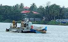
Thalassery (Tellicherry), Kannur and Azhikkal are the minor ports in the district. Kannur is an ancient port. The nearest all-weather sea port is Mangalore, presently in Karnataka State. The inland water transport system connecting Perumba and Taliparamba was constructed in 1766 by the Ali Raja of Kannur. This the 3.8 km long Sultan's Canal. The west flowing rivers are used for navigation. The Kuppam river has 244 km of navigable length; Valappattanam, 55 km and Anjarakandi, 23 km. Kannur Tourism
Demographics
According to the 2011 census Kannur district has a population of 2,525,637,[6] roughly equal to the nation of Kuwait[7] or the US state of Nevada.[8] This gives it a ranking of 170th in India (out of a total of 640).[6] The district has a population density of 852 inhabitants per square kilometre (2,210/sq mi).[6] Its population growth rate over the decade 2001-2011 was 4.84%.[6] Kannur has a sex ratio of 1133 females for every 1000 males,[6] the highest among any district in India, and a literacy rate of 95.41%.[6]
The District has a population of 2,412,365 (2001 census). This was the most urbanised district in Kerala in 2001, but was pushed to 4th place after Ernakulam, Thrissur and Kozhikode in 2011.[9] About 50.35% of the population reside in the urban agglomerations. The total urban population of Kannur district is 1,212,898. This is the second largest urban population in Kerala after Ernakulam and is more than the population of a metro city.
In the 2001 Indian Census Hindus made up 61.47% of the population; Christians 10.84%; and Muslims 27.63%.The majority of the Anglo-Indian community lives in the Kannur Cantonment and the surrounding areas of Thillery, No.3 Bazaar and Camp Bazaar.
The high urban population is due to the 45 towns in the district which was the highest in Kerala as per 2001 census. 2011 census has Thrissur with 135 towns with Kannur having 67.[10] Kannur district has seven statutory towns: Kannur, Kannur Cantonment, Thalassery, Payyannur, Thaliparamba, Kuthuparamba and Mattannur. In addition to this there are 60 including Ancharakandy, Azhikode North, Azhikode South, Chala, Chelora, Cherukunnu, Cheruthazham, Chirakkal, Chockli, Dharmadom, Elayavoor, Eranholi, Iriveri, Kadachira, Kadirur, Kalliasseri, Kanhirode, Kannadiparamba, Kannapuram, Kottayam-Malabar, Mavilayi, Munderi, Muzhappilangad, Narath, New Mahe, Paduvilayi, Pallikkunnu, Panniyannur, Panoor, Pappinisseri, Pathiriyad, Pattiom, Peralasseri, Peringathur, Pinarayi, Puzhathi, Thottada, Valapattanam, Varam.[9]
Kannur city has, apart from Malayalam, minorities of Kannada, Konkani, Tulu, Gujarati and Tamil speakers. English is the language spoken by the Anglo-Indian community apart from Cannanore Indo-Portuguese creole which is still spoken by members of this community.
Flora and fauna
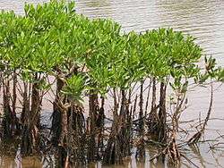
Kannur district is very rich in vegetation. Natural vegetation, except in some coastal regions, consists of forests. But, in spite of generally favourable climatic conditions, vegetation is not uniform. In restricted regions, with their own micro climate or special edaphic features, plant formations assume different characters. Thus, plant communities, ranging from psammophytes and mangroves to evergreen forests are seen.
The coastal region is a comparatively narrow zone, characterised by secondary soil which is rather lose and sandy. The sterile sandy tract supports only a poor vegetation of the psammophyte type. Plants are few and mostly prostrate. Erect species are small and short. Owing to very poor water holding capacity of the soil, these plants are provided with special xerophytic adaptations. Another conspicuous feature of this area is the mangrove vegetation, found at the estuaries of rivers and backwaters, and often extending to the interior along their banks. Human interference has much changed the vegetation of the coastal region.
Major part of the district comes under midland region with numerous hills and dales and it presents an undulating surface gradually ascending and merging into the slopes of Western Ghats. Soil is secondary and lateritic with underlying rock of laterite or disintegrated gneiss. Typical flora of this area is deciduous forest consisting of a mixture of evergreen and deciduous trees. Undergrowth consists of a variety of annuals and perennials.
The mountains are a continuation of the midland region, gradually ascending to the main ridge of the Western Ghats. Soil in the western slopes is a ferruginous red, sandy loam. Vegetation over the whole area is of the forest type. Irregular distribution of teak, localised areas of bamboo dominance, change of good quality forest into open grass lands, etc. are characteristic.
Aralam wildlife
The Aralam Wildlife sanctuary is spread over 55 square kilometres of undulating forested highlands on the slopes of the Western Ghats. It was established in 1984. The headquarters of the sanctuary is near Iritty, a small town about 55 kilometres from Kannur. The sanctuary adjoins the Central state Farm at Aralam. Aralam wild life is situated at Muzhakkunnu panchayath and Aralam panchayath. Muzhakkunnu is also a tourist spot.
The elevation varies from 50 m to 1145 m. The highest peak, Katti Betta, rises to a majestic 1145 m above sea level. Covered with tropical and semi evergreen forests, the Aralam Sanctuary is home to a vast variety of flora and fauna endemic to the Western Ghats. Herds of deer, elephant, boar and bison are common sights. Leopards, jungle cats and squirrels are also seen here. The proposed Ranipuram wildlife sanctuary of Kasaragod district has similar flora and fauna as that of Aralam wildlife sanctuary.
Education
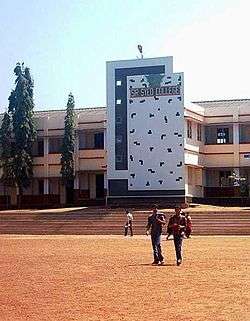
There are 1,293 schools in Kannur District including 187 highschools.
In the 14th and 15th centuries, during the regime of the Kolathiri Rajas, Taliparamba was renowned all over Kerala as a seat of learning, enlightenment and culture. In the early days, the Eshuthu pallies under the Ezhuthachan or village school master, provided facilities to pupils to acquire elementary education. After undergoing the preliminary course of study in these institutions, the children were sent to the kalaries for acquiring training in gymnastics and in the use of arms. Then they were sent to study Sanskrit in Vedic schools under well-trained teachers. This district had in the past its share of such kalaries and Vedic schools. The art, kalaripayattu, is particularly associated with this district.
The beginning of western education in the district may be traced back to the middle of the 16th century. The first English school, known as the Basel German Mission English School, was started on 1 March 1856 at Thalassery. The Brennen School at Thalassery, the nucleus of the present Govt. Brennen College, was started in 1862 with a donation made by Mr. Brennen, Master Attendant at Thalassery.
Kannur University was established by the Act 22 of 1996 of Kerala Legislative Assembly. The University by the name “Malabar University” had come into existence even earlier by the promulgation of an Ordinance by the Governor of Kerala, on 9 November 1995. The University was inaugurated on 2 March 1996 by the Hon. Chief Minister of Kerala. The objective of the Kannur University Act 1996 is to establish in the state of Kerala a teaching, residential and affiliating University so as to provide for the development of higher education in Kasargod and Kannur revenue Districts and the Mananthavady Taluk of Wayanad district. Pariyaram Medical college established in 1999 near Payyanur and Kannur Medical college with a 500-bed super speciality hospital established in 2006 at Anjarakkandy are two medical colleges functioning in Kannur district.
- Arts and Science Colleges: Govt. Brennen College-Thalassey, S.N College Kannur, Payyannur College, Sir Syed College Taliparamba, Nirmalagiri college, Kuthuparamba, Mahatma Gandhi College, Iritty
- Engineering College: Government College of Engineering, Kannur, Malabar Institute of Technology - Anjarakandy,[11] College of Engineering - Thalassery, Vimal Jyothi Engineering College - Chemperi, Sree Narayana Guru College of Engineering - Payyannur
Kannur hosts the 13th centre for National Institute of Fashion Technology NIFT near Dharmasala,Kannur. The famous Kalady Sankaracharya Sanskrit University has a regional centre in the district situated in Payyannur.
Sports and games
Many well-known personalities in the field of sports and games have adorned Kannur in their respective fields. The Englishmen of the Military Centre brought field hockey, cricket, football, etc. to Kannur during the pre-independence period. The Fort Maidan and Police Maidan provide ample facilities for youths to excel in this field. The CDRE Football team and Hockey team excelled in those days. At the same time, traditional martial arts like Kalaripayatu has also been flourishing here all along.
After Independence, the football clubs helped spread the spirit of the game in Kannur. Cannanore Spirited Youths, Lucky Star Cannanore, The Brothers Club Cannanore and Gymkhana Club Cannanore were popular and produced well known players like D'cruz, Soman, Dasan,VP Sathyan,Goalkeeper Mustafa, etc. Sree Narayana College in Thottada was considered a nursery of sportsmen the most prominent of them being B Devananad who captained the college and later Calicut University (the college is now under Kannur University) to national universities title. Devananad later played for the Indian Youth team in Bangkok and several other tournaments to be picked by Tata Football team in Mumbai. He was the fullback when Kerala won its first Santosh Trophy title in 1973. Similarly Mani, the captain of the Santosh Trophy winning Kerala team was another well-known player though he faded off the sports horizon.Denson Devadas who is currently playing for Sporting Clube De Goa in I league and Delhi Dynamos in ISL and CK.Vineeth who is currently playing for Bengaluru fc in the I-League as a striker is from Kannur, CK.Vineeth is also Kerala Blasters player in the Indian Super League. And once kannur known as the Mecca of kerala football and nursery of Indian football.
Jimmy George, the veteran volleyball player who was selected as one of the top 10 strikers in the world when he was playing for an Italian club was born and brought up in Kannur.
In hockey, apart from the military team, there were good teams in Kannur and Thalassery. Cricket, ball-badminton, weightlifting, gymnastics, wrestling, volleyball, etc. have been widely played in both urban and rural areas. Volleyball has been concentrated upon by youths in rural areas. Former Indian hockey goalkeeper Manuel Frederick is from Kannur. Ivan D'Cruz who hails from Kannur has represented Kerala in cricket and hockey.
When Sports Divisions were started in schools in 1976 to tap talents, one of its divisions was started in the district. The Sports Division attached to Govt. Higher Secondary School, Kannur, produced international stars like P.T Usha and M.D. Valsamma in athletics. Leelamma Thomas and Moly Benedict in basketball and Anitha Retnam and Anandavalli in volleyball. The Police Maidan was the venue for M.D Valsamma and Mercy Mathew to practise athletics; P.K. Balachandran, V.P. Sathyan, D'cruz, Rajan, Ramanan, Sugunan, C.M. Chidanandan, B Devananad and George in football and Ford and Olympian Manuel Frederick in hockey. Westline and Leslie in cricket had their training at Fort Maidan.
Kannur became noted in South India for ball badminton, when T.K. Ramakrishnan and Kumaran were playing. A.M. Bharathan created history in weight lifting in the early fifties. Nelliary Krishnan Nair, the first Malayalee to represent India (weightlifting) at the first Asian Games held at New Delhi in 1951 is from Kannur.Aryabandhu gymnasium, Thykandy gymnasium, Potheri gymnasium and Cannanore Barbel club where famous training centers in old times for Wrestling,Weightlifting,Body building and boxing.
It is also believed that the game of cricket first found its way to Kannur, with the British, thus making it the birthplace of the game in India. A few years back, the district cricket association celebrated the 200th anniversary of the game in the district, in a function attended by eminent cricketers like Dilip Vengsarkar.
Tourism
- V-Pra Kaayal Floating Park, Vayalapra Chemballikundu
- Snake Park, Parassinikkadavu
- St.Angelo's Fort, Kannur
- Paithalmala Hills, Naduvil
- Palakkayam thattu, Naduvil
- Ezhimala Hills, Payyanur
- Madayippara, Pazhayangadi
- District Farm, Taliparamba
- Eco Park,vellikkeel, Taliparamba
- Elapeedika, Peravoor
- Hanging Bridge, Peralassery
- Hanging Bridge, Kuttiyeri
- Kanjirakolly Waterfalls, Payyavoor
- Chathamangalam (Kannur)

Places of worship
Kannur district has a large number of temples, churches and mosques. The most important temples are the Parassinikkadavu temple, the Talap temple and the Kottiyoor temple. The most important churches are located at Burnassery, Taliparamba and Thalassery. The biggest mosques are located at Ayikkara, Taliparamba and Thalassery.
Notable individuals
- Pazhassi Raja - Ruler of the Pazhassi Kingdom in present-day Kannur District
- A. K. Gopalan - Politician, former leader of the Communist Party of India (Marxist) and first opposition leader in the Lok Sabha
- E. K. Nayanar - Former three time Chief Minister of Kerala
- K. Karunakaran - Former Chief Minister of Kerala and Congress leader
- E. Ahamed - Former Minister of State for Railways
- Kadannappalli Ramachandran - Minister of Port of Kerala
- Kavya Madhavan - Actor
- Kaithapram Damodaran Namboothiri - Lyricist, music director, actor, singer, screenwriter, and performer of Carnatic music
- K. P. P. Nambiar - Industrialist and technocrat
- M. V. Raghavan - Former Minister
- P. K. Sreemathy - MP
- Pinarayi Vijayan - Former CPIM General Secretary and Chief Minister of Kerala.
- Sreenivasan - Actor
- M. N. Nambiar - Actor
- Shamna Kasim - Actor
- Vineeth Sreenivasan - Actor, Singer,Film Director
- Dhyan Sreenivasan - Actor
- Vineeth Kumar - Actor
- Vineeth - Actor
- Geetu Mohandas Actor
- Niveda Thomas - Actor
- Sruthi Lakshmi - Actor
- Mamta Mohandas - Actor
- Sanoop Santhosh - Actor
- Samvrutha Sunil - Actor
- Manju Warrier - Actor
- Salim_Ahamed - Film director, screenwriter, film producer
- Sukumar Azhikode - Writer
- Sanjayan - Writer
- T. Padmanabhan - Writer
- Kannur Rajan - Music Composer
- K. Raghavan - Music Composer
- V. P. Sathyan - Footballer
- Jimmy George - Volleyball Player
- Tintu Lukka - Athlete
- Moorkoth Ramunni - Fighter Pilot
- C. P. Krishnan Nair - Businessman and founder of Leela group of hotels
- Ronald Lynsdale Pereira - Admiral from the Pereira family of Burnacherry Kannur
- Mattannoor Sankarankutty - Percussionist
- Major General CK Lakshmanan - First Malayali Olympian.
Films
- Thattathin Marayathu
- Oru Vadakkan Selfie
- Malarvadi Arts Club
- Veendum Kannur
- Makalkku
- Balram vs. Tharadas
- Kannur Deluxe
- Iruvattam Manavaatti
- Vellimoonga
- ayal kadha ezhuthukayanu
Photo gallery of tourist centers in the Kannur District
-

Payyambalam Beach, 3 km from Kannur town
-

Kottiyoor temple festival- Kottiyoor Vysakha Mahotsavam
People from Kannur
The following list contains names of notable people from Kannur District who have a Wikipedia page on them.
- Azhikodan Raghavan
- Sukumar Azhikode
- N.E. Balaram
- Kaithapram Damodaran Namboothiri
- M. V. Devan
- A. K. Gopalan
- T. Govindan
- V. K. Krishna Menon
- E. K. Nayanar
- K. Karunakaran
- T. Padmanabhan
- T.V. Rajesh
- Kadannappalli Ramachandran
- P. K. Sreemathy
- Prijesh Kannan
See also
References
- ↑ http://urbanindia.nic.in/theministry/subordinateoff/tcpo/pop_name/ANNEX-CONCEPTS_DEFINITIONS.pdf
- ↑ http://dic.kerala.gov.in/web/distknr.php
- ↑ Arakkal royal family
- ↑ "Pazhassi Raja Museum and Art Gallery, Kozhikode - Kerala Tourism". Retrieved 5 April 2015.
- ↑ "Only Centre can end Kannur violence: High Court". Chennai, India: The Hindu. 12 March 2008.
- 1 2 3 4 5 6 "District Census 2011". Census2011.co.in. 2011. Retrieved 2011-09-30.
- ↑ US Directorate of Intelligence. "Country Comparison:Population". Retrieved 2011-10-01.
Kuwait 2,595,62
- ↑ "2010 Resident Population Data". U. S. Census Bureau. Retrieved 2011-09-30.
Nevada 2,700,551
- 1 2 Indian Census
- ↑
- ↑ "Malabar Institute of Technology Anjrakandy". Retrieved 15 May 2015.
External links
| Wikimedia Commons has media related to Kannur district. |
| Wikivoyage has a travel guide for Kannur District. |
- Official Website
- Best places in Kannur
- Kannur page - Official Website of Kerala Government
- Kannur Community Portal
 |
Kasaragod district | Kodagu district, Karnataka | | |
| Lakshadweep Sea | |
|||
| ||||
| | ||||
| Kozhikode district | Wayanad district |