Myitkyina
| Myitkyina မြစ်ကြီးနားမြို့ | |
|---|---|
 | |
 Myitkyina Location in Burma | |
| Coordinates: 25°23′0″N 97°24′0″E / 25.38333°N 97.40000°E | |
| Country |
|
| Division | Kachin State |
| District | Myitkyina District |
| Township | Myitkyina Township |
| Population (2014) | |
| • Total | 306,949 |
| • Ethnicities | |
| • Religions | |
| Time zone | MST (UTC+6.30) |
| Area code(s) | 74 |
| Climate | Cwa |
| [1] | |
Myitkyina (Burmese: မြစ်ကြီးနားမြို့; MLCTS: mrac kri: na: mrui., pronounced: [mjɪʔtɕíná]; Jinghpaw: Myitkyina, [mjìtkjí̠ná]) is the capital city of Kachin State in Myanmar (Burma), located 1,480 kilometers (920 mi) from Yangon, and 785 kilometers (488 mi) from Mandalay. In Burmese it means "near the big river", and Myitkyina is on the west bank of the Ayeyarwady River, just below 40 kilometers (25 mi) from Myit-son (Burmese for confluence) of its two headstreams (the Mali and N'mai rivers).[2] It is the northernmost river port and railway terminus in Myanmar.[3] The city is served by Myitkyina Airport.
History
Myitkyina has been an important trading town between China and Burma since ancient times.
American Baptist missionary George J. Geis and his wife arrived in Myitkyina in the late 1890s and in 1900 requested permission to build a misison there.[4]
Japanese forces captured the town and nearby airbase during World War II in 1942. In August 1944, Myitkyina was recaptured by the Allied forces under General Joseph Stilwell after a prolonged siege and heavy fighting between Nationalist Chinese divisions, the Chindits, and Merrill's Marauders of the Northern Combat Area Command and the besieged elements of the 33rd Imperial Japanese Army under General Masaki Honda. The town was strategically important not only because of its rail and water links to the rest of Burma, but also because it was on the planned route of the Ledo Road.[2][5]
Economy and business
Myitkyina is business center of Kachin State. Resources are jade, gold, teak and forestry products and agriculture products. Due to short term contract of jade, gold mines, teak, Kachin State was good in business field for Chinese. As per government data, almost US$2 billion in jade were exported yearly in 2010, 2011. Now, due to fighting between Kachin KIA rebels and government army, all business are going down . Most of Kachin State business trades are done in Myitkyina.
It has two big markets.
Education
The city is home to Myitkyina University, a teachers college, a nurses training school, and a computer college, and Christian theological seminaries and colleges affiliated with several seminaries in the U.S. and Asia, notably Kachin Theological College-Nawng Nang. It is also home to a branch of the I.L.B.C. chain of schools, a leading institution in the Myanmar sector of private schools.
- Technological University, Myitkyina
- Computer University, Myitkyina
- Myitkyina University
- Myitkyina Education College
Transportation
Myitkyina Airport is the main airport serving the city. It connects to the cities of Putao and Mandalay.
The Mandalay to Myitkyina railway has been used for 100 years without repairing the tracks. It takes almost 24 hours because of old and bad railway tracks. This railway is major transportation for all kind of goods.
The Myitkyi Moegaung Tanai to Putao city road was constructed under British rule. Now, the road is very bad condition, Due to Kachin Rebel KIA, there is a good road from Myitkyina to Laiza (KIA city) to go to China. Another developing road is from Bamo to Myitkyina.
Population
As the capital of the state, it has government offices, and a greater population than other cities in the state. The city has a population of approximately 150,000, with a mix of Kachin, Shan, Bamar peoples and some Chinese and Indians.[6] Fragrant rice produced near Myitkyina, called khat cho, is considered the best in Myanmar.
The Kachin language is the common language among the Kachin, but Burmese is the national language and everyone can speak Burmese.
Foreigners are now free to visit Myitkyina without prior government permission.
Religion
Major religions are Theravada Buddhism and Christianity (Roman Catholic and Baptist are major denominations). Other religions such as animism, Hinduism and Islam are also practised.
Climate
Myitkyina has a humid subtropical climate (Köppen climate classification Cwa) bordering on a tropical savanna climate (Köppen climate classification Aw). Temperatures are very warm throughout the year, although the winter months (December–February) are milder. There is a winter dry season (November–April) and a summer wet season (May–October).
| Climate data for Myitkyina | |||||||||||||
|---|---|---|---|---|---|---|---|---|---|---|---|---|---|
| Month | Jan | Feb | Mar | Apr | May | Jun | Jul | Aug | Sep | Oct | Nov | Dec | Year |
| Record high °C (°F) | 32.0 (89.6) |
36.1 (97) |
41.3 (106.3) |
42.2 (108) |
42.5 (108.5) |
40.5 (104.9) |
39.5 (103.1) |
39.6 (103.3) |
38.0 (100.4) |
36.3 (97.3) |
34.7 (94.5) |
29.8 (85.6) |
42.5 (108.5) |
| Average high °C (°F) | 24.2 (75.6) |
26.7 (80.1) |
30.0 (86) |
33.3 (91.9) |
32.7 (90.9) |
30.6 (87.1) |
30.0 (86) |
30.6 (87.1) |
31.2 (88.2) |
30.3 (86.5) |
27.4 (81.3) |
24.6 (76.3) |
29.3 (84.75) |
| Average low °C (°F) | 10.3 (50.5) |
12.7 (54.9) |
16.4 (61.5) |
19.5 (67.1) |
22.3 (72.1) |
24.1 (75.4) |
24.2 (75.6) |
24.3 (75.7) |
23.4 (74.1) |
21.2 (70.2) |
16.0 (60.8) |
11.6 (52.9) |
18.83 (65.9) |
| Record low °C (°F) | −0.1 (31.8) |
3.4 (38.1) |
4.8 (40.6) |
9.9 (49.8) |
12.5 (54.5) |
16.4 (61.5) |
18.5 (65.3) |
19.0 (66.2) |
15.6 (60.1) |
9.4 (48.9) |
5.3 (41.5) |
2.1 (35.8) |
−0.1 (31.8) |
| Average rainfall mm (inches) | 8 (0.31) |
18 (0.71) |
26 (1.02) |
46 (1.81) |
159 (6.26) |
535 (21.06) |
513 (20.2) |
411 (16.18) |
285 (11.22) |
158 (6.22) |
28 (1.1) |
9 (0.35) |
2,196 (86.44) |
| Mean monthly sunshine hours | 248 | 224 | 248 | 210 | 186 | 120 | 124 | 155 | 150 | 186 | 210 | 248 | 2,309 |
| Source #1: Climate Charts | |||||||||||||
| Source #2: World Climate Guide | |||||||||||||
Military
- Northern SOC (HQ at Myitkyina)
- Nanpong Air Base headquarters (former 503 Air Base)
Notes
- ↑ "National Telephone Area Codes". Myanmar Yellow Pages.
- 1 2 "Myitkyina, Myanmar". Encyclopaedia Britannica Online. Retrieved 2009-03-29.
- ↑ "Train travel in Myanmar(Burma)". seat61.com. Retrieved 2009-03-29.
- ↑ Baptist missionary magazine, Volume 80. American Baptist Foreign Mission Society, American Baptist Missionary Union,. 1900. p. 196.
- ↑ Gardner, Major John J. "Battle of Myitkyina". Retrieved 2006-10-15.
- ↑ "MYITKYINA". my-myitkyina.com. Retrieved 2006-08-24.
External links
| Wikimedia Commons has media related to Myitkyina. |
- Satellite Map of Myitkyina from Google Map
- Kachin State map Asterism
- http://www.kachinstate.com
- http://www.infoplease.com/ce6/world/A0834638.html
Coordinates: 25°23′N 97°24′E / 25.383°N 97.400°E
Capital: Myitkyina | ||
| Bhamo District |  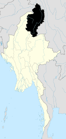 | |
| Mohnyin District | ||
| Myitkyina District | ||
| Putao District | ||
| Main cities and towns | ||