Nalbari
| Nalbari Nabadeep | |
|---|---|
| Town | |
|
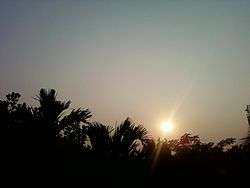
Sunset at Nalbari | |
 Nalbari  Nalbari Location in Assam, India | |
| Coordinates: 26°26′42″N 91°26′24″E / 26.445°N 91.440°ECoordinates: 26°26′42″N 91°26′24″E / 26.445°N 91.440°E | |
| Country |
|
| State | Assam |
| Region | Lower Assam |
| District | Nalbari |
| Government | |
| • Body | Nalbari Municipality Board |
| Elevation | 42 m (138 ft) |
| Population (2001) | |
| • Total | 27,389 |
| Languages | |
| • Official | Assamese |
| Time zone | IST (UTC+5:30) |
| PIN | 781335 |
| Telephone code | 03624 |
| ISO 3166 code | IN-AS |
| Vehicle registration | AS-14-XXXX |
| Website | www.nalbari.nic.in |
Nalbari (Pron: nɔ:lˈbɑ:rɪ) is a small town and a municipal board in Nalbari district in the Indian state of Assam. Nalbari town is also the headquarters of Nalbari District.
Etymology
The word Nalbari derived from Nal and Bari. Nal is variety of reed while Bari denotes garden.
History
In ancient times Western Assam was known as Kamarupa, which existed in harmony with Davaka of central Assam. Kamarupa was divided into Kamarupa Pithas or geographical divisions; Nalbari placed in Kamapitha division. Region continued to be called as Kamrup till colonial times. The area congruent to Kamapitha, became Undivided Kamrup district of colonial and post colonial times until 1985, when Nalbari district was carved out.
Growth
In the early part of the twenties a railway station of the Assam-Bengal Railway Company had been established here. As the train started running through, certain traders and businessmen from outside the state came and interacted with the local people. Business transactions were started on the rail station road. The Nalbari M.E. School had been started in the meantime to the Gurdon School site, and it was upgraded into a High School named Gurdon High School in 1917. Both these two events attracted the people to throng to the area which had changed its shape and size. It became a strong business centre with great growth potentials in the whole of the north bank of the river.
Migration started in a significant way. Population increased, administrative offices were started gradually and in 1931 it assumed an urban look. In 1941 it was declared as one of the town in Kamrup district with a town committee with a population of 3578. In 1945 the Nalbari College was started in a temporary shed and in 1950 it was shifted to its present site which helped in the growth of the Bidyapur-Shantipur area of the town into a densely populated area. The establishment of the PWD offices on the Palla road, led to the growth of the Gopalbazar area.
In 1968 Nalbari was upgraded into a subdivision with headquarters at Nalbari and in 1984 it was made the district headquarters of Nalbari District, all of which led to the upsurge of development process with huge population migration, primarily of local people.[1]
Climate
Nalbari has subtropical climate, with chilly winters, hot summers and wet monsoons.
| Climate data for Nalbari | |||||||||||||
|---|---|---|---|---|---|---|---|---|---|---|---|---|---|
| Month | Jan | Feb | Mar | Apr | May | Jun | Jul | Aug | Sep | Oct | Nov | Dec | Year |
| Record high °C (°F) | 28.8 (83.8) |
32.2 (90) |
38.4 (101.1) |
39.0 (102.2) |
37.0 (98.6) |
38.3 (100.9) |
36.5 (97.7) |
36.2 (97.2) |
35.8 (96.4) |
34.3 (93.7) |
31.0 (87.8) |
28.1 (82.6) |
39 (102.2) |
| Average high °C (°F) | 23.6 (74.5) |
26.2 (79.2) |
30.0 (86) |
31.2 (88.2) |
31.2 (88.2) |
31.7 (89.1) |
31.9 (89.4) |
32.2 (90) |
31.7 (89.1) |
30.3 (86.5) |
27.6 (81.7) |
24.7 (76.5) |
29.36 (84.87) |
| Average low °C (°F) | 10.3 (50.5) |
12.0 (53.6) |
15.9 (60.6) |
20.0 (68) |
22.7 (72.9) |
24.9 (76.8) |
25.6 (78.1) |
25.6 (78.1) |
24.7 (76.5) |
21.9 (71.4) |
16.7 (62.1) |
11.8 (53.2) |
19.34 (66.82) |
| Record low °C (°F) | 4.7 (40.5) |
5.1 (41.2) |
8.3 (46.9) |
13.0 (55.4) |
16.2 (61.2) |
20.4 (68.7) |
21.4 (70.5) |
22.1 (71.8) |
19.7 (67.5) |
13.6 (56.5) |
10.3 (50.5) |
6.0 (42.8) |
4.7 (40.5) |
| Average rainfall mm (inches) | 11.9 (0.469) |
18.3 (0.72) |
55.8 (2.197) |
147.9 (5.823) |
244.2 (9.614) |
316.4 (12.457) |
345.4 (13.598) |
264.3 (10.406) |
185.9 (7.319) |
91.2 (3.591) |
18.7 (0.736) |
7.1 (0.28) |
1,717.7 (67.626) |
| Average rainy days | 1.8 | 2.9 | 5.8 | 13.1 | 17.0 | 19.6 | 22.3 | 18.5 | 15.2 | 7.4 | 2.8 | 1.3 | 127.7 |
| Average relative humidity (%) | 79 | 65 | 57 | 68 | 75 | 81 | 83 | 82 | 83 | 82 | 82 | 82 | 76.6 |
| Mean monthly sunshine hours | 226.3 | 214.7 | 220.1 | 201.0 | 192.2 | 132.0 | 124.0 | 161.2 | 138.0 | 204.6 | 231.0 | 232.5 | 2,277.6 |
| Source: World Meteorological Organization | |||||||||||||
Education
Educational opportunities in Nalbari are of high quality. It boasts of producing most number of toppers in School level. Nalbari is famous for Sanskrit education and known as "Nabadeep" for presence of various Sanskrit education institutions like Kamrup Sanskrit Sanjivani Sabha.
First School was set up in Nalbari in the year 1887,which later known as Nalbari Govt Gurdon H.S School. Nalbari College, Nalbari; Nalbari Sanskrit College, Nalbari; Nalbari Commerce College, Nalbari; MNC Balika College, Nalbari; Barbhag College, Kamarkuchi; Baska College, Mashalpur; Barkhetri College, Mukalmua; Tihu College, Tihu; Barama College, Barama; Kamrup College, Chamata; Dhamdhama Anchalik Mahavidyalaya, Dhamdhama; Dhamdhama Anchalik Mahavidyalaya, Dhamdhama; Gyanpeeth Mahavidyalaya; Nalbari Law College, Nalbari; Sankardev Academy, Nalbari, D.S.R.Academy, nalbari are some premier colleges of Nalbari. Along with 28 Higher Secondary Schools, 145 High Schools, and 276 ME and MV Schools, Nalbari have massive educational infrastructure.
"Kumar Bhaskar Varma Sanskrit and Ancient Studies University" named after glorious king of Kamarupa, Bhaskar Varman and "Planetarium and the Science Centre" at Sariahtali, added up to this existing system.[2]
Transport
By road, Nalbari is on National Highway 31 in North and connected to "Hajo Doulashal Road" in South. The Nalbari railway station is within town center and Guwahati International Airport is at distance of 60 km.
Politics
Nalbari is part of Mangaldoi (Lok Sabha constituency).[3]
Notable people
- Angoorlata Deka, Actress & Politician
- Abani Chakraborty, Poet
- Bhumidhar Barman, Politician
- Mahadev Deka, Body Builder
- Seema Biswas, Bollywood actress
See also
References
- ↑ Ganguly, J. B. Urbanization and Development in North-east India: Trends and Policy Implications. Deep and Deep Publications. p. 191.
- ↑ "Planetarium and the Science Centre". newslivetv.com. Retrieved 2012-05-23.
- ↑ "List of Parliamentary & Assembly Constituencies" (PDF). Assam. Election Commission of India. Retrieved 2008-10-06.