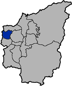
Nantou City
| Nantou 南投市 | |
|---|---|
| County-controlled city | |
| Nantou City | |
 | |
| Coordinates: 23°55′N 120°41′E / 23.917°N 120.683°E | |
| Country | Taiwan |
| Province | Taiwan Province |
| County | Nantou County |
| Area | |
| • Total | 71.2063 km2 (27.4929 sq mi) |
| Population (December 2014) | |
| • Total | 102,314 |
| Time zone | CST (UTC+8) |
| Website | http://www.ntc.gov.tw/ |
| Nantou City | |||||||||||||
| Chinese | 南投市 | ||||||||||||
|---|---|---|---|---|---|---|---|---|---|---|---|---|---|
| |||||||||||||

Nantou City (Chinese: 南投市) is a county-controlled city located in the northwest of Nantou County, Taiwan. It lies between the Bagua Mountains and the Maoluo River[1] and is the county seat of Nantou County. Freeway No. 3 serves Nantou City.[2] Its name is a transliteration of the Hoanya word Ramtau with its first character (南; "south") chosen to complement that of Beitou's (北; "north"), a district in Taipei, even though there is no relation between the aboriginal names.[3]
History
Qing Dynasty
The Han Chinese began arriving in the area during the reign of the Qianlong Emperor of Qing Dynasty. Members of the Zhang clan from Zhangzhou as well as the Jian (簡), Lin and Xiao clans from Nanjing County in Zhangzhou were among the early settlers. A yamen was established in 1759 near the present Nantou Elementary School. In 1898, Nantou Commandery was organized.
Empire of Japan
In 1901, during Japanese rule, Nanto Chō (南投廳) was one of twenty local administrative offices established. In 1909, part of Toroku Chō (斗六廳) was merged into Nanto Chō. In 1920, Nantō Town was governed under Nantō District, Taichū Prefecture.
Republic of China
After handover to the Republic of China, Nantou County was organized out of Taichung County in 1950, and, in October of the same year, Nantou Township was organized with the county government seated in it. On July 1, 1957, the Taiwan provincial government moved to Zhongxing New Village, making Nantou the location of the provincial government. On 25 December 1981, Nantou became a county-controlled city from the previous urban township.[1] Due to its location along the Chelungpu Fault,[4] Nantou was strongly affected by the 1999 921 earthquake: 92 people died[5] and over 1,000 buildings were damaged[6]
Administrative divisions
Longquan Village, Kangshou Village, Sanmin Village, Renhe Village, Nantou Village, Zhangren Village, Chongwen Village, Sanxing Village, Sanhe Village, Jiaxing Village, Jiahe Village, Pinghe Village, Zhenxing Village, Qianqiu Village, Jungong Village, Tungshan Village, Yingnan Village, Yingbei Village, Neixing Village, Neixin Village, Guanghui Village, Guangrong Village, Guangming Village, Guanghua Village, Zhangxing Village, Zhanghe Village, Pingshan Village, Xinxing Village, Yongfeng Village, Fuxing Village, Fengshan Village, Yongxing Village, Fengming Village and Fushan Village.
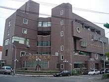
Government institutions
Tourist attractions
Notable natives
- Sonia Sui, model and actress
See also
| Wikimedia Commons has media related to Nantou City. |
References
- 1 2 南投市簡介 [Brief introduction to Nantou city] (in Chinese). Archived from the original on 2007-01-29. Retrieved 2007-02-09.
- ↑ "Freeway No. 3". Retrieved 2007-06-05.
- ↑ 地名解說集錦 [Collection of the best place name explanations] (in Chinese). Retrieved 2007-02-09.
- ↑ "Event Report Chi-Chi, Taiwan Earthquake" (pdf).
- ↑ "Mortality of the 921 Earthquake in Nantou and Taichung Counties" (PDF). Archived from the original (pdf) on September 28, 2007. Retrieved 2007-02-13.
- ↑ Tsai, K.C.; Chiang Pi Hsiao; Michel Bruneau (March 2000). "Overview of Building Damages in 921 Chi-Chi Earthquake" (PDF). Earthquake Engineering and Engineering Seismology. 2 (1): 93–108. Retrieved 2007-02-13.
Coordinates: 23°55′N 120°41′E / 23.917°N 120.683°E
Cities and townships of Nantou County | ||
|---|---|---|
| Cities |  | |
| Urban townships | ||
| Rural townships | ||
| Mountain indigenous townships | ||