Narva-Jõesuu
| Narva-Jõesuu | |||
|---|---|---|---|
| Town and municipality | |||
|
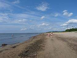
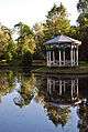
Narva-Jõesuu beach | |||
| |||
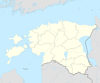 Narva-Jõesuu Location in Estonia | |||
| Coordinates: 59°27′32″N 28°02′26″E / 59.45889°N 28.04056°ECoordinates: 59°27′32″N 28°02′26″E / 59.45889°N 28.04056°E | |||
| Country |
| ||
| County |
| ||
| Government | |||
| • Mayor | Andres Noormägi | ||
| Area | |||
| • Total | 11.03 km2 (4.26 sq mi) | ||
| Population (01.01.2010) | |||
| • Total | 2,602 | ||
| • Density | 240/km2 (610/sq mi) | ||
| Time zone | EET (UTC+2) | ||
| • Summer (DST) | EEST (UTC+3) | ||
| Website | www.narva-joesuu.ee | ||

Narva-Jõesuu (Estonian pronunciation: [ˈnɑrˈʋɑ-ˈjɤeˈsuː]; Russian: Усть-Нарва, Ust'-Narva) is a town in Ida-Viru County, in north-eastern Estonia.
Geography
It is located on the country's northern Baltic coast and the Gulf of Finland. The town's name in Estonian and Russian means "Mouth of the Narva", the river which forms the border with Russia.
Narva-Jõesuu has a population of 2,602 (as of 1 January 2010).[1] As in the nearby city of Narva, most residents today are Russian or Russian-speaking, although the percentage of native Estonians is slightly higher in Narva-Jõesuu (13% compared to 4% in Narva).
Narva-Jõesuu marks the north-eastern end of the E9 European Coastal Path, which runs for 5000 km (3125 miles) from Cabo de São Vicente in Portugal.
History
The settlement probably arose in the 14th century, then part of the Duchy of Estonia, a dominion of the Livonian Order within Terra Mariana from 1346. It was first documented in a 1503 deed issued by Master of the Order Wolter von Plettenberg. It was the site of an outer harbour of the City of Narva from the 16th century, containing several timber stockyards, sawmills, and a small shipbuilding industry.
The German name Hungerburg allegedly goes back to the Russian emperor Peter the Great, who during the 1704 Battle of Narva noticed the great poverty of the rural population. The Narva-Jõesuu Lighthouse was erected in 1808.
Tourism
Thanks to its eight-kilometre-long white sand beach lined with pine trees – one of the best in Estonia – Narva-Jõesuu has long been a popular summer destination. In the late 19th and early 20th century it was a spa town frequented by the nobility from Saint Petersburg, which is less than 150 km (93 mi) to the east, and from Moscow. During the Soviet period it was visited in large numbers by residents of the renamed Leningrad, particularly the Russian intelligentsia, many of whom have bought dachas (summer houses) in Narva-Jõesuu or on the outskirts.
In the first ten to fifteen years after the restoration of Estonia's independence Narva-Jõesuu saw few visitors, with a large number of hotels and guest houses closing their doors and going out of business. In the last few years its resort facilities have been renovated and the number of tourists is rising, however, the number of hotels is still considerably lower in comparison to the late 1980s.
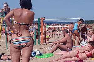
Near Narva-Jõesuu, 2 km (1.2 mi) southwest from the town border lies the Narva-Jõesuu nudist beach, the only official nudist beach in Estonia.
Symbols
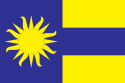
Narva-Jõesuu's flag and coat of arms were designed and approved in the mid-1990s by the chairman of the local government Pavel Grigorjev. The gold strips of land on the image symbolise Estonian and Russian coasts on both sides along the Narva River and the blue area symbolises its iconic mouth.
Twinnings
 Billund Municipality, Denmark
 Imatra, Finland[2]
 Kronstadt, Russia[2]
Gallery
 Ruins of Narva-Jõesuu kuursaal (resort hall).
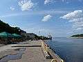 Pier in the mouth of Narva River.
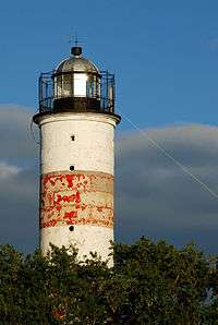
References
- ↑ "Population figure and composition". Statistics Estonia. Retrieved 24 May 2010.
- 1 2 "Sõpruslinnad" (in Estonian). Narva-Jõesuu. Retrieved 24 May 2010.
External links
| Wikimedia Commons has media related to Narva-Jõesuu. |
| Wikivoyage has a travel guide for Narva-Jõesuu. |
- Official website (Estonian) (Russian) (English) (Finnish)
- Narva-Jõesuu Nude Beach
| ||
Jaanilinn (Ivangorod) and Petseri (Pechory) were annexed by the Soviet Union in 1945 and are currently part of Russia. | ||
| Urban municipalities | ||
|---|---|---|
| Rural municipalities | ||