Võru
| Võru Võro (Võro) | |||
|---|---|---|---|
| Town and municipality | |||
|
Võru city centre at night. | |||
| |||
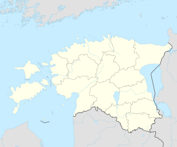 Võru Location in Estonia | |||
| Coordinates: 57°50′55″N 26°59′34″E / 57.848611111111°N 26.992777777778°ECoordinates: 57°50′55″N 26°59′34″E / 57.848611111111°N 26.992777777778°E | |||
| Country |
| ||
| County |
| ||
| Founded | 21 August 1784 | ||
| Government | |||
| • Mayor | Anti Allas[1] | ||
| Area | |||
| • Total | 13.24 km2 (5.11 sq mi) | ||
| Elevation | 20 m (70 ft) | ||
| Population (2016) | |||
| • Total | 12,430 | ||
| • Density | 1,099.2/km2 (2,847/sq mi) | ||
| Ethnicity | |||
| • Estonians | 92% | ||
| • Russians | 6% | ||
| • other | 2% | ||
| Time zone | EET (UTC+2) | ||
| • Summer (DST) | EEST (UTC+3) | ||
| Website |
www | ||


Võru (Estonian pronunciation: [ˈʋɤru]) (Võro: Võro; German: Werro; Russian: Выру (Vyru); Latvian: Veru) is a town and a municipality in south-eastern Estonia. It is the capital of Võru County and the centre of Võru Parish.
History

Võru was founded on 21 August 1784, according to the wish of the Empress Catherine II of Russia, by the order of Riga Governor general count George Browne, on the site of the former Võru estate.
Geography and climate
The town is situated on the shore of Lake Tamula. Võru has a humid continental climate with warm summers and cold winters.
| Climate data for Võru (1981–2010) | |||||||||||||
|---|---|---|---|---|---|---|---|---|---|---|---|---|---|
| Month | Jan | Feb | Mar | Apr | May | Jun | Jul | Aug | Sep | Oct | Nov | Dec | Year |
| Record high °C (°F) | 9.6 (49.3) |
12.4 (54.3) |
18.0 (64.4) |
26.9 (80.4) |
30.7 (87.3) |
33.5 (92.3) |
35.2 (95.4) |
35.6 (96.1) |
29.9 (85.8) |
22.2 (72) |
13.3 (55.9) |
11.2 (52.2) |
35.6 (96.1) |
| Average high °C (°F) | −1.9 (28.6) |
−1.8 (28.8) |
3.3 (37.9) |
11.1 (52) |
17.7 (63.9) |
20.7 (69.3) |
23.2 (73.8) |
21.7 (71.1) |
15.7 (60.3) |
9.5 (49.1) |
2.8 (37) |
−0.9 (30.4) |
10.1 (50.2) |
| Daily mean °C (°F) | −4.6 (23.7) |
−5.1 (22.8) |
−0.8 (30.6) |
5.9 (42.6) |
11.9 (53.4) |
15.5 (59.9) |
18.0 (64.4) |
16.6 (61.9) |
11.3 (52.3) |
6.3 (43.3) |
0.5 (32.9) |
−3.3 (26.1) |
6.1 (43) |
| Average low °C (°F) | −7.2 (19) |
−8.4 (16.9) |
−4.2 (24.4) |
1.1 (34) |
6.1 (43) |
10.5 (50.9) |
13.0 (55.4) |
11.9 (53.4) |
7.5 (45.5) |
3.5 (38.3) |
−1.7 (28.9) |
−5.8 (21.6) |
2.2 (36) |
| Record low °C (°F) | −35.8 (−32.4) |
−35.6 (−32.1) |
−26.7 (−16.1) |
−12.5 (9.5) |
−5.4 (22.3) |
0.2 (32.4) |
1.7 (35.1) |
3.5 (38.3) |
−3.8 (25.2) |
−14.4 (6.1) |
−21.9 (−7.4) |
−34.6 (−30.3) |
−35.8 (−32.4) |
| Average precipitation mm (inches) | 46 (1.81) |
34 (1.34) |
36 (1.42) |
30 (1.18) |
52 (2.05) |
84 (3.31) |
80 (3.15) |
86 (3.39) |
62 (2.44) |
64 (2.52) |
51 (2.01) |
47 (1.85) |
665 (26.18) |
| Average relative humidity (%) | 87 | 85 | 79 | 70 | 67 | 73 | 74 | 78 | 82 | 86 | 88 | 89 | 80 |
| Mean monthly sunshine hours | 25.9 | 57.5 | 121.9 | 184.8 | 261.0 | 246.6 | 271.5 | 228.2 | 137.2 | 78.1 | 29.4 | 16.7 | 1,659 |
| Source: Estonian Weather Service[2][3][4][5] | |||||||||||||
Culture
The Võru Folklore Festival is held annually in Võru in July since 1995.[6]
Friedrich Reinhold Kreutzwald, the author of the Estonian national epic "Kalevipoeg", lived in Võru from 1833 to 1877.
Transport
European route E263 is the main connection with the rest of Estonia. Other roads connect Võru with Põlva, Räpina, Antsla and Valga. Currently inactive Valga–Pechory railway passes through Võru.
Sports
Võru is home to Võru Stadium, the home ground of II liiga football team Võru JK.
Twin towns
|
Notable people
- Priit Aimla (born 1941,) writer, poet, humorist and politician was born in Võru.
- Helmut Ajango (1931–2013), Estonian-American architect, was born in Võru.
- Moses Wolf Goldberg (1905–1964), Estonian-Jewish chemist, lived in Võru as a child.
- Sulev Iva (born 1969), Võro identity advocate, founder of Võro Institute.
- Meelis Kanep (born 1983), Estonian chess grandmaster, was born in Võru.
- Friedrich Reinhold Kreutzwald (1803–1822), Estonian writer and folklorist, the author of Estonian national epic "Kalevipoeg", lived in Võru from 1833 to 1877.
- Marianne Mikko (born 1961), Estonian politician
- Priit Narusk (born 1977), Estonian cross-country skier, was born in Võru.
- Erki Nool (born 1970), Estonian decathlete and politician, was born in Võru.
- Erki Pehk (born 1968), Estonian conductor, was born in Võru.
- Anti Saarepuu (born 1983), Estonian cross-country skier, was born in Võru.
- Leon Sibul (1932–2007), American electrical engineer, was born in Võru.
- Uku Suviste (born 1982), Estonian singer, was born in Võru.
- Kaija Udras (born 1986), Estonian cross-country skier, was born in Võru.
- Kullar Viimne (born 1980), Estonian fillmaker, was born in Võru.
See also
References
- ↑ "Valitsus". Retrieved 3 August 2016.
- ↑ "Climate normals-Temperature". Estonian Weather Service. Retrieved 28 September 2016.
- ↑ "Climate normals-Precipitation". Estonian Weather Service. Retrieved 28 September 2016.
- ↑ "Climate normals-Humidity". Estonian Weather Service. Retrieved 28 September 2016.
- ↑ "Climate normals-Sunshine". Estonian Weather Service. Retrieved 28 September 2016.
- ↑ "Ajalugu". MTÜ Võru Folkloorifestival. Retrieved 3 August 2016.
- ↑ "Võru sõpruslinnad" (in Estonian). Võru. Retrieved 2 May 2012.
External links
| Wikimedia Commons has media related to Võru. |
| Wikivoyage has a travel guide for Võru. |
| ||
Jaanilinn (Ivangorod) and Petseri (Pechory) were annexed by the Soviet Union in 1945 and are currently part of Russia. | ||
| Urban municipality | ||
|---|---|---|
| Rural municipalities | ||