Nieuwkoop
| Nieuwkoop | |||
|---|---|---|---|
| Municipality | |||
|
Nieuwkoopse plassen | |||
| |||
.svg.png) Location in South Holland | |||
| Coordinates: 52°11′N 4°46′E / 52.183°N 4.767°ECoordinates: 52°11′N 4°46′E / 52.183°N 4.767°E | |||
| Country | Netherlands | ||
| Province | South Holland | ||
| Government[1] | |||
| • Body | Municipal council | ||
| • Mayor | Frans Buijserd (CDA) | ||
| Area[2] | |||
| • Total | 91.16 km2 (35.20 sq mi) | ||
| • Land | 78.88 km2 (30.46 sq mi) | ||
| • Water | 12.28 km2 (4.74 sq mi) | ||
| Elevation[3] | −5 m (−16 ft) | ||
| Population (May 2014)[4] | |||
| • Total | 27,122 | ||
| • Density | 344/km2 (890/sq mi) | ||
| Time zone | CET (UTC+1) | ||
| • Summer (DST) | CEST (UTC+2) | ||
| Postcode | 2420–2441, 2460–2461, 3651–3653 | ||
| Area code | 0172, 0297 | ||
| Website |
www | ||


Nieuwkoop (![]() pronunciation ) is a town and municipality in the western Netherlands, in the province of South Holland. The municipality was enlarged on 1 January 2007, through the amalgamation of Liemeer and Ter Aar. The municipality now covers an area of 91.16 km2 (35.20 sq mi) of which 12.28 km2 (4.74 sq mi) is water. Its population was 27,122 in 2014.
pronunciation ) is a town and municipality in the western Netherlands, in the province of South Holland. The municipality was enlarged on 1 January 2007, through the amalgamation of Liemeer and Ter Aar. The municipality now covers an area of 91.16 km2 (35.20 sq mi) of which 12.28 km2 (4.74 sq mi) is water. Its population was 27,122 in 2014.
On May 3rd, 2008, the Dutch newspaper het Algemeen Dagblad published an article which stated that Nieuwkoop is the safest municipality of the Netherlands.
The municipality of Nieuwkoop includes the following communities:
- Aardam
- Korteraar
- Langeraar
- Nieuwkoop
- Nieuwveen
- Noordeinde
- Noorden
- Noordsedorp
- Papenveer
- Ter Aar
- Vrouwenakker
- Woerdense Verlaat
- Zevenhoven
History
The oldest part of Nieuwkoop are the buildings along the Nieuwkoopse Plassen (Nieuwkoop's Ponds), many of which are completely surrounded by water and accessible over individual bridges to the main road. The Nieuwkoopse Plassen are shallow lakes that were dug for peat harvesting in the 16th century and are now designated as a natural monument. New neighborhoods north-west of the main road are built after World War II.
Gallery
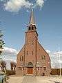 Zevenhoven, church
 Woerdense Verlaat, drawbridge
References
- ↑ "College van B&W" [Board of mayor and aldermen] (in Dutch). Gemeente Nieuwkoop. Retrieved 16 August 2013.
- ↑ "Kerncijfers wijken en buurten" [Key figures for neighbourhoods]. CBS Statline (in Dutch). CBS. 2 July 2013. Retrieved 12 March 2014.
- ↑ "Postcodetool for 2441LE". Actueel Hoogtebestand Nederland (in Dutch). Het Waterschapshuis. Retrieved 16 August 2013.
- ↑ "Bevolkingsontwikkeling; regio per maand" [Population growth; regions per month]. CBS Statline (in Dutch). CBS. 26 June 2014. Retrieved 24 July 2014.
External links
 |
Uithoorn (NH) | De Ronde Venen (UT) | | |
| Kaag en Braassem | |
|||
| ||||
| | ||||
| Alphen aan den Rijn | Bodegraven-Reeuwijk | Woerden (UT) |
