Zwijndrecht, Netherlands
| Zwijndrecht | |||
|---|---|---|---|
| Municipality | |||
|
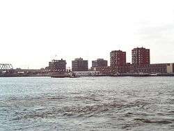
Zwijndrecht across the Oude Maas | |||
| |||
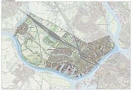
.svg.png) Location in South Holland | |||
| Coordinates: 51°49′N 4°39′E / 51.817°N 4.650°ECoordinates: 51°49′N 4°39′E / 51.817°N 4.650°E | |||
| Country | Netherlands | ||
| Province | South Holland | ||
| Government[1] | |||
| • Body | Municipal council | ||
| • Mayor | Dominic Schrijer (PvdA) | ||
| Area[2] | |||
| • Total | 22.77 km2 (8.79 sq mi) | ||
| • Land | 20.35 km2 (7.86 sq mi) | ||
| • Water | 2.42 km2 (0.93 sq mi) | ||
| Elevation[3] | −1 m (−3 ft) | ||
| Population (May 2014)[4] | |||
| • Total | 44,546 | ||
| • Density | 2,189/km2 (5,670/sq mi) | ||
| Demonym(s) | Zwijndrechter | ||
| Time zone | CET (UTC+1) | ||
| • Summer (DST) | CEST (UTC+2) | ||
| Postcode | 3330–3336 | ||
| Area code | 078 | ||
| Website |
www | ||
_vlag.svg.png)
.svg.png)
Zwijndrecht (Dutch pronunciation: [ˈzʋɛi̯ndrɛxt]) is a town and municipality in the western Netherlands. It is located in the province of South Holland, at the southern tip of the island of IJsselmonde, and at the confluence of the rivers Oude Maas, Beneden-Merwede, and Noord.
Population
The town of Zwijndrecht is one of the "Drecht" cities. Part of the suburban zone south of Rotterdam, it has grown from around 6,000 inhabitants in 1960, to about 45,000 today.
Since 2003, the municipality of Zwijndrecht also includes the villages of Heerjansdam and Kleine-Lindt. It had a population of 44,546 in 2014.
Zwijndrecht has the highest concentration of Estonians in the Netherlands.[5]
Transportation
The town is served by a railway station of the same name (Station Zwijndrecht).
By train you go north to Rotterdam and The Hague, and south it takes you to either Breda or Roosendaal.
A waterbus lines 21 and 24 both stops at (Zwijndrecht Veerplein) connects it with the following:
The busses are driven by Arriva. and can bring you to Dordrecht, Rotterdam and other places in the Drechtsteden.
References
- ↑ "Samenstelling college: Collegeperiode 2010–2014" [Members of the board: 2010–2014] (in Dutch). Gemeente Zwijndrecht. Retrieved 31 August 2013.
- ↑ "Kerncijfers wijken en buurten" [Key figures for neighbourhoods]. CBS Statline (in Dutch). CBS. 2 July 2013. Retrieved 12 March 2014.
- ↑ "Postcodetool for 3331BT". Actueel Hoogtebestand Nederland (in Dutch). Het Waterschapshuis. Retrieved 31 August 2013.
- ↑ "Bevolkingsontwikkeling; regio per maand" [Population growth; regions per month]. CBS Statline (in Dutch). CBS. 26 June 2014. Retrieved 24 July 2014.
- ↑ "Welkom bij het Meertens Instituut". Meertens.knaw.nl. 2013-11-26. Retrieved 2014-05-26.
External links
| Wikimedia Commons has media related to Zwijndrecht, Netherlands. |
- (Dutch) Official website
 |
Barendrecht | Ridderkerk, Hendrik-Ido-Ambacht | | |
| |
Noord / Papendrecht | |||
| ||||
| | ||||
| Binnenmaas / Oude Maas | Oude Maas / Dordrecht |
