North Freedom, Wisconsin
| North Freedom, Wisconsin | |
|---|---|
| Village | |
 Location of North Freedom, Wisconsin | |
| Coordinates: 43°27′39″N 89°51′57″W / 43.46083°N 89.86583°WCoordinates: 43°27′39″N 89°51′57″W / 43.46083°N 89.86583°W | |
| Country | United States |
| State | Wisconsin |
| County | Sauk |
| Area[1] | |
| • Total | 0.87 sq mi (2.25 km2) |
| • Land | 0.81 sq mi (2.10 km2) |
| • Water | 0.06 sq mi (0.16 km2) |
| Elevation[2] | 879 ft (268 m) |
| Population (2010)[3] | |
| • Total | 701 |
| • Estimate (2012[4]) | 704 |
| • Density | 865.4/sq mi (334.1/km2) |
| Time zone | Central (CST) (UTC-6) |
| • Summer (DST) | CDT (UTC-5) |
| Area code(s) | 608 |
| FIPS code | 55-58025[5] |
| GNIS feature ID | 1570440[2] |
North Freedom is a village in Sauk County, Wisconsin, United States, along the Baraboo River. The population was 701 at the 2010 census.
History
North Freedom was named from the American ideal of freedom.[6]
Geography
North Freedom is located at 43°27′39″N 89°51′57″W / 43.46083°N 89.86583°W (43.460843, -89.865862).[7]
According to the United States Census Bureau, the village has a total area of 0.87 square miles (2.25 km2), of which, 0.81 square miles (2.10 km2) of it is land and 0.06 square miles (0.16 km2) is water.[1]
Demographics
| Historical population | |||
|---|---|---|---|
| Census | Pop. | %± | |
| 1890 | 316 | — | |
| 1900 | 485 | 53.5% | |
| 1910 | 647 | 33.4% | |
| 1920 | 621 | −4.0% | |
| 1930 | 554 | −10.8% | |
| 1940 | 547 | −1.3% | |
| 1950 | 611 | 11.7% | |
| 1960 | 579 | −5.2% | |
| 1970 | 596 | 2.9% | |
| 1980 | 616 | 3.4% | |
| 1990 | 591 | −4.1% | |
| 2000 | 649 | 9.8% | |
| 2010 | 701 | 8.0% | |
| Est. 2015 | 706 | [8] | 0.7% |
2010 census
As of the census[3] of 2010, there were 701 people, 271 households, and 176 families residing in the village. The population density was 865.4 inhabitants per square mile (334.1/km2). There were 293 housing units at an average density of 361.7 per square mile (139.7/km2). The racial makeup of the village was 97.1% White, 0.1% African American, 0.3% Native American, 0.4% Asian, 0.9% from other races, and 1.1% from two or more races. Hispanic or Latino of any race were 2.6% of the population.
There were 271 households of which 35.8% had children under the age of 18 living with them, 46.5% were married couples living together, 11.4% had a female householder with no husband present, 7.0% had a male householder with no wife present, and 35.1% were non-families. 24.7% of all households were made up of individuals and 8.9% had someone living alone who was 65 years of age or older. The average household size was 2.59 and the average family size was 3.03.
The median age in the village was 35.9 years. 29.7% of residents were under the age of 18; 4.9% were between the ages of 18 and 24; 31.2% were from 25 to 44; 24.4% were from 45 to 64; and 9.7% were 65 years of age or older. The gender makeup of the village was 53.2% male and 46.8% female.
2000 census
As of the census[5] of 2000, there were 649 people, 238 households, and 164 families residing in the village. The population density was 745.9 people per square mile (288.0/km²). There were 252 housing units at an average density of 289.6 per square mile (111.8/km²). The racial makeup of the village was 98.31% White, 0.77% Native American, and 0.92% from two or more races. Hispanic or Latino of any race were 1.08% of the population.
There were 238 households out of which 39.1% had children under the age of 18 living with them, 58.4% were married couples living together, 5.9% had a female householder with no husband present, and 30.7% were non-families. 25.6% of all households were made up of individuals and 11.8% had someone living alone who was 65 years of age or older. The average household size was 2.73 and the average family size was 3.28.
In the village the population was spread out with 30.7% under the age of 18, 7.1% from 18 to 24, 31.4% from 25 to 44, 18.5% from 45 to 64, and 12.3% who were 65 years of age or older. The median age was 33 years. For every 100 females there were 102.8 males. For every 100 females age 18 and over, there were 93.1 males.
The median income for a household in the village was $37,273, and the median income for a family was $41,818. Males had a median income of $32,500 versus $20,000 for females. The per capita income for the village was $14,354. About 5.4% of families and 11.3% of the population were below the poverty line, including 8.5% of those under age 18 and 10.1% of those age 65 or over.
Notable residents
- Samuel Northrup (1801–1860), Wisconsin State Assemblyman, resided in nearby Dellona, is buried in North Freedom.[10]
- Algie Martin Simons (1870–1950), Socialist journalist and editor, born and raised on a farm near North Freedom.[11]
- Chester D. Seftenberg (1904-1970), Wisconsin State Assemblyman, was born in North Freedom.[12]
Attractions
See also
Footnotes
- 1 2 "US Gazetteer files 2010". United States Census Bureau. Retrieved 2012-11-18.
- 1 2 "US Board on Geographic Names". United States Geological Survey. 2007-10-25. Retrieved 2008-01-31.
- 1 2 "American FactFinder". United States Census Bureau. Retrieved 2012-11-18.
- ↑ "Population Estimates". United States Census Bureau. Retrieved 2013-06-24.
- 1 2 "American FactFinder". United States Census Bureau. Retrieved 2008-01-31.
- ↑ Chicago and North Western Railway Company (1908). A History of the Origin of the Place Names Connected with the Chicago & North Western and Chicago, St. Paul, Minneapolis & Omaha Railways. p. 108.
- ↑ "US Gazetteer files: 2010, 2000, and 1990". United States Census Bureau. 2011-02-12. Retrieved 2011-04-23.
- ↑ "Annual Estimates of the Resident Population for Incorporated Places: April 1, 2010 to July 1, 2015". Retrieved July 2, 2016.
- ↑ "Census of Population and Housing". Census.gov. Retrieved June 4, 2015.
- ↑ "Samuel Northrup". Political Graveyard. Retrieved 2011-12-30.
- ↑ Kreuter, Kent; Kreuter, Gretchen (13 January 2015). An American Dissenter: The Life of Algie Martin Simons 1870--1950. University Press of Kentucky. p. 2. ISBN 978-0-8131-6370-3.
- ↑ 'Wisconsin Blue Book 1970,' Biographical Sketch of Chester D. Seftenberg, pg. 726
External links
Municipalities and communities of Sauk County, Wisconsin, United States | ||
|---|---|---|
| Cities | 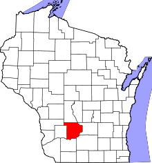 | |
| Villages | ||
| Towns | ||
| CDPs | ||
| Unincorporated communities | ||
| Indian reservation | ||
| Footnotes | ‡This populated place also has portions in an adjacent county or counties | |