Nzau Namsan
| Nzau Namsan | |
|---|---|
| village | |
 Nzau Namsan  Nzau Namsan Location in Nagaland, India | |
| Coordinates: 25°15′34″N 93°36′50″E / 25.259432°N 93.613871°ECoordinates: 25°15′34″N 93°36′50″E / 25.259432°N 93.613871°E | |
| Country | India |
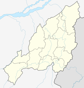
| State | Nagaland |
| District | Peren |
| Circle | Tening |
| Population (2011) | |
| • Total | 1,199 |
| Time zone | IST (UTC+5:30) |
| Census code | 268389 |
Nzau Namsan is a village in the Peren district of Nagaland, India. It is located in the Tening Circle.[1]
Demographics
According to the 2011 census of India, Nzau Namsan has 252 households. The effective literacy rate (i.e. the literacy rate of population excluding children aged 6 and below) is 43.15%.[2]
| Total | Male | Female | |
|---|---|---|---|
| Population | 1199 | 635 | 564 |
| Children aged below 6 years | 207 | 112 | 95 |
| Scheduled caste | 0 | 0 | 0 |
| Scheduled tribe | 1198 | 635 | 563 |
| Literates | 428 | 266 | 162 |
| Workers (all) | 702 | 360 | 342 |
| Main workers (total) | 38 | 22 | 16 |
| Main workers: Cultivators | 10 | 5 | 5 |
| Main workers: Agricultural labourers | 5 | 3 | 2 |
| Main workers: Household industry workers | 1 | 1 | 0 |
| Main workers: Other | 22 | 13 | 9 |
| Marginal workers (total) | 664 | 338 | 326 |
| Marginal workers: Cultivators | 561 | 279 | 282 |
| Marginal workers: Agricultural labourers | 5 | 1 | 4 |
| Marginal workers: Household industry workers | 0 | 0 | 0 |
| Marginal workers: Others | 98 | 58 | 40 |
| Non-workers | 497 | 275 | 222 |
References
- ↑ Nagaland revenue village directory
- 1 2 "District Census Handbook - Peren" (PDF). 2011 Census of India. Directorate of Census Operations, Nagaland. Retrieved 2015-07-22.
This article is issued from Wikipedia - version of the 8/26/2016. The text is available under the Creative Commons Attribution/Share Alike but additional terms may apply for the media files.