Tening HQ
| Tening HQ | |
|---|---|
| village | |
 Tening HQ  Tening HQ Location in Nagaland, India | |
| Coordinates: 25°18′N 93°36′E / 25.30°N 93.60°ECoordinates: 25°18′N 93°36′E / 25.30°N 93.60°E | |
| Country | India |
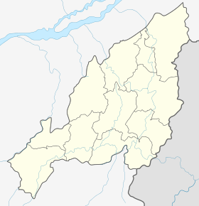
| State | Nagaland |
| District | Peren |
| Circle | Tening |
| Population (2011) | |
| • Total | 2,525 |
| Time zone | IST (UTC+5:30) |
| Census code | 268383 |
Tening HQ is a village in the Peren district of Nagaland, India. It is the headquarters of the Tening Circle.[1]
Demographics
According to the 2011 census of India, Tening HQ has 448 households. The effective literacy rate (i.e. the literacy rate of population excluding children aged 6 and below) is 78.37%.[2]
| Total | Male | Female | |
|---|---|---|---|
| Population | 2525 | 1320 | 1205 |
| Children aged below 6 years | 264 | 153 | 111 |
| Scheduled caste | 0 | 0 | 0 |
| Scheduled tribe | 2472 | 1286 | 1186 |
| Literates | 1772 | 957 | 815 |
| Workers (all) | 1397 | 723 | 674 |
| Main workers (total) | 933 | 489 | 444 |
| Main workers: Cultivators | 499 | 221 | 278 |
| Main workers: Agricultural labourers | 135 | 76 | 59 |
| Main workers: Household industry workers | 5 | 3 | 2 |
| Main workers: Other | 294 | 189 | 105 |
| Marginal workers (total) | 464 | 234 | 230 |
| Marginal workers: Cultivators | 107 | 59 | 48 |
| Marginal workers: Agricultural labourers | 247 | 123 | 124 |
| Marginal workers: Household industry workers | 65 | 33 | 32 |
| Marginal workers: Others | 45 | 19 | 26 |
| Non-workers | 1128 | 597 | 531 |
References
- ↑ Nagaland revenue village directory
- 1 2 "District Census Handbook - Peren" (PDF). 2011 Census of India. Directorate of Census Operations, Nagaland. Retrieved 2015-07-22.
This article is issued from Wikipedia - version of the 8/26/2016. The text is available under the Creative Commons Attribution/Share Alike but additional terms may apply for the media files.