O'Donnell, Texas
| O'Donnell, Texas | |
|---|---|
| City | |
|
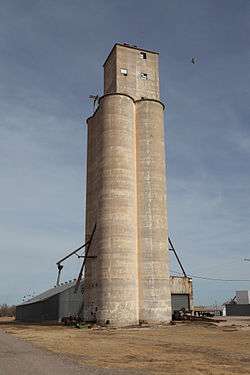
Grain elevator in O'Donnell | |
 O'Donnell Location of O'Donnell in Texas | |
| Coordinates: 32°57′49″N 101°49′58″W / 32.96361°N 101.83278°WCoordinates: 32°57′49″N 101°49′58″W / 32.96361°N 101.83278°W | |
| Country |
|
| State |
|
| Counties | Lynn, Dawson |
| Region | Llano Estacado |
| Established | 1910 |
| Area | |
| • Total | 0.8 sq mi (2.2 km2) |
| • Land | 0.8 sq mi (2.2 km2) |
| • Water | 0.0 sq mi (0.0 km2) |
| Elevation[1] | 3,045 ft (928 m) |
| Population (2010) | |
| • Total | 831 |
| • Density | 966/sq mi (373.0/km2) |
| Time zone | CST (UTC-6) |
| ZIP code | 79351 |
| Area code | 806 |
O'Donnell is a West Texas city that lies primarily in Lynn County, with a small portion extending south into Dawson County, Texas.[2] The population was 831 at the 2010 census,[3] down from 1,011 at the 2000 census.
History
O'Donnell was first settled in 1910[4] and named for Tom J. O'Donnell, a railroad promoter. O'Donnell was a railroad-created town, founded in anticipation that the Pecos and Northern Texas Railway would lay tracks through the area.[5] A branch of the Pecos and Northern Texas Railway was constructed from Slaton to Lamesa in 1910.[6] The rails were abandoned and completely removed in 1999.
Geography
O'Donnell is located on the high plains of the Llano Estacado at 32°57′49″N 101°49′58″W / 32.96361°N 101.83278°W (32.9637085 -101.8326542).[7] U.S. Highway 87 passes just northwest of the city limits, leading southwest 17 miles (27 km) to Lamesa and north 45 miles (72 km) to Lubbock.
According to the United States Census Bureau, O'Donnell has a total area of 0.85 square miles (2.2 km2), all of it land.[3]
Demographics
| Historical population | |||
|---|---|---|---|
| Census | Pop. | %± | |
| 1930 | 1,026 | — | |
| 1940 | 1,147 | 11.8% | |
| 1950 | 1,473 | 28.4% | |
| 1960 | 1,356 | −7.9% | |
| 1970 | 1,148 | −15.3% | |
| 1980 | 1,200 | 4.5% | |
| 1990 | 1,102 | −8.2% | |
| 2000 | 1,011 | −8.3% | |
| 2010 | 831 | −17.8% | |
| Est. 2015 | 807 | [8] | −2.9% |
As of the census[10] of 2000, 1,011 people, 364 households, and 275 families resided in the city. The population density was 1,177.5 people per square mile (453.9/km²). There were 423 housing units at an average density of 492.7/sq mi (189.9/km²). The racial makeup of the city was 64.00% White, 1.09% African American, 1.09% Native American, 0.10% Asian, 31.75% from other races, and 1.98% from two or more races. Hispanics or Latinos of any race were 65.28% of the population.
Of 364 households, 41.2% had children under the age of 18 living with them, 58.8% were married couples living together, 12.1% had a female householder with no husband present, and 24.2% were not families. About 23.4% of all households were made up of individuals and 12.9% had someone living alone who was 65 years of age or older. The average household size was 2.78 and the average family size was 3.28.
In the city, the population was distributed as 30.5% under the age of 18, 9.5% from 18 to 24, 24.9% from 25 to 44, 21.5% from 45 to 64, and 13.6% who were 65 years of age or older. The median age was 34 years. For every 100 females, there were 101.0 males. For every 100 females age 18 and over, there were 89.0 males.
The median income for a household in the city was $26,103, and for a family was $30,833. Males had a median income of $26,193 versus $15,917 for females. The per capita income for the city was $12,924. About 24.4% of families and 24.8% of the population were below the poverty line, including 31.1% of those under age 18 and 15.0% of those age 65 or over.
Education
O'Donnell is served by the O'Donnell Independent School District and is home to the O'Donnell High School Eagles.
Gallery
-
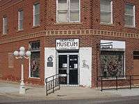
O'Donnell Heritage Museum at the intersection of Doak and Eighth streets
-
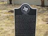
Texas Historical Commission marker in O'Donnell
-

O'Donnell Cemetery
-
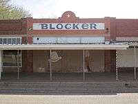
The former Blocker Store is now an abandoned building in downtown O'Donnell.
Notable people
- Dan Blocker was born in DeKalb, Texas, and moved with his parents to O'Donnell shortly after his birth. He is best known for playing Hoss Cartwright on the NBC television series Bonanza. A small museum in O'Donnell features limited Blocker memorabilia.
- Phil Hardberger, a former mayor of San Antonio, grew up in O'Donnell. His parents, Homer Reeves Hardberger and the former Bess Scott, are buried in O'Donnell.[11]
See also
References
- ↑ "O'Donnell". Geographic Names Information System. United States Geological Survey.
- ↑ Donald R. Abbe. "O'Donnell, Texas". Handbook of Texas Online. Retrieved 12 March 2013.
- 1 2 "Geographic Identifiers: 2010 Demographic Profile Data (G001): O'Donnell city, Texas". American Factfinder. U.S. Census Bureau. Retrieved January 7, 2016.
- ↑ Columbia-Lippincott Gazeteer. (New York City: Columbia University Press, 1952) p. 1366
- ↑ Donald R. Abbe, "The History of Lynn County," Master’s thesis, Texas Tech College University, 1974.
- ↑ H. Allen Anderson. "Pecos and Northern Texas Railway". Handbook of Texas Online. Retrieved 12 March 2013.
- ↑ "US Gazetteer files: 2010, 2000, and 1990". United States Census Bureau. 2011-02-12. Retrieved 2011-04-23.
- ↑ "Annual Estimates of the Resident Population for Incorporated Places: April 1, 2010 to July 1, 2015". Retrieved July 2, 2016.
- ↑ "Census of Population and Housing". Census.gov. Retrieved June 4, 2015.
- ↑ "American FactFinder". United States Census Bureau. Retrieved 2008-01-31.
- ↑ Bess Scott Hardberger | Lubbock Avalanche-Journal
External links
- Roadside America, Dan Blocker Memorial
- Handbook of Texas: O'Donnell, Texas
- Photos of the Llano Estacado
Municipalities and communities of Dawson County, Texas, United States | ||
|---|---|---|
| Cities | 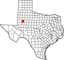 | |
| CDP | ||
| Other unincorporated communities | ||
| Footnotes | ‡This populated place also has portions in an adjacent county or counties | |
Municipalities and communities of Lynn County, Texas, United States | ||
|---|---|---|
| Cities | 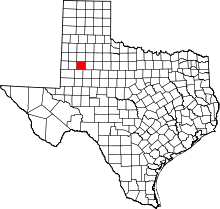 | |
| Unincorporated communities | ||
| Footnotes | ‡This populated place also has portions in an adjacent county or counties | |