Oak Hill, Ohio
| Oak Hill, Ohio | |
|---|---|
| Village | |
|
Oak Hill Public Library | |
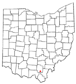 Location of Oak Hill, Ohio | |
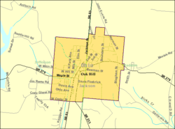 Detailed map of Oak Hill | |
| Coordinates: 38°53′47″N 82°34′14″W / 38.89639°N 82.57056°WCoordinates: 38°53′47″N 82°34′14″W / 38.89639°N 82.57056°W | |
| Country | United States |
| State | Ohio |
| County | Jackson |
| Government | |
| • Mayor | Rob Leonard |
| Area[1] | |
| • Total | 1.14 sq mi (2.95 km2) |
| • Land | 1.14 sq mi (2.95 km2) |
| • Water | 0 sq mi (0 km2) |
| Elevation[2] | 699 ft (213 m) |
| Population (2010)[3] | |
| • Total | 1,551 |
| • Estimate (2012[4]) | 1,528 |
| • Density | 1,360.5/sq mi (525.3/km2) |
| Time zone | Eastern (EST) (UTC-5) |
| • Summer (DST) | EDT (UTC-4) |
| ZIP code | 45656 |
| Area code(s) | 740 |
| FIPS code | 39-57596[5] |
| GNIS feature ID | 1080995[2] |
| Website | www.oakhillvillage.net |

Oak Hill is a village in Jackson County, Ohio, United States. The population was 1,551 at the 2010 census.
History
Oak Hill was also a stop on Morgan's Raid, led by Confederate Brigadier General John Hunt Morgan during the American Civil War. Oak Hill was settled by Welsh immigrants that had been stranded on the Ohio River in Gallipolis.
Nineteenth-century events
- 1814 - First settler, Peter Seel[6]
- 1818 - First Welsh settlers
- 1819 - Organization of the Union Baptist Church[7]
- 1835 - Organization of the Moriah "Mother Church"
- 1837 - Establishment of the post office
- 1837 - Organization of Horeb Church
- 1839 - Beginning of Welsh immigration
- 1841 - Organization of Bethel Church
- 1841 - Organization of Congregational Church
- 1843 - Organization of Sardis Church
- 1843 - Organization of the Welsh Calvinistic Methodist Church (United Presbyterian Church)
- 1853 - Construction of Jefferson Furnace
- 1856 - Organization of Gallia Baptist Church
- 1866 - Establishment of Portland Masonic Lodge No. 366
- 1873 - Incorporation of the village
- 1880 - Creation of the Oak Hill Morgan Academy
- 1881 - First Newspaper Created
- 1891 - Creation of the Farmers' Bank
- 1873 - Incorporation of the Aetna Fire Brick and Coal Company
- 1873 - Incorporation of the Oak Hill Fire Brick Company
- 1898 - Incorporation of the Ohio Fire Brick Company
- 1893 - Formation of the Oak Hill Local Union School District
Geography
Oak Hill is located at 38°53′47″N 82°34′14″W / 38.89639°N 82.57056°W (38.896514, -82.570649).[8]
According to the United States Census Bureau, the village has a total area of 1.14 square miles (2.95 km2), all land.[1]
Demographics
| Historical population | |||
|---|---|---|---|
| Census | Pop. | %± | |
| 1880 | 646 | — | |
| 1890 | 657 | 1.7% | |
| 1900 | 825 | 25.6% | |
| 1910 | 1,148 | 39.2% | |
| 1920 | 1,394 | 21.4% | |
| 1930 | 1,578 | 13.2% | |
| 1940 | 1,619 | 2.6% | |
| 1950 | 1,615 | −0.2% | |
| 1960 | 1,748 | 8.2% | |
| 1970 | 1,642 | −6.1% | |
| 1980 | 1,713 | 4.3% | |
| 1990 | 1,831 | 6.9% | |
| 2000 | 1,685 | −8.0% | |
| 2010 | 1,551 | −8.0% | |
| Est. 2015 | 1,500 | [9] | −3.3% |
2010 census
As of the census[3] of 2010, there were 1,551 people, 624 households, and 386 families residing in the village. The population density was 1,360.5 inhabitants per square mile (525.3/km2). There were 687 housing units at an average density of 602.6 per square mile (232.7/km2). The racial makeup of the village was 97.5% White, 0.5% African American, 0.2% Native American, 0.3% Asian, and 1.6% from two or more races. Hispanic or Latino of any race were 0.3% of the population.
There were 624 households of which 32.1% had children under the age of 18 living with them, 43.8% were married couples living together, 14.1% had a female householder with no husband present, 4.0% had a male householder with no wife present, and 38.1% were non-families. 31.4% of all households were made up of individuals and 15.8% had someone living alone who was 65 years of age or older. The average household size was 2.49 and the average family size was 3.12.
The median age in the village was 36.3 years. 25.2% of residents were under the age of 18; 10% were between the ages of 18 and 24; 24.4% were from 25 to 44; 25.4% were from 45 to 64; and 15% were 65 years of age or older. The gender makeup of the village was 47.6% male and 52.4% female.
2000 census
As of the census[5] of 2000, there were 1,685 people, 673 households, and 458 families residing in the village. The population density was 1,474.5 people per square mile (570.7/km²). There were 739 housing units at an average density of 646.7 per square mile (250.3/km²). The racial makeup of the village was 98.28% White, 0.24% African American, 0.42% Native American, 0.24% Asian, 0.12% from other races, and 0.71% from two or more races. Hispanic or Latino of any race were 0.12% of the population.
There were 673 households out of which 34.3% had children under the age of 18 living with them, 49.2% were married couples living together, 14.6% had a female householder with no husband present, and 31.8% were non-families. 27.8% of all households were made up of individuals and 13.7% had someone living alone who was 65 years of age or older. The average household size was 2.44 and the average family size was 2.95.
In the village the population was spread out with 25.3% under the age of 18, 8.7% from 18 to 24, 29.6% from 25 to 44, 19.8% from 45 to 64, and 16.6% who were 65 years of age or older. The median age was 35 years. For every 100 females there were 82.0 males. For every 100 females age 18 and over, there were 78.4 males.
The median income for a household in the village was $28,289, and the median income for a family was $31,898. Males had a median income of $28,750 versus $20,438 for females. The per capita income for the village was $13,580. About 14.2% of families and 20.6% of the population were below the poverty line, including 29.4% of those under age 18 and 24.7% of those age 65 or over.
Village Government
The Village of Oak Hill, OH is governed by an elected six member council. The present mayor is Rob Leonard. As of 2014, The Council Members are:[11]
- Council President - Dan Rhodes
- Council Member - Terry McCain
- Council Member - Tim McCoy
- Council Member - Jodie Fulk
- Council Member - Tara Cooper
- Council Member - James Coleman
- Sgt. at Arms - Bradley Conley
Landmarks
The Welsh museum is the only one of its kind in the United States and houses Welsh books, bibles, documents, pictures, and a fine collection of other Welsh items. Maintained by local historian Mildred Bangert, the Welsh-American Heritage Museum is located in the old Welsh Congregational Church in Oak Hill.
Jackson Lake is a man-made lake, in Lake Jackson State Park, near the city limits of Oak Hill. The park is the home of the Jefferson Furnace, in which pig iron for the ironclad USS Monitor was made during the Civil War. The Jefferson Furnace is available to sightseers as of 2005. The furnace is located at the edge of the lake on State Route 279.
References
- 1 2 "US Gazetteer files 2010". United States Census Bureau. Archived from the original on January 24, 2012. Retrieved 2013-01-06.
- 1 2 "US Board on Geographic Names". United States Geological Survey. 2007-10-25. Retrieved 2008-01-31.
- 1 2 "American FactFinder". United States Census Bureau. Retrieved 2013-01-06.
- ↑ "Population Estimates". United States Census Bureau. Archived from the original on June 17, 2013. Retrieved 2013-06-17.
- 1 2 "American FactFinder". United States Census Bureau. Archived from the original on September 11, 2013. Retrieved 2008-01-31.
- ↑ Seel, Peter B., III. "The Early History of the Seel Family in Southeastern Ohio (1807-1902)".
- ↑
- ↑ "US Gazetteer files: 2010, 2000, and 1990". United States Census Bureau. 2011-02-12. Retrieved 2011-04-23.
- ↑ "Annual Estimates of the Resident Population for Incorporated Places: April 1, 2010 to July 1, 2015". Retrieved July 2, 2016.
- ↑ "Census of Population and Housing". Census.gov. Archived from the original on May 11, 2015. Retrieved June 4, 2015.
- ↑ "Official Website". Retrieved 3 January 2014.
External links
Municipalities and communities of Jackson County, Ohio, United States | ||
|---|---|---|
| Cities |  | |
| Villages | ||
| Townships | ||
| Unincorporated communities | ||