Ocean Hill, Brooklyn
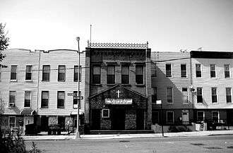
Ocean Hill is a subsection of Bedford-Stuyvesant in the New York City borough of Brooklyn. Founded in 1890, the neighborhood is part of Brooklyn Community Board 16.[1] The ZIP code for the neighborhood is 11233. The neighborhood has a diverse community with a large number of African Americans, and a small number of Caribbean and Latin Americans. Ocean Hill's boundaries start from Broadway (Bushwick) in the north, Saratoga Avenue (Bedford-Stuyvesant) to the west, East New York Avenue (Crown Heights and Brownsville) in the south, and Van Sinderen Avenue (Cypress Hills) to the east.
History
Ocean Hill received its name in 1890 for being slightly hilly. Hence it was subdivided from the larger community of Stuyvesant Heights. From the beginning of the 20th century to the 1960s Ocean Hill was an Italian enclave. By the late 1960s Ocean Hill and Bedford-Stuyvesant proper together formed the largest African American community in the United States.
In 1968, the Ocean Hill-Brownsville school district experienced the worst teacher strike in history. At that time, the New York City Board of Education controlled the entire school system. In response to complaints from parents in poor minority neighborhoods that schools were failing their students, the Ford Foundation helped fund an experimental program in the district that gave control to local educators and families. The program started off smoothly, but it ended as a fiery chapter in city history. Charging that Board of Education employees were seeking to sabotage the decentralization effort, black district leaders exiled 13 teachers and six administrators—most of them Jewish—to other districts. As the United Federation of Teachers protested the transfers, the two sides traded harsh accusations of racism and anti-Semitism. Teachers declared a months' long strike that shuttered most of the city’s schools. The conflict finally ended when the Board of Education agreed to set up local school boards throughout the city.[2]
In 1977, a major blackout devastated New York City. The neighborhood experienced arson and ransacking. Many apartment buildings were badly burned and abandoned for many years like the ones in the South Bronx. Finally in the 1990s Ocean Hill experienced a revitalization as many abandoned buildings and lots were renovated.
Gentrification
Ocean Hill is in the process of gentrification. An increasing number of people of various ethnicities are moving into the area due to slightly lower rent prices in Brownsville[3] and eastern Crown Heights, within which Ocean Hill is located.[4] Many abandoned buildings and brownstones have been rehabilitated. Prospect Plaza Houses, once a notorious housing project unit, has been closed by the New York City Housing Authority and is in the process of being rebuilt under the federally funded HOPE VI program.[5] In recent years some trendy shops have attracted businesses into Rockaway Avenue. There are attempts to overhaul the area to resemble Fort Greene-Clinton Hill due to the low rents and massive retail space. Brownstones, tenement and regular houses in the area are among the lowest in Brooklyn, ranging from $300,000 to $600,000.
Many residents of Ocean Hill consider themselves residents of Bedford-Stuyvesant. Due to gentrification, many real estate developers and the community board use the name Bedford-Stuyvesant/Ocean Hill or just Bedford-Stuyvesant, to avoid the neighborhood being confused with neighboring Brownsville to the southeast.
Broadway Junction
Ocean Hill, itself a sub-neighborhood of Bedford-Stuyvesant, also contains the sub-sub-neighborhood of Broadway Junction, defined by Broadway to the north, Atlantic Avenue to the south, Rockaway Avenue to the west, and Van Sinderen Avenue to the east.[6] The area is mostly zoned for light commercial and industrial use, but there is some residential development in the area which consists of two- to three-story residences.[7] Broadway Junction is split roughly in half by the Atlantic Avenue/LIRR viaduct, with few connections between the two parts of the neighborhood. This disconnect, combined with small blocks and relatively underused streets, parcels, and public spaces, has led to the subsection's characterization as a blighted area, and as such, it is largely ignored by neighboring communities.[7] There are plans to add mixed-use areas in Broadway Junction, as well as rezone the area for residential, commercial, and industrial developments, as well as improve transit connectivity in the area. A plan put forth by the New York City Department of Transportation would make Broadway Junction into a transportation hub, with residential integration with Ocean Hill on the west and mixed-use industrial and commercial properties on the east.[7]
Broadway Junction was originally known as Jamaica Pass, a name that became famous in 1776 as the route the British Army marched from southern Kings County to attack Brooklyn during the Battle of Long Island.[6][8] The current name refers to the current Broadway Junction subway station, which once connected to the LIRR and the Fulton Street El as well.[7] Nearby is the Cemetery of the Evergreens, and Highland Park.[6]
Demographics
Based on data from the 2010 United States Census, the population of Ocean Hill was 31,935, an increase of 1,868 (6.2%) from the 30,067 counted in 2000. Covering an area of 460.85 acres (186.50 ha), the neighborhood had a population density of 69.3 inhabitants per acre (44,400/sq mi; 17,100/km2).[9]
The racial makeup of the neighborhood was 1.4% (439) White, 77.7% (24,825) African American, 0.4% (132) Native American, 0.6% (199) Asian, 0.0% (2) Pacific Islander, 0.3% (111) from other races, and 1.6% (511) from two or more races. Hispanic or Latino of any race were 17.9% (5,716) of the population.[10]
Safety
The 73rd Precinct of the New York City Police Department covers the area. From the 1960s to early 2000s, Ocean Hill and neighboring Brownsville experienced a high crime rate, but currently, the crime rates have reached an all-time low.[11]
Transportation
Ocean Hill is served by the A C J Z L trains of the New York City Subway, on the BMT Canarsie Line, BMT Jamaica Line, and IND Fulton Street Line, which all meet at Broadway Junction.[12] There is also Long Island Rail Road (LIRR) service at nearby East New York.
Notable residents
- Red Holzman, Hall of Fame NBA 2-time All-Star & coach
- Steve Cuozzo, New York Post writer/editor
See also
References
- ↑ Brooklyn Community Boards, New York City. Accessed December 31, 2007.
- ↑ Weisman, Steven R. "A City at War", The New York Times, March 1, 1997. Accessed July 6, 2016.
- ↑ Stephen Jacob Smith. "Closing in on Brownsville: Brooklyn Gentrification Nears the Final Frontier". Observer.
- ↑ "Bigger Spaces, Smaller Rents Lure New Faces Eastward in Crown Heights". DNAinfo New York.
- ↑ See New York City Planning Commission report C 030474 HAK http://www.nyc.gov/html/dcp/pdf/cpc/030474.pdf
- 1 2 3 Jackson, Kenneth T., ed. (1995), The Encyclopedia of New York City, New Haven: Yale University Press, ISBN 0300055366, p. 141.
- 1 2 3 4 "Sustainable Communities East New York; Chapter V: Broadway Junction Subarea" (PDF). nyc.gov. New York City Department of City Planning. June 2014. pp. 86–113. Retrieved 16 July 2016.
- ↑ Schecter, Barnet. The Battle for New York - The City at the Heart of the American Revolution. Walker & Company. New York. 2002. ISBN 0-8027-1374-2
- ↑ Table PL-P5 NTA: Total Population and Persons Per Acre - New York City Neighborhood Tabulation Areas*, 2010, Population Division - New York City Department of City Planning, February 2012. Accessed June 16, 2016.
- ↑ Table PL-P3A NTA: Total Population by Mutually Exclusive Race and Hispanic Origin - New York City Neighborhood Tabulation Areas*, 2010, Population Division - New York City Department of City Planning, March 29, 2011. Accessed June 14, 2016.
- ↑ "Newsday". nycpba.org.
- ↑ "Subway Map" (PDF). Metropolitan Transportation Authority. November 2016. Retrieved 2016-11-07.
External links
Coordinates: 40°40′48″N 73°54′29″W / 40.680°N 73.908°W