Ogilvie, Minnesota
| Ogilvie, Minnesota | |
|---|---|
| City | |
| Motto: "We Are The Lions" | |
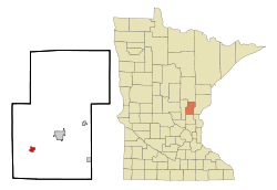 Location of Ogilvie, Minnesota | |
| Coordinates: 45°49′53″N 93°25′25″W / 45.83139°N 93.42361°W | |
| Country | United States |
| State | Minnesota |
| County | Kanabec |
| Area[1] | |
| • Total | 0.93 sq mi (2.41 km2) |
| • Land | 0.93 sq mi (2.41 km2) |
| • Water | 0 sq mi (0 km2) |
| Elevation | 1,050 ft (320 m) |
| Population (2010)[2] | |
| • Total | 369 |
| • Estimate (2012[3]) | 361 |
| • Density | 396.8/sq mi (153.2/km2) |
| Time zone | Central (CST) (UTC-6) |
| • Summer (DST) | CDT (UTC-5) |
| ZIP code | 56358 |
| Area code(s) | 320 |
| FIPS code | 27-48166[4] |
| GNIS feature ID | 0648904[5] |
Ogilvie is a city in Kanabec County, Minnesota, United States. The population was 369 at the 2010 census.[6]
Geography
According to the United States Census Bureau, the city has a total area of 0.93 square miles (2.41 km2), all of it land.[1]
Minnesota State Highways 23 and 47 are two of the main routes in the community.
Demographics
| Historical population | |||
|---|---|---|---|
| Census | Pop. | %± | |
| 1910 | 270 | — | |
| 1920 | 436 | 61.5% | |
| 1930 | 344 | −21.1% | |
| 1940 | 438 | 27.3% | |
| 1950 | 362 | −17.4% | |
| 1960 | 376 | 3.9% | |
| 1970 | 384 | 2.1% | |
| 1980 | 423 | 10.2% | |
| 1990 | 510 | 20.6% | |
| 2000 | 474 | −7.1% | |
| 2010 | 369 | −22.2% | |
| Est. 2015 | 352 | [7] | −4.6% |
2010 census
As of the census[2] of 2010, there were 369 people, 160 households, and 91 families residing in the city. The population density was 396.8 inhabitants per square mile (153.2/km2). There were 186 housing units at an average density of 200.0 per square mile (77.2/km2). The racial makeup of the city was 98.9% White, 0.3% Native American, and 0.8% from two or more races. Hispanic or Latino of any race were 0.3% of the population.
There were 160 households of which 27.5% had children under the age of 18 living with them, 33.8% were married couples living together, 16.9% had a female householder with no husband present, 6.3% had a male householder with no wife present, and 43.1% were non-families. 30.6% of all households were made up of individuals and 16.9% had someone living alone who was 65 years of age or older. The average household size was 2.31 and the average family size was 2.89.
The median age in the city was 41.3 years. 24.4% of residents were under the age of 18; 6.1% were between the ages of 18 and 24; 22.3% were from 25 to 44; 28.4% were from 45 to 64; and 18.7% were 65 years of age or older. The gender makeup of the city was 49.6% male and 50.4% female.
2000 census
As of the census[4] of 2000, there were 474 people, 182 households, and 111 families residing in the city. The population density was 507.0 people per square mile (196.8/km²). There were 199 housing units at an average density of 212.9 per square mile (82.6/km²). The racial makeup of the city was 93.88% White, 0.42% African American, 2.11% Native American, 2.74% Asian, 0.21% from other races, and 0.63% from two or more races. Hispanic or Latino of any race were 0.63% of the population.
There were 182 households out of which 39.0% had children under the age of 18 living with them, 37.9% were married couples living together, 15.9% had a female householder with no husband present, and 38.5% were non-families. 30.2% of all households were made up of individuals and 13.2% had someone living alone who was 65 years of age or older. The average household size was 2.60 and the average family size was 3.13.
In the city the population was spread out with 32.3% under the age of 18, 8.0% from 18 to 24, 27.8% from 25 to 44, 19.4% from 45 to 64, and 12.4% who were 65 years of age or older. The median age was 32 years. For every 100 females there were 89.6 males. For every 100 females age 18 and over, there were 86.6 males.
The median income in 2000 for a household in the city was $27,292, and the median income for a family was $33,125. Males had a median income of $22,083 versus $21,250 for females. The per capita income for the city was $15,198. About 8.8% of families and 14.6% of the population were below the poverty line, including 20.0% of those under age 18 and 6.7% of those age 65 or over.
History
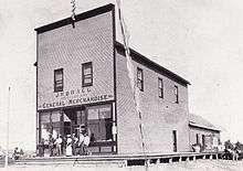
A post office called Ogilvie has been in operation since 1899.[9] The city was named for Oric Ogilvie Whited, a local landowner.[10]
Today
The Ogilvie Raceway, a 3/8 mile Dirt clay oval race track, opened on May 29, 2009.
Notable people
- Clayton Tonnemaker (1928–1996), American football player
References
- 1 2 "US Gazetteer files 2010". United States Census Bureau. Archived from the original on January 24, 2012. Retrieved 2012-11-13.
- 1 2 "American FactFinder". United States Census Bureau. Retrieved 2012-11-13.
- ↑ "Population Estimates". United States Census Bureau. Archived from the original on June 17, 2013. Retrieved 2013-05-28.
- 1 2 "American FactFinder". United States Census Bureau. Archived from the original on September 11, 2013. Retrieved 2008-01-31.
- ↑ "US Board on Geographic Names". United States Geological Survey. 2007-10-25. Retrieved 2008-01-31.
- ↑ "2010 Census Redistricting Data (Public Law 94-171) Summary File". American FactFinder. U.S. Census Bureau, 2010 Census. Archived from the original on July 21, 2011. Retrieved 23 April 2011.
- ↑ "Annual Estimates of the Resident Population for Incorporated Places: April 1, 2010 to July 1, 2015". Retrieved July 2, 2016.
- ↑ "Census of Population and Housing". Census.gov. Archived from the original on May 11, 2015. Retrieved June 4, 2015.
- ↑ "Kanabec County". Jim Forte Postal History. Retrieved 15 July 2015.
- ↑ Upham, Warren (1920). Minnesota Geographic Names: Their Origin and Historic Significance. Minnesota Historical Society. p. 266.
Municipalities and communities of Kanabec County, Minnesota, United States | ||
|---|---|---|
| Cities | 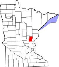 | |
| Townships | ||
| Unincorporated communities | ||
| Indian reservation | ||
| Footnotes | ‡This populated place also has portions in an adjacent county or counties | |
Coordinates: 45°49′56″N 93°25′35″W / 45.83222°N 93.42639°W