Cattaraugus County, New York
Coordinates: 42°14′N 78°41′W / 42.24°N 78.68°W
| Cattaraugus County, New York | |
|---|---|
 Location in the U.S. state of New York | |
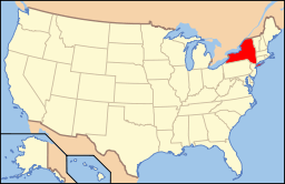 New York's location in the U.S. | |
| Founded | March 28, 1817 |
| Seat | Little Valley |
| Largest city | Olean |
| Area | |
| • Total | 1,322 sq mi (3,424 km2) |
| • Land | 1,308 sq mi (3,388 km2) |
| • Water | 14 sq mi (36 km2), 1.1% |
| Population | |
| • (2010) | 80,317 |
| • Density | 61/sq mi (24/km²) |
| Congressional district | 23rd |
| Time zone | Eastern: UTC-5/-4 |
| Website |
www |
Cattaraugus County is a county in the western part of the U.S. state of New York, with one side bordering Pennsylvania. As of the 2010 census, the population was 80,317.[1] The county seat is Little Valley.[2] The county was created in 1808 and later organized in 1817.[3]
Cattaraugus County comprises the Olean, NY Micropolitan Statistical Area, which is included in the Buffalo-Cheektowaga, NY Combined Statistical Area. Within its boundaries are the Allegany Indian Reservation of the Seneca Nation of New York, and the Allegany State Park. The Allegheny River runs through the county.
History
The largely unsettled territory was the traditional homeland of the now-extinct Wenrohronon Indians and later occupied by the Seneca people, one of the five Nations of the Haudenosaunee. During the colonial era, it was claimed by at least three territories: New York Colony, Massachusetts Bay Colony and Pennsylvania Colony, each of which extended their colonial claims to the west until after the Revolutionary War.
When counties were established in the province of New York in 1683, the territory of Cattaraugus County was included within the very large Albany County. This was an enormous county, including the northern part of New York as well as all of the present state of Vermont and, in theory, extending westward to the Pacific Ocean. As additional areas were settled, this county was reduced on July 3, 1766 by the creation of Cumberland County, and on March 16, 1770 by the creation of Gloucester County, both containing territory now in Vermont.
On March 12, 1772, what was left of Albany County was split into three parts, one remaining under the name Albany County. One of the other pieces, Tryon County, contained the western portion (and thus, since no western boundary was specified, theoretically still extended west to the Pacific). The eastern boundary of Tryon County was approximately five miles west of the present city of Schenectady. The county included the western part of the Adirondack Mountains and the area west of the West Branch of the Delaware River. The area then designated as Tryon County is represented in the 21st century by 37 counties of New York. The county was named for William Tryon, colonial governor of New York.
In the years prior to 1776, most of the Loyalists in Tryon County fled across the Niagara Frontier into modern day Ontario, Canada. In 1784, following the peace treaty that ended the American Revolutionary War (and a treaty with Massachusetts that finally settled who owned Western New York), the name of Tryon County was changed to Montgomery County in honor of the general, Richard Montgomery, who had captured several places in Canada and died attempting to capture the city of Quebec. This replaced the name of the hated British governor.
In practice, however, these counties did not cover modern Cattaraugus County or Western New York. Most of that area lay within the Indian Reserve established in the Treaty of Fort Stanwix by the British; it was intended to be reserved for Native Americans and was ruled off-limits to European settlement.
The newly independent United States sought to extinguish native reserves after the British ceded their territory east of the Mississippi River and south of the Great Lakes to the United States. This included Iroquois territory in New York; the four nations that had been allies of the British mostly relocated to Ontario, where the Crown gave them land grants in some compensation for losses. The Treaty of Canandaigua, in 1794, extinguished what was left of native title, with the exception of several reservations, three of which were at least partially located in what is now Cattaraugus County.
Ontario County was split from Montgomery County in 1789 as a result of the establishment of the Morris Reserve. In turn, Genesee County was split from Ontario County in 1802 as a result of the Holland Purchase. This period was the beginning of more significant European-American settlement of this western territory. Shortly afterward, Genesee County was reduced in 1806 by the creation of Allegany County.
Cattaraugus County was formed in 1808, split off from Genesee County. At first there was no county government due to the sparse population. From 1812 to 1814, Cattaraugus County was incorporated in Allegany County; from 1814 to 1817, records of the county were divided between Belmont (Allegany County) and Buffalo (then in Niagara County). The name "Cattaraugus" derives from a Seneca word for "bad smelling banks," and was named for the "odor of natural gas leaking from rock seams." [4] In 1817, a county government was established for Cattaraugus County in the southwestern corner of the town of Hebe, now Ellicottville.
Numerous towns in the county are named after agents of the Holland Land Company, including Ellicottville (Joseph Ellicott), Franklinville (William Temple Franklin, a speculator and grandson of Benjamin Franklin), and Otto and East Otto (Jacob Otto). The first settlement in the county was in Olean. After 1860, the county seat was moved to Little Valley.
The Allegany Indian Reservation is within the county boundaries and is one of two controlled by the federally recognized Seneca Nation of New York in the western part of the state; the Seneca's other territories, Cattaraugus and Oil Springs, are both partially within county boundaries. South of Salamanca, New York, a small city located within the reservation, is Allegany State Park, which is contiguous with the Allegheny National Forest in Pennsylvania.
Geography
According to the U.S. Census Bureau, the county has a total area of 1,322 square miles (3,420 km2), of which 1,308 square miles (3,390 km2) is land and 14 square miles (36 km2) (1.1%) is water.[5]
Cattaraugus County is in the southwestern part of the state, immediately north of the Pennsylvania border. The southern part of Cattaraugus County is the only area of western New York that was not covered by the last ice age glaciation . It is noticeably more rugged than neighboring areas that had peaks rounded and valleys filled by the glacier. The entire area is a dissected plateau of Pennsylvanian and Mississippian age, but appears mountainous to the casual observer.
The plateau is an extension of the Allegany Plateau from nearby Pennsylvania. Southern Cattaraugus County is part of the same oil field, and petroleum was formerly a resource of the area. It is now mostly played out, but natural gas continues to be extracted.
A continental divide between the Mississippi River and Great Lakes watersheds runs through Cattaraugus County
The northern border of the county is formed by Cattaraugus Creek and the Allegheny River arises in the county.
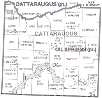
Adjacent counties
- Erie County - north
- Wyoming County - northeast
- Allegany County - east
- McKean County, Pennsylvania - southeast
- Warren County, Pennsylvania - southwest
- Chautauqua County - west
Transportation
Major highways

 I-86 / NY 17
 U.S. Route 62
 U.S. Route 219
 New York State Route 16
 New York State Route 98
 New York State Route 240
 New York State Route 242
 New York State Route 353
 New York State Route 417
Airports
Great Valley Airport is located in Cattaraugus County, one nautical mile (1.85 km) southeast of the central business district of Great Valley.[6][7]
Cattaraugus County-Olean Airport is located outside of Olean located in the Town of Ischua.
Bus service
Intercity bus service is provided through Coach USA, which runs through the county on its twice-daily Jamestown to Olean route (with connections to Buffalo and New York City). Trailways offers a once-daily north-to-south run between Buffalo and points south in Pennsylvania.
The county does not have a unified public transit system. The Seneca Nation serves much of the county through its own bus line, which connects its reservations; another service, the Olean Area Transit System, connects the cities of Salamanca and Olean.
Rail
There is no regular passenger rail service in Cattaraugus County; Amtrak does not serve the county. The WNY & PA Railroad, based in Olean, provides freight service on most of the rail routes in Cattaraugus County; the New York and Lake Erie Railroad serves the northwest corner and the Buffalo and Pittsburgh Railroad runs a north-to-south route.
Demographics
| Historical population | |||
|---|---|---|---|
| Census | Pop. | %± | |
| 1820 | 4,090 | — | |
| 1830 | 16,724 | 308.9% | |
| 1840 | 28,872 | 72.6% | |
| 1850 | 38,950 | 34.9% | |
| 1860 | 43,886 | 12.7% | |
| 1870 | 43,909 | 0.1% | |
| 1880 | 55,806 | 27.1% | |
| 1890 | 60,866 | 9.1% | |
| 1900 | 65,643 | 7.8% | |
| 1910 | 65,919 | 0.4% | |
| 1920 | 71,323 | 8.2% | |
| 1930 | 72,398 | 1.5% | |
| 1940 | 72,652 | 0.4% | |
| 1950 | 77,901 | 7.2% | |
| 1960 | 80,187 | 2.9% | |
| 1970 | 81,666 | 1.8% | |
| 1980 | 85,697 | 4.9% | |
| 1990 | 84,234 | −1.7% | |
| 2000 | 83,955 | −0.3% | |
| 2010 | 80,317 | −4.3% | |
| Est. 2015 | 77,922 | [8] | −3.0% |
| U.S. Decennial Census[9] 1790-1960[10] 1900-1990[11] 1990-2000[12] 2010-2013[1] | |||
As of the census[13] of 2000, there were 83,955 people, 32,023 households, and 21,647 families residing in the county. The population density was 64 people per square mile (25/km²). There were 39,839 housing units at an average density of 30 per square mile (12/km²). The racial makeup of the county was 94.63% White, 1.06% Black or African American, 2.60% Native American, 0.46% Asian, 0.02% Pacific Islander, 0.23% from other races, and 1.01% from two or more races. 0.94% of the population were Hispanic or Latino of any race. 26.8% were of German, 13.2% Irish, 11.3% English, 9.1% Polish, 8.2% Italian and 7.4% American ancestry according to Census 2000. 95.2% spoke English and 1.4% Spanish as their first language.
There were 32,023 households out of which 32.10% had children under the age of 18 living with them, 52.30% were married couples living together, 10.80% had a female householder with no husband present, and 32.40% were non-families. 26.80% of all households were made up of individuals and 11.60% had someone living alone who was 65 years of age or older. The average household size was 2.52 and the average family size was 3.05.
In the county the population was spread out with 26.20% under the age of 18, 9.30% from 18 to 24, 26.50% from 25 to 44, 23.50% from 45 to 64, and 14.60% who were 65 years of age or older. The median age was 37 years. For every 100 females there were 95.90 males. For every 100 females age 18 and over, there were 92.50 males.
The median income for a household in the county was $33,404, and the median income for a family was $39,318. Males had a median income of $30,901 versus $22,122 for females. The per capita income for the county was $15,959. About 10.00% of families and 13.70% of the population were below the poverty line, including 18.60% of those under age 18 and 9.90% of those age 65 or over.
Government and politics
Cattaraugus County is run by a unicameral legislature who appoint a county "administrator." This individual serves many executive duties of a county executive but has no legislative veto power and is not elected.
The legislators are elected independently by districts (while some also serve as mayors of the villages they represent, their status as mayors does not affect in any way their seats on the legislature and thus it is not a Board of Supervisors). The votes of each legislator are counted in proportion to the number of people that said legislator represents (for example, if a legislator from Olean has 10,000 people in his/her district, and the legislator serving Lyndon only has 5,000, the Lyndon legislator's vote has only half the worth of the Olean legislator's). There are currently 21 members of the legislature with 15 Republicans and 6 Democrats; the county is in the process of reducing that number to 17. Each legislator serves a four-year term, with a limit of three terms.
A majority of the county council are Republicans. Norman L. Marsh of Little Valley serves as Chairman, and James J. Snyder of Olean serves as Vice-Chairman.
- 01 - Paula J. Stockman (R)
- 02 - Richard L. Klancer (R) and Patrick J. Murphy (R)
- 03 - Norman L. Marsh (R) and Howard VanRensselaer (R)
- 04 - William E. Sprague (D)
- 05 - Donna Vickman (R), Gary M. Felton (R) and William H. Weller (R)
- 06 - James J. Snyder Jr. (R) and Dan M. Hale (R)
- 07 - James L. Boser (D) and Richard J. Lamberson (D)
- 08 - Carl W. Edwards (R)
- 09 - David M. Koch (D) and Susan Labuhn (R)
- 10 - John J. Padlo (D), Linda M. Edstrom (R), James J. Snyder (R), Earl B. McElfresh (R) and Steven Teachman (R)
Cattaraugus County is entirely within the boundaries of the 148th New York State Assembly District (served currently by Joseph Giglio), the 57th New York State Senate District (served currently by Catharine Young), and the U.S. House of Representatives 29th district (served currently by Tom Reed). In the last of these, Cattaraugus County's votes proved pivotal in the 2008 elections: incumbent Republican Randy Kuhl, who had strongly carried the county in 2004 and 2006, lost Cattaraugus County to Democrat Eric Massa in the 2008 elections.
The county is generally considered a "red county," with Republicans usually outvoting Democrats in most statewide and national offices (for instance, in 2004 George W. Bush defeated John Kerry in Cattaraugus County by a 60-40 margin) although Bill Clinton won the Cattaraugus County very narrowly in 1996. In 2006, the county narrowly chose Eliot Spitzer over John Faso by a margin of about 1% in the governor's race, and Hillary Clinton defeated John Spencer in the county by a 10 percentage point margin. (That being said, in all other positions up for office that year, Republicans won—including all congressional and state legislature representatives.)
In 2008 the county voted for the Republican presidential candidate, with John McCain defeating Barack Obama by a 55-44% margin. In 2010, Republican Carl Paladino carried Cattaraugus County over Democrat (and eventual winner) Andrew Cuomo 65% to 31%. Senator Kirsten Gillibrand and Senator Chuck Schumer, both incumbent Democrats, carried the county by 51% to 46% and 54% to 43% margins, respectively. Despite largely being a non-factor in heavily Democratic New York's statewide elections, the county regularly has unusually high turnout for Presidential elections, with upwards of 70% of eligible voters typically voting in the county.
An emerging trend among Cattaraugus County's villages has been consolidation with their surrounding towns. Limestone voters approved dissolution into the Town of Carrollton in September 2009; that took effect at the beginning of 2011. On March 18, 2010, three other villages (East Randolph, Randolph and Perrysburg) followed suit and approved dissolution into their surrounding towns (Town of Randolph for the first two, and Town of Perrysburg for the third); these three villages dissolved at the beginning of 2012.
Additional facts
Two geological formations, both called "Rock City," have the appearance of a town laid out with streets. One is in Olean and the other is in Little Valley.
Olean is the largest city in the county and is the major center for business. Ski country runs through Cattaraugus County; two ski resorts, popular with Canadians, lie in the town of Ellicottville: Holiday Valley Resort and HoliMont; Cattaraugus County once had numerous ski resorts within its bounds, scattered throughout the county, before contracting into Ellicottville alone by 1980. In addition, several snowmobile trails cross the county, including the Pat McGee Trail, a flagship for the county's trail system, and the North Country Trail.
Cattaraugus County's current promotional nickname is the Enchanted Mountains. The county's heights are mostly described as hills; it has only two comparatively small "mountains" (Mount Seneca and Mount Tuscarora, both in Allegany State Park). During the 1980s, the county used the slogan Naturally Yours to Enjoy.
Cattaraugus County is considered part of Appalachia, as well as Western New York, upstate New York, the Southern Tier, the Twin Tiers and the Buffalo-Niagara-Cattaraugus Combined Statistical Area. As a result of being at a geographic crossroads, the people of Cattaraugus County speak a variety of accents, ranging from mild variants of Appalachian English to Inland Northern American English, with a handful of people speaking in the more loud and nasal Buffalo English.
The sales tax in Cattaraugus County is 8% (4% from New York, 4% from the county).
A large Amish community is located in the western part of the county. A portion of this community maintains an exceptionally older order that eschews indoor plumbing, which, combined with a small number of Seneca who still live on traditional subsistence, gives the county a high rate of homes without indoor plumbing compared to nearby counties.[14]
Media
Newspapers
- Salamanca Press (weekly, serving Salamanca and a few other small towns)
- Olean Times Herald (daily, serving all of the western Twin Tiers)
- Olean Source (free weekly)
- Franklinville Mercury-Gazette (free weekly)
- Ellicottville Times (free weekly, based in Ellicottville)
- The Villager (free weekly, based in Ellicottville)
- Randolph Register (monthly)
- Ellicottville Snowed In / The Summer Local (monthly)
Radio stations
- WPIG (95.7, Olean)
- WHDL (1450, Olean)
- WOLN (91.3, Olean, operated out of Buffalo)
- WQRS (98.3, Salamanca)
- WGGO (1590, Salamanca)
- WGWE (105.9, Little Valley, operated from the Allegany Reservation)
- WOEN (1360, Olean)
- WMXO (101.5, Olean)
- WSBU (88.3, Allegany)
- WVTT (96.7, Portville, operated out of Olean)
- WTWT (90.5, transmitter in Allegany, licensed to Bradford, PA, operated out of Russell, PA)
- WWG32 (162.425, Little Valley, operated out of Buffalo)
Television stations
Education
A branch of Jamestown Community College, in Olean provides higher education for residents. Olean Business Institute provided specialized education and is also in Olean; it closed in 2013 due to financial and enrollment declines. Jamestown Business College operates a satellite campus in Salamanca. Cornplanter College, a tribally controlled college, opened in 2014 in Salamanca. St. Bonaventure University is located in its own census-designated place just west of Olean.
Communities
Cities
Towns
- Allegany
- Ashford
- Carrollton
- Coldspring
- Conewango
- Dayton
- East Otto
-
Elko(dissolved 1965) - Ellicottville
- Farmersville
- Franklinville
- Freedom
- Great Valley
- Hinsdale
- Humphrey
- Ischua
- Leon
- Little Valley
- Lyndon
- Machias
- Mansfield
- Napoli
- New Albion
- Olean
- Otto
- Perrysburg
- Persia
- Portville
- Randolph
- Red House
- Salamanca
- South Valley
- Yorkshire
Villages
Census-designated places
Hamlets
Indian reservations
- Allegany Reservation
- Cattaraugus Reservation, Cattaraugus County
- Oil Springs Reservation, Cattaraugus County
Notable residents
- Bill Bergey, professional football player
- Governor Blacksnake, Seneca war chief and possibly the world's oldest man
- Ray Caldwell of Salamanca, MLB pitcher
- William R. Case of Little Valley, founder of the eponymous knife company
- Anna Botsford Comstock, 1854–1930, artist, Cornell professor, leader of nature study movement
- Chuck Crist of Salamanca, professional football player
- Brian Dunkleman of Ellicottville, co-host of the first season of American Idol
- Ray Evans (1915–2007) of Salamanca, member of famous songwriting duo alongside Jay Livingston
- Ira Joe Fisher of Salamanca and Little Valley, poet and weatherman at CBS
- James F. Hastings of Olean, retired former U.S. Congressman (served from 1969 to 1976)
- William C. Hayward (1847-1917), Iowa Secretary of State
- Marvin "Marv" Hubbard of Red House, professional football player
- Timothy Kellner U.S. Army Staff Sergeant of Ischua, regarded as one of the top snipers still active in the U.S. Army with 78 confirmed kills during Operation Iraqi Freedom and 3 in Haiti.
- Riki Lindhome of Portville, actress and member of the satirical musical group "Garfunkel and Oates"
- Ted Marchibroda, NFL Head Coach of Baltimore Colts/Ravens, attended St. Bonaventure University
- Paul Owens (1924–2003) of Salamanca, professional baseball player, manager, and executive
- Terrence Pegula of Allegany, multibillionaire natural gas tycoon and professional sports investor
- Kimberly Pressler of Franklinville, Miss USA 1999
- Isaac Seneca of Cattaraugus, professional football player
- Margaret Shulock of Franklinville, cartoonist, part of the ensemble behind the Six Chix comic strip
- Peter Tomarken (1942–2006) of Olean, host of Press Your Luck
- Lyman M. Ward, Union Army Brigadier General
- Louis Zamperini of Olean, Olympic distance runner and World War II prisoner of war
See also
- List of counties in New York
- National Register of Historic Places listings in Cattaraugus County, New York
References
- 1 2 "State & County QuickFacts". United States Census Bureau. Retrieved October 11, 2013.
- ↑ "Find a County". National Association of Counties. Archived from the original on 2011-05-31. Retrieved 2011-06-07.
- ↑ "New York: Individual County Chronologies". New York Atlas of Historical County Boundaries. The Newberry Library. 2008. Retrieved January 9, 2015.
- ↑ "The Origins of New York State's County Names" (PDF). New York State Department of State. Retrieved 10 April 2015.
- ↑ "2010 Census Gazetteer Files". United States Census Bureau. August 22, 2012. Retrieved January 3, 2015.
- ↑ FAA Airport Master Record for N56 (Form 5010 PDF). Federal Aviation Administration. Effective 8 April 2010.
- ↑ "Great Valley Airport (N56)" (PDF). New York State Department of Transportation.
- ↑ "County Totals Dataset: Population, Population Change and Estimated Components of Population Change: April 1, 2010 to July 1, 2015". Retrieved July 2, 2016.
- ↑ "U.S. Decennial Census". United States Census Bureau. Archived from the original on May 11, 2015. Retrieved January 3, 2015.
- ↑ "Historical Census Browser". University of Virginia Library. Retrieved January 3, 2015.
- ↑ "Population of Counties by Decennial Census: 1900 to 1990". United States Census Bureau. Retrieved January 3, 2015.
- ↑ "Census 2000 PHC-T-4. Ranking Tables for Counties: 1990 and 2000" (PDF). United States Census Bureau. Retrieved January 3, 2015.
- ↑ "American FactFinder". United States Census Bureau. Archived from the original on 2013-09-11. Retrieved 2008-01-31.
- ↑ "1.6 million Americans don't have indoor plumbing. Here's where they live", The Washington Post. Retrieved April 24, 2014.
| Wikimedia Commons has media related to Cattaraugus County, New York. |
External links
- Cattaraugus County CattCo.org
- Cattaraugus County at DMOZ
- Cattaraugus County webpage
- Western Southern Tier information
- Cattaraugus historical links/information
- Summary early history of Cattaraugus County and its communities
- Cattaraugus County Industrial Development Agency
- Enchanted Mountains of Cattaraugus County (Tourism Site)
- Little Valley Area Chamber of Commerce
 |
Erie County | Wyoming County | | |
| Chautauqua County | |
Allegany County | ||
| ||||
| | ||||
| Warren County, Pennsylvania | McKean County, Pennsylvania |
Municipalities and communities of Cattaraugus County, New York, United States | ||
|---|---|---|
| Cities | | |
| Towns |
| |
| Villages | ||
| CDPs | ||
| Other hamlets | ||
| Indian reservations | ||
| Footnotes |
| |
| Principal city | 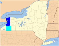 | |
|---|---|---|
| Other major cities | ||
| Counties | ||