Otis, Kansas
| Otis, Kansas | |
|---|---|
| City | |
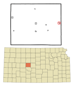 Location within Rush County and Kansas | |
 KDOT map of Rush County (legend) | |
| Coordinates: 38°32′6″N 99°3′8″W / 38.53500°N 99.05222°WCoordinates: 38°32′6″N 99°3′8″W / 38.53500°N 99.05222°W | |
| Country | United States |
| State | Kansas |
| County | Rush |
| Area[1] | |
| • Total | 0.30 sq mi (0.78 km2) |
| • Land | 0.30 sq mi (0.78 km2) |
| • Water | 0 sq mi (0 km2) |
| Elevation | 2,037 ft (621 m) |
| Population (2010)[2] | |
| • Total | 282 |
| • Estimate (2015)[3] | 268 |
| • Density | 940/sq mi (360/km2) |
| Time zone | Central (CST) (UTC-6) |
| • Summer (DST) | CDT (UTC-5) |
| ZIP code | 67565 |
| Area code(s) | 785 |
| FIPS code | 20-53525 [4] |
| GNIS feature ID | 0475495 [5] |
Otis is a city in Rush County, Kansas, United States. As of the 2010 census, the city population was 282.[6]
History
Otis was founded in 1886, and named for the founder's son, Otis Modderwell.[7][8]
The first post office in Otis was established in August 1887.[9]
Geography
Otis is located at 38°32′6″N 99°3′8″W / 38.53500°N 99.05222°W (38.534933, -99.052088).[10] According to the United States Census Bureau, the city has a total area of 0.30 square miles (0.78 km2), all of it land.[1]
Demographics
| Historical population | |||
|---|---|---|---|
| Census | Pop. | %± | |
| 1920 | 505 | — | |
| 1930 | 407 | −19.4% | |
| 1940 | 413 | 1.5% | |
| 1950 | 410 | −0.7% | |
| 1960 | 362 | −11.7% | |
| 1970 | 387 | 6.9% | |
| 1980 | 410 | 5.9% | |
| 1990 | 385 | −6.1% | |
| 2000 | 325 | −15.6% | |
| 2010 | 282 | −13.2% | |
| Est. 2015 | 268 | [3] | −5.0% |
| U.S. Decennial Census | |||
2010 census
As of the census[2] of 2010, there were 282 people, 146 households, and 84 families residing in the city. The population density was 940.0 inhabitants per square mile (362.9/km2). There were 169 housing units at an average density of 563.3 per square mile (217.5/km2). The racial makeup of the city was 96.1% White, 0.4% African American, 0.7% Native American, 0.4% Asian, 0.7% from other races, and 1.8% from two or more races. Hispanic or Latino of any race were 2.5% of the population.
There were 146 households of which 15.8% had children under the age of 18 living with them, 46.6% were married couples living together, 6.2% had a female householder with no husband present, 4.8% had a male householder with no wife present, and 42.5% were non-families. 40.4% of all households were made up of individuals and 19.8% had someone living alone who was 65 years of age or older. The average household size was 1.93 and the average family size was 2.56.
The median age in the city was 52.7 years. 16% of residents were under the age of 18; 8.1% were between the ages of 18 and 24; 14.2% were from 25 to 44; 37.2% were from 45 to 64; and 24.5% were 65 years of age or older. The gender makeup of the city was 51.4% male and 48.6% female.
2000 census
As of the census[4] of 2000, there were 325 people, 148 households, and 92 families residing in the city. The population density was 1,080.3 people per square mile (418.3/km²). There were 170 housing units at an average density of 565.1 per square mile (218.8/km²). The racial makeup of the city was 98.77% White, 0.31% Native American, 0.31% Asian, and 0.62% from two or more races. Hispanic or Latino of any race were 1.85% of the population.
There were 148 households out of which 30.4% had children under the age of 18 living with them, 52.0% were married couples living together, 6.1% had a female householder with no husband present, and 37.8% were non-families. 35.1% of all households were made up of individuals and 22.3% had someone living alone who was 65 years of age or older. The average household size was 2.20 and the average family size was 2.82.
In the city the population was spread out with 22.2% under the age of 18, 10.2% from 18 to 24, 21.8% from 25 to 44, 24.6% from 45 to 64, and 21.2% who were 65 years of age or older. The median age was 43 years. For every 100 females there were 94.6 males. For every 100 females age 18 and over, there were 94.6 males.
The median income for a household in the city was $27,109, and the median income for a family was $35,625. Males had a median income of $26,875 versus $18,929 for females. The per capita income for the city was $14,290. About 4.5% of families and 6.5% of the population were below the poverty line, including 2.3% of those under age 18 and 15.3% of those age 65 or over.
Industry
The Linde Group, based in Munich, Germany, operates the world's second largest helium production facility in Otis, producing nearly one-sixth of the global supply of the gas.[11] The Otis facility supplies helium to the Macy's Thanksgiving Day Parade, sending nearly 400,000 cubic feet (11,000 m3) in 2008 alone.[12]
Further reading
References
- 1 2 "US Gazetteer files 2010". United States Census Bureau. Archived from the original on 2012-01-24. Retrieved 2012-07-06.
- 1 2 "American FactFinder". United States Census Bureau. Retrieved 2012-07-06.
- 1 2 "Annual Estimates of the Resident Population for Incorporated Places: April 1, 2010 to July 1, 2015". Retrieved July 2, 2016.
- 1 2 "American FactFinder". United States Census Bureau. Archived from the original on 2013-09-11. Retrieved 2008-01-31.
- ↑ "US Board on Geographic Names". United States Geological Survey. 2007-10-25. Retrieved 2008-01-31.
- ↑ "2010 City Population and Housing Occupancy Status". U.S. Census Bureau. Archived from the original on July 21, 2011. Retrieved September 16, 2011.
- ↑ "History of Rush County". Rush County Economic Development. Archived from the original on March 22, 2012. Retrieved 22 June 2014.
- ↑ Kansas State Historical Society (1916). Biennial Report of the Board of Directors of the Kansas State Historical Society. Kansas State Printing Plant. p. 278.
- ↑ "Kansas Post Offices, 1828-1961". Kansas Historical Society. Archived from the original on May 29, 2014. Retrieved 22 June 2014.
- ↑ "US Gazetteer files: 2010, 2000, and 1990". United States Census Bureau. 2011-02-12. Retrieved 2011-04-23.
- ↑ Peter Gavigan (2008). "The Linde Group - Fact Sheet" (PDF). KWCH. Retrieved November 27, 2008.
- ↑ Rick Montgomery (2008). "Kansas helps keep helium supply up". Kansas City Star. Retrieved November 27, 2008.
External links
| Wikimedia Commons has media related to Otis, Kansas. |
- City
- Schools
- USD 403, local school district
- Historical
- History of Cities in Rush County
- Otis Info, Legends of Kansas
- Maps
- Rush County Map, KDOT
Municipalities and communities of Rush County, Kansas, United States | ||
|---|---|---|
| Cities | 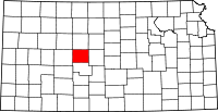 | |
| Unincorporated communities | ||