Otjiwarongo
| Otjiwarongo | ||
|---|---|---|
| City | ||
|
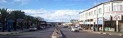
Otjiwarongo main road pictured from the south of the town | ||
| ||
| Nickname(s): OTT, OT | ||
| Motto: Gradatim | ||
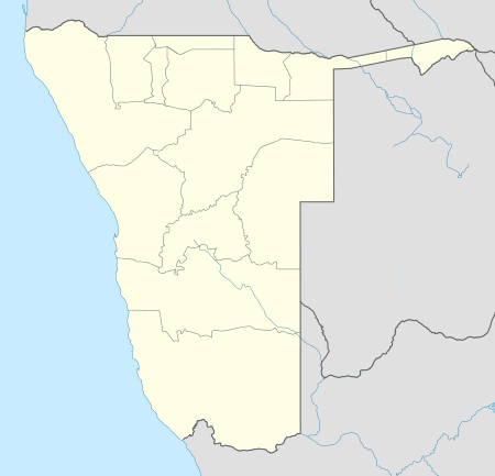 Otjiwarongo Location in Namibia | ||
| Coordinates: 20°27′51″S 16°39′10″E / 20.46417°S 16.65278°ECoordinates: 20°27′51″S 16°39′10″E / 20.46417°S 16.65278°E | ||
| Country |
| |
| Region | Otjozondjupa Region | |
| Constituency | Otjiwarongo Constituency | |
| Government | ||
| • Type | Municipal | |
| • Mayor | Hilda Makano Jesaja | |
| Population (2011)[1] | ||
| • Total | 28,249 | |
| Time zone | South African Standard Time (UTC+1) | |
| Area code(s) | 067 | |
| Climate | BSh | |
| Website | www.otjiwarongomun.org | |

Otjiwarongo (Otjiherero: pleasant place or place where fat cattle graze) is a city[2] of 70,000 inhabitants in the Otjozondjupa Region of Namibia. It is the district capital of the Otjiwarongo electoral constituency and also the capital of Otjozondjupa.
Otjiwarongo is situated in central-north Namibia on the TransNamib railway. It is the biggest business centre for Otjozondjupa Region. Otjiwarongo is located on the B1 road and its links between Windhoek, the Golden Triangle of Otavi, Tsumeb and Grootfontein, and Etosha National Park. It is one of Namibia’s fast-growing towns, with a neat and peaceful quality environment, and many excellent facilities including supermarkets, banks, lodges and hotels. Some of Namibia's best-known private game farms and nature reserves are located in and around the town.
Otjiwarongo is one of Namibia's towns with a large population of German-speaking people. German influence is also evident on its Germanic buildings. The school "Donatus School Otjiwarongo" (D.S.O.) was once known as "Deutsche Schule Otjiwarongo".
History
The Herero people were the original settlers of this area, and they called the place Otjiwarongo, meaning "Place Where Fat Cattle Graze". The name is appropriate as Otjiwarongo is home to some of the biggest cattle-breeding companies in Namibia. German Namibians first settled in Otjiwarongo in 1900. A bloody war was fought in the area between the Hereros and the Germans in 1904 where many of the tribes people died. The Hereros were the only African settlers in the town until 1906 when few amount of Ovambo and Damara tribes migrated to the town for settlement. This happened when Otjiwarongo was established as an administration point for the Germans and officially became a town. A narrow-gauge railway was built from Swakopmund on the coast, to the Otavi copper mine which helped Otjiwarongo become a prosperous agricultural centre. The three tribes where separated like in many of Namibia's towns, where each lived in a separate neighborhood: Ovambo Location, Damara Location and Herero Location respectively. The three locations together made up the suburb of Orwetoveni.
Economy and infrastructure
The town connects to the South, Okahandja through to Windhoek, to the North, Otavi through to Ondangwa and Oshakati, to the West, Kalkfeld through to Swakopmund and Walvis Bay, and to the North-West, Outjo through to Opuwo. Taxi's are mainly used as a form of transport while others use their private cars. Otjiwarongo is the junction for the branch railway to Outjo.
Otjiwarongo has a well-developed road network as well as an air strip. There are plans to develop an international airport. The trans-caprivi highway also passes through Otjiwarongo. The railway line links other towns: Windhoek, Walvisbay, Tsumeb and Oshikango. On many occasions the Council has budgeted for upgrading roads in the town. Today Otjiwarongo is one of the few towns that has tarred roads even in the townships.
Health facilities
Otjiwarongo State Hospital is the biggest hospital in the town, it is mostly used by the middle and low income residents. A number of private clinics and hospitals are also present in the town, including a branch of MediCity Private Clinic.
Tourism
The main interest for tourists is Otjiwarongo's proximity to the Waterberg Plateau Park. Otjiwarongo is home to the Cheetah Conservation Fund, an internationally recognized organization dedicated to ensuring the long-term survival of the cheetah through research, conservation and education. Also about 50 miles from Otjiwarongo is Okonjima, the home of the Africat Foundation, a cheetah and leopard rehabilitation centre.[3]
On the edge of town is the Crocodile Ranch, one of the few captive breeding programs for the Nile Crocodile that has been registered with CITES.[4] Also in town is Locomotive No 41, originally brought from Germany to haul ore between Tsumeb and the port at Swakopmund. Otjibamba Lodge, an afro-colonial style lodge, is situated on the southern side of the town near the Otjiwarongo Golf Course.
Built 15 km outside of town, the Omatjenne Dam provides artificial recharge of local groundwater.[5]
Politics
Otjiwarongo is governed by a municipal council that currently has seven seats.[6]
Education
There are about twelve schools in Otjiwarongo, three private schools and nine public schools. All schools final exams for grade 10 and 12 are regulated by the Ministry of Education. The schools of Otjiwarongo attract more and more non-resident students.
There are a number of institution for higher education in the town, as well as the MTI and COSDEC vocational training centres and a convent. The University of Namibia and the Namibia University of Science and Technology had plans to build satellite campuses in the town. The two institutions already have their regional centers in the town where distance students interact with the two institutions respectively.
Public Schools
- Karundu Primary School
- Orwetoveni Primary School
- Rogate Primary School
- Spes Bona Primary School
- Vooruit Primary School
- Donatus School Otjiwarongo (until 1995 Deutsche Schule Otjiwarongo)
- Otjiwarongo Secondary School
- Paresis Secondary School
- Tsaraxa-Aibes Combined School
Private Schools
- Privatschule Otjiwarongo
- Otjiwarongo Christian Primary
- Edugate Academy
Previously the German school Regierungsschule Otjiwarongo was in the city.[7]
Language
About 90% of the town’s residents speak and understand Afrikaans. About 75% speaks English and 35% German. Other languages includes indigenous languages like Otjiherero, Damara-nama and Oshiwambo.
Sport
Mighty Gunners FC is the town's major football team. Mokati Stadium, the smallest of two stadia in Otjiwarongo, is located in Orwetoveni and it is the main football stadium in town. There are also grounds for basketball, netball, and tennis. The largest, Paresis Park also known as The Show Ground, is located in the upper suburb of the town. It is the towns biggest sport ground and one of the biggest in Namibia. It has two soccer fields and two rugby fields. There are also grounds for hockey, tennis, netball and cricket. The park is also used to host sport tournaments and business events such as the Otjiwarongo Trade Show. In 2011, it hosted the main event of the 21st Independence Celebrations of Namibia.[8]
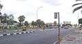
South Otjiwarongo CBD 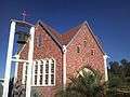
Christian's church in central Otjiwarongo 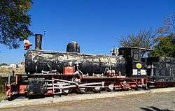
German Locomotive No 41 at Otjiwarongo railway station 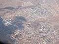
Aerial photo of Otjiwarongo showing mostly the South and Eastern part of the town 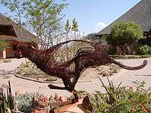
Cheetah Conservation Research Centre in Otjiwarango
Geography
Climate
Otjiwarongo has a semi-arid climate (BSh, according to the Köppen climate classification), with hot summers and mild winters. The average annual precipitation is 457 mm (18 in).
| Climate data for Otjiwarongo | |||||||||||||
|---|---|---|---|---|---|---|---|---|---|---|---|---|---|
| Month | Jan | Feb | Mar | Apr | May | Jun | Jul | Aug | Sep | Oct | Nov | Dec | Year |
| Average high °C (°F) | 32 (90) |
30 (86) |
29 (84) |
29 (84) |
27 (81) |
24 (75) |
24 (75) |
27 (81) |
31 (88) |
32 (90) |
33 (91) |
34 (93) |
29.3 (84.8) |
| Daily mean °C (°F) | 24.5 (76.1) |
23.5 (74.3) |
22.5 (72.5) |
21 (70) |
18 (64) |
15 (59) |
15 (59) |
17.5 (63.5) |
22 (72) |
23 (73) |
24.5 (76.1) |
25 (77) |
20.96 (69.71) |
| Average low °C (°F) | 17 (63) |
17 (63) |
16 (61) |
13 (55) |
9 (48) |
6 (43) |
6 (43) |
8 (46) |
13 (55) |
14 (57) |
16 (61) |
16 (61) |
12.6 (54.7) |
| Average precipitation mm (inches) | 100 (3.94) |
121 (4.76) |
80 (3.15) |
41 (1.61) |
5 (0.2) |
0 (0) |
0 (0) |
1 (0.04) |
2 (0.08) |
14 (0.55) |
39 (1.54) |
54 (2.13) |
457 (18) |
| Source: World Climate Guide.[9] | |||||||||||||
Twin cities
Notable residents
- Hage Geingob (born 1941), first prime minister and third President of Namibia
- Otto Ipinge, politician, former mayor of the town, former regional councillor for Otjiwarongo Constituency, and current governor of Otjozondjupa Region
- Vekuii Rukoro (born 1954), lawyer, businessman and the paramount chief of the Herero people
- Dan Craven (born 1983), Namibian racing cyclist
- Lazarus Kandara (1963–2005), businessman in Namibia[10]
References
- ↑ "Table 4.2.2 Urban population by Census years (2001 and 2011)" (PDF). Namibia 2011 - Population and Housing Census Main Report. Namibia Statistics Agency. p. 39. Retrieved 24 August 2016.
- ↑ "Local Authorities". Association of Local Authorities in Namibia (ALAN). Retrieved 1 October 2012.
- ↑ Jackman, Brian. "BBC - Science & Nature - Articles - Big cat watching in Africa". www.bbc.co.uk. Archived from the original on 2008-03-19. Retrieved 2008-03-17.
- ↑ "Otjiwarongo Namibia". The Cardboard Box Travel Shop. Retrieved 9 April 2012.
- ↑ Omatjenne Dam at NamWater.com.na
- ↑ "Know Your Local Authority". Election Watch (3). Institute for Public Policy Research. 2015. p. 4.
- ↑ "Deutscher Bundestag 4. Wahlperiode Drucksache IV/3672" (Archive). Bundestag (West Germany). 23 June 1965. Retrieved on 12 March 2016. p. 32/51.
- ↑ http://www.nbc.com.na/article.php?id=5445 Otjiwarongo to host the 21st Independence Celebrations
- ↑ World Climate Guide
- ↑ National Society for Human Rights in Namibia
External links
| Wikivoyage has a travel guide for Otjiwarongo. |