Otsego, New York
| Otsego, New York | |
|---|---|
| Town | |
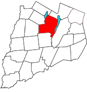 Otsego County map with the Town of Otsego in Red | |
| Coordinates: 42°44′5″N 74°57′32″W / 42.73472°N 74.95889°WCoordinates: 42°44′5″N 74°57′32″W / 42.73472°N 74.95889°W | |
| Country | United States |
| State | New York |
| County | Otsego |
| Area | |
| • Total | 57.8 sq mi (149.6 km2) |
| • Land | 54.2 sq mi (140.4 km2) |
| • Water | 3.6 sq mi (9.3 km2) |
| Elevation | 1,355 ft (413 m) |
| Population (2010) | |
| • Total | 3,900 |
| • Density | 67/sq mi (26/km2) |
| Time zone | Eastern (EST) (UTC-5) |
| • Summer (DST) | EDT (UTC-4) |
| ZIP code | 13337 |
| Area code(s) | 607 |
| FIPS code | 36-55695 |
| GNIS feature ID | 0979329 |
Otsego is a town in Otsego County, New York, United States. The population was 3,900 at the 2010 census. The town is named after a lake on its border.
The Town of Otsego is in the north central part of the county.
History
Gideon Hawley, a missionary, arrived in this area in 1753. William Cooper purchased land (Cooper Patent) that now is marked, in part, by Cooperstown. Major settlement began around 1788.
The Town of Otsego was organized while still in Montgomery County in 1788 and is the oldest town in the county.
People of note
- Willard Bundy, inventor of the time clock.
- James Fenimore Cooper, author who lived much of his life in Cooperstown and died there.
- Daniel DeWitt Tompkins Davie (1816–1877), American photographer, was born in Otsego.
- Isaac Singer, inventer who worked at a machine shop in Fly Creek in the 1830s. The family of his future business partner, Edward C. Clark, has been a major benefactor of Cooperstown since the 19th century.
Geography
According to the United States Census Bureau, the town has a total area of 57.8 square miles (150 km2), of which, 54.2 square miles (140 km2) of it is land and 3.6 square miles (9.3 km2) of it (6.18%) is water.
Otsego Lake forms most of the eastern boundary, and Canadarago Lake forms part of the western boundary.
New York State Route 80 is a north-south highway along the west side of Otsego Lake. At Cooperstown, NY-80 is partly conjoined with New York State Route 28 as an east-west highway. New York State Route 205 intersects NY-80 in the western part of Otsego.
Demographics
| Historical population | |||
|---|---|---|---|
| Census | Pop. | %± | |
| 1820 | 4,186 | — | |
| 1830 | 4,363 | 4.2% | |
| 1840 | 4,120 | −5.6% | |
| 1850 | 3,901 | −5.3% | |
| 1860 | 4,303 | 10.3% | |
| 1870 | 4,590 | 6.7% | |
| 1880 | 4,690 | 2.2% | |
| 1890 | 4,917 | 4.8% | |
| 1900 | 4,497 | −8.5% | |
| 1910 | 4,287 | −4.7% | |
| 1920 | 4,223 | −1.5% | |
| 1930 | 4,345 | 2.9% | |
| 1940 | 4,074 | −6.2% | |
| 1950 | 4,304 | 5.6% | |
| 1960 | 4,121 | −4.3% | |
| 1970 | 3,998 | −3.0% | |
| 1980 | 4,012 | 0.4% | |
| 1990 | 3,932 | −2.0% | |
| 2000 | 3,904 | −0.7% | |
| 2010 | 3,900 | −0.1% | |
| Est. 2014 | 3,822 | [1] | −2.0% |
As of the census[3] of 2000, there were 3,904 people, 1,701 households, and 1,029 families residing in the town. The population density was 72.0 people per square mile (27.8/km²). There were 2,193 housing units at an average density of 40.5 per square mile (15.6/km²). The racial makeup of the town was 97.75% White, 0.64% African American, 0.08% Native American, 0.69% Asian, 0.26% from other races, and 0.59% from two or more races. Hispanic or Latino of any race were 1.54% of the population.
There were 1,701 households out of which 25.5% had children under the age of 18 living with them, 49.1% were married couples living together, 8.3% had a female householder with no husband present, and 39.5% were non-families. 33.6% of all households were made up of individuals and 15.2% had someone living alone who was 65 years of age or older. The average household size was 2.22 and the average family size was 2.85.
In the town the population was spread out with 22.0% under the age of 18, 5.4% from 18 to 24, 23.8% from 25 to 44, 27.7% from 45 to 64, and 21.1% who were 65 years of age or older. The median age was 44 years. For every 100 females there were 89.0 males. For every 100 females age 18 and over, there were 84.6 males.
The median income for a household in the town was $40,036, and the median income for a family was $48,320. Males had a median income of $33,684 versus $22,868 for females. The per capita income for the town was $26,305. About 4.5% of families and 7.5% of the population were below the poverty line, including 6.7% of those under age 18 and 6.0% of those age 65 or over.
Communities and locations in Otsego, New York
- Brookwood Point – A projection into Otsego Lake north of Cooperstown.
- Cattown – A hamlet west of Fly Creek and Oaksville on NY-80.
- Cooperstown – Most of the Village of Cooperstown.
- Five Mile Point – A projection into Otsego Lake near the north town line.
- Fly Creek – A hamlet west of Cooperstown on conjoined NY-28/NY-80. The Fly Creek Methodist Church, The Cornfield, Fly Creek Grange No. 844, and Fly Creek Historic District are listed on the National Register of Historic Places.[4]
- Index – A hamlet
- Oaksville – A hamlet west of Fly Creek on NY-80.
- Pail Shop Corners – A hamlet north of Fly Creek.
- Panther Mountain – An elevation on the east side of Canadarago Lake.
- Pierstown – A hamlet near the west side of Otsego Lake.
- Snowdon – A hamlet near the west town line on NY-80.
- Taylortown – A location north of Pail Shop Corners.
- Toddsville – A hamlet south of Cooperstown.
- Tunnicliff Hill – An elevation north of Snowdon.
- Twelve Thousand – A location in the northwest corner of the town.
- Wileytown – A hamlet in the southwest part of the town on NY-205.
References
- ↑ "Annual Estimates of the Resident Population for Incorporated Places: April 1, 2010 to July 1, 2014". Retrieved June 4, 2015.
- ↑ "Census of Population and Housing". Census.gov. Retrieved June 4, 2015.
- ↑ "American FactFinder". United States Census Bureau. Retrieved 2008-01-31.
- ↑ National Park Service (2009-03-13). "National Register Information System". National Register of Historic Places. National Park Service.
External links
Municipalities and communities of Otsego County, New York, United States | ||
|---|---|---|
| City | 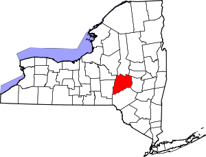 | |
| Towns | ||
| Villages | ||
| CDPs | ||
| Other hamlets | ||
| Footnotes | ‡This populated place also has portions in an adjacent county or counties | |