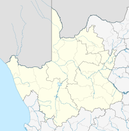
Pampierstad
| Pampierstad | |
|---|---|
 Pampierstad  Pampierstad  Pampierstad
| |
| Coordinates: 27°46′34″S 24°41′24″E / 27.776°S 24.690°ECoordinates: 27°46′34″S 24°41′24″E / 27.776°S 24.690°E | |
| Country | South Africa |
| Province | Northern Cape |
| District | Frances Baard |
| Municipality | Phokwane |
| Area[1] | |
| • Total | 10.39 km2 (4.01 sq mi) |
| Population (2011)[1] | |
| • Total | 21,707 |
| • Density | 2,100/km2 (5,400/sq mi) |
| Racial makeup (2011)[1] | |
| • Black African | 98.9% |
| • Coloured | 0.5% |
| • Indian/Asian | 0.3% |
| • Other | 0.3% |
| First languages (2011)[1] | |
| • Tswana | 83.3% |
| • English | 4.7% |
| • Xhosa | 4.0% |
| • Afrikaans | 1.9% |
| • Other | 6.0% |
| Postal code (street) | 8566 |
| PO box | 8566 |
| Area code | 053 |
Pampierstad is a town in Frances Baard District Municipality in the Northern Cape province of South Africa.
The town lies in the northern part of the Vaalharts irrigation scheme and 14 km from Hartswater. Most residents are Tswana speaking.
Pampierstad was initially established in the former Bophuthatswana to house black workers of South African industries and farms. The name comes from the type of cardboard that was used to construct the first houses.
Education
Pampierstad consist of 6 Primary schools, 2 Secondaries and 2 High schools
1. Pabalelo 2. Bontleng 3. Gaoshupe Makodi 4. Mooki Lobelo 5. Simon Medupe 6. Kgono
Secondaries 1. Olehile Manchwe 2. Reitlamile
High Schools 1. Kgomotso 2. Pampierstad High
References
- 1 2 3 4 "Main Place Pampierstad". Census 2011.
This article is issued from Wikipedia - version of the 11/7/2016. The text is available under the Creative Commons Attribution/Share Alike but additional terms may apply for the media files.
.svg.png)