Ritchie, Northern Cape
| Ritchie | |
|---|---|
 Ritchie  Ritchie  Ritchie
| |
| Coordinates: 29°03′S 24°36′E / 29.05°S 24.6°ECoordinates: 29°03′S 24°36′E / 29.05°S 24.6°E | |
| Country | South Africa |
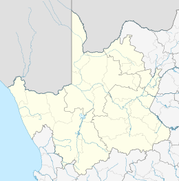
| Province | Northern Cape |
| District | Frances Baard |
| Municipality | Sol Plaatje |
| Area[1] | |
| • Total | 24.8 km2 (9.6 sq mi) |
| Population (2011)[1] | |
| • Total | 14,850 |
| • Density | 600/km2 (1,600/sq mi) |
| Racial makeup (2011)[1] | |
| • Black African | 50.9% |
| • Coloured | 45.4% |
| • Indian/Asian | 0.8% |
| • White | 2.1% |
| • Other | 0.7% |
| First languages (2011)[1] | |
| • Afrikaans | 87.6% |
| • Tswana | 6.3% |
| • Xhosa | 1.8% |
| • Sotho | 1.6% |
| • Other | 2.7% |
| Postal code (street) | 8701 |
| PO box | 8701 |
| Area code | +27 (0)53 |
Ritchie is a small town situated 40 kilometres (20 mi) south of Kimberley on the north bank of the Riet River in the Northern Cape province of South Africa. The town, with a population of approximately 15,000, is in the Sol Plaatje Local Municipality, which forms part of the Frances Baard District Municipality.
Demographics
According to the 2011 census, the town of Ritchie proper has a population of 7,610, while the adjacent township of Motswedimosa has a population of 7,240, giving the urban area a population of 14,850. Of this population 50.9% described themselves as "Black African", 45.4% as "Coloured" and 2.1% as "White". 87.6% spoke Afrikaans as their home language, 6.3% spoke Tswana, 1.8% spoke Xhosa and 1.6% spoke Sotho.
References
 |
Kimberley | | ||
| Douglas, Plooysburg | |
Jacobsdal | ||
| ||||
| | ||||
| Salt Lake | Hopetown | Koffiefontein |
Municipalities and communities of Frances Baard District Municipality, Northern Cape | ||
|---|---|---|
District seat: Kimberley | ||
| Sol Plaatje | .svg.png) | |
| Phokwane | ||
| Magareng | ||
| Dikgatlong | ||