Panoche, California
| Panoche, California | |
|---|---|
| Unincorporated community | |
 Panoche, California Location of Panoche within California | |
| Coordinates: 36°35′49″N 120°50′01″W / 36.59694°N 120.83361°WCoordinates: 36°35′49″N 120°50′01″W / 36.59694°N 120.83361°W | |
| Country | United States |
| State | California |
| County | San Benito |
| Elevation | 1,220 ft (372 m) |
| Time zone | Pacific (UTC-8) |
| • Summer (DST) | Pacific (UTC-7) |
| ZIP Code | 95043 |
| Area code(s) | 831 |
| GNIS feature ID | 252760 [1] |
The unincorporated community of Panoche is located along Panoche Road in the southern, rural part of San Benito County, California, United States. The community is about 2.7 driving miles east of County Route J1. The county seat, Hollister, is roughly 35 miles (56 km) straight-line distance. The Fresno County line is about 3.7 miles (6.0 km) distant to the northeast. The area encompassed by San Benito County continues just over 20 miles (32 km) farther south where the south extent meets Fresno and Monterey counties.[2]
The US Geological Survey feature ID is 252760 and the NAD27 latitude and longitude are listed as 36°35′49″N 120°50′01″W / 36.596944°N 120.833611°W. Elevation is shown as 1,220 feet (372 m) AMSL.[3]
The Panoche Inn is one of few area landmarks. The bar and restaurant is busy with motorcycle enthusiasts on weekends in sunny weather. Some customers camp at Mercey Hot Springs or ride off-road vehicles at a nearby Bureau of Land Management tract. The adjacent private grass airstrip is also used by local glider pilots in spring and autumn by agreement with the Inn owners. On the drive from Interstate 5, motorists will pass Little Panoche Reservoir: about 12.6 straight-line miles distant at 7.6 degrees off true north.
Panoche Valley grasslands are frequented by a variety of bird species of special interest, including Golden Eagle, Mountain Plover, Ferruginous Hawk, Prairie Falcon, Merlin, Mountain Bluebird, Loggerhead Shrike, Burrowing Owl, and Long-billed Curlew. The valley provides critical habitat, especially in winter, for these birds. Mammals in the area include three federally endangered species; the San Joaquin Kit Fox, Giant Kangaroo Rat, and Nelson's Antelope Squirrel. American Badger is also native to the valley. Endangered reptiles in the valley includes Blunt-nosed Leopard Lizard.
There is only one place in the entire world named Panoche, making it unique among the world's place names. It is thought that the name Panoche is derived from the local Indian word for a species of cane that once grew in the valley from which the Indians extracted panoche, a kind of sugar. It is believed that this is the origin for the name panocha, a popular Mexican and Filipino sugar (though processed somewhat differently from each other), and a pudding eaten during Lent in New Mexico and Southern Colorado.[4]
The ZIP Code is 95043. The community is inside area code 831.
Politics
In the state legislature Panoche is located in the 12th Senate District, represented by Republican Anthony Cannella, and in the 30th Assembly District, represented by Democrat Luis Alejo.
In the United States House of Representatives, Panoche is in California's 20th congressional district, represented by Democrat Sam Farr.[5]
Nearby features
Notes
- ↑ Geographic Names Information System — GNIS Detail – Panoche
- ↑ Panoche, California, 7.5-minute quadrangle, US Geological Survey, (1969).
- ↑ National Geographic Names Database, US Geological Survey, March, 1998.
- ↑ Three Rocks Report, Three Rocks Research, April 2006.
- ↑ "California's 20th Congressional District - Representatives & District Map". Civic Impulse, LLC. Retrieved September 24, 2014.
External links
- BLM Panoche and Tumey Hills areas.
- Panoche Inn
- Three Rocks Research, Three Rocks Report, April 2006 Newsletter
Municipalities and communities of San Benito County, California, United States | ||
|---|---|---|
| Cities | 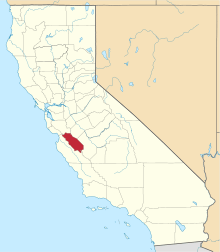 | |
| CDPs | ||
| Unincorporated communities | ||
| Ghost town | ||
| Footnotes | ‡This populated place also has portions in an adjacent county or counties | |