Paonta Sahib
| Paonta Sahib पांवटा साहिब ਪਾਂਉਟਾ ਸਾਹਿਬ | |
|---|---|
| City | |
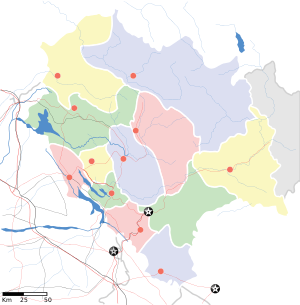 Paonta Sahib  Paonta Sahib Location in Himachal Pradesh | |
| Coordinates: 30°26′17″N 77°37′26″E / 30.438°N 77.624°ECoordinates: 30°26′17″N 77°37′26″E / 30.438°N 77.624°E | |
| Country | India |
| State | Himachal Pradesh |
| District | Sirmour |
| Municipality | Sirmaur |
| Elevation | 389 m (1,276 ft) |
| Population (2011) | |
| • Total | 25,172[1] |
| Languages | |
| • Official | Hindi |
| Time zone | IST (UTC+5:30) |
Paonta Sahib (पांवटा साहिब, ਪਾਂਉਟਾ ਸਾਹਿਬ) is one of the major industrial towns of Himachal Pradesh. It is located in the south of Sirmour district, on National Highway 7. Major industries are cement production (Cement Corporation of India in Rajban), power generation and renewable energy, pharmaceuticals (Sun Pharmaceutical,[2] Mankind Pharma Limited), textiles, chemicals and food, as well as Asia's biggest limestone market at Sataun. Paonta Sahib is also an an important religious spot for Sikhs, hosting a large Gurdwara named Gurudwara Paonta Sahib, on the banks of the river Yamuna. The river is the boundary between the states of Himachal Pradesh and Uttarakhand.
History
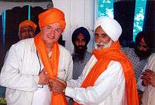
The town was founded by Sikh Guru Guru Gobind Singh.[3] The Gurudwara Paonta Sahib has linkages to the tenth Sikh Guru, Guru Gobind Singh and the Sikh leader Banda Bahadur. Its original name was Paontika. "Paon" in Hindi means feet and "tika" in Hindi means became stable. It is believed that Guru Gobind Singh and his horse stopped at this place and he decided to stay here. He lived here for 4 and half year as he never stayed so long at any place in his entire life. He wrote many Sikh religious books here and then went to Anandpur Sahib to establish the Khalsa Panth. The Gurudwara also houses a museum which contains a lot of antiques and weapons used by Guru Gobind Singh during his stay.

Geography
Paonta Sahib is located at 30°26′17″N 77°37′26″E / 30.438°N 77.624°E.[4] It has an average elevation of 389 metres (1,276 feet). It is on the bank of the river Yamuna, the river being the boundary between the states of Himachal Pradesh and Uttarakhand. It is situated near the towns of Nahan in Himachal Pradesh, Yamunanagar in Haryana, Saharanpur in Western Uttar Pradesh and Dehradun in Uttarakhand. It is on the western extreme of the Doon Valley a distance of about 44 km from Dehradun. Kalesar National Park is 12 km from Paonta Sahib.

Climate
Paonta Sahib has a sub-tropical continental monsoon climate characterised by a seasonal rhythm, hot summers, slightly cold winters, unreliable rainfall and great variation in temperature (0 °C to 40 °C). In winters, frost sometimes occurs during December and January. It also receives occasional winter rains from the western disturbance.
Average temperatures
- Summer: Temperature in summers may rise high to maximum of 44 °C. Temperature generally remains 35 °C to 40 °C.
- Autumn: In Autumn, temperature may go to high to maximum 36 °C. Temperature usually remains between 16 °C to 27 °C in autumn. Lowest temperature may go to 13 °C.
- Winter: Winters are quite cool. However, it may sometimes gets chilly. Average temperature in winters (November to February) remains at (max) 7 °C to 15 °C and (min) 0 °C to 5 °C.
- Spring: Climate remains quite pleasant in spring season. Temperature remains (max) 16 °C to 25 °C and (min) 9 °C to 18 °C.
Demographics
As of 2011 India census,[5] Paonta Sahib had a population of 1,58,268 (urban 25,172/ rural 1,33,096). Males constitute 53% of the population and females 47%.[6] Paonta Sahib has an average literacy rate of 76%, higher than National average of 74.04% (2011 figure).: male literacy is 79%, and female literacy is 72%. In Paonta Sahib, 13% of the population is under 6 years of age.
Paonta Sahib is a municipal council which has 13 wards. This council looks after the development of the city, maintenance of roads, streets, cleanliness etc. The election takes place every five years to elect ward members & Chairman.
Education
Schools In Paonta Sahib
- Guru Nanak Mission Public School
- The Scholar's Home
- D.A.V Sirmour Sr. Sec School
- Doon Valley School
- Hill View Public School, Majra
- Bibi Jeet Kaur School
- Kid's Paradise
- The Rose Orchid World School
- Vidya Peeth High School
References
- ↑ http://www.censusindia.gov.in/PopulationFinder/Population_Finder.aspx
- ↑ http://www.sunpharma.com/operations/manufacturing
- ↑ http://religions.iloveindia.com/sikh-shrines/gurudwara-paonta-sahib.html
- ↑ Falling Rain Genomics, Inc – Paonta Sahib
- ↑ http://www.censusindia.gov.in/2011-prov-results/paper2-vol2/data_files/himachal%20pradesh/statement%20%20wise2.6.pdf
- ↑ http://www.censusindia.gov.in/2011-prov-results/paper2-vol2/data_files/himachal%20pradesh/statement%20%20wise5.7.pdf
- ↑ http://www.census2011.co.in/data/town/800132-paonta-sahib-himachal-pradesh.html
External links
- http://www.himachalpr.gov.in/pressreleaseEng.asp?id=3078
- http://www.himachal.nic.in/
- http://hpsirmaur.nic.in/