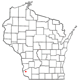
Patch Grove, Wisconsin
| Patch Grove, Wisconsin | |
|---|---|
| Village | |
 | |
| Coordinates: 42°56′22.07″N 90°58′20.25″W / 42.9394639°N 90.9722917°WCoordinates: 42°56′22.07″N 90°58′20.25″W / 42.9394639°N 90.9722917°W | |
| Country | United States |
| State | Wisconsin |
| County | Grant |
| Area[1] | |
| • Total | 0.39 sq mi (1.01 km2) |
| • Land | 0.39 sq mi (1.01 km2) |
| • Water | 0 sq mi (0 km2) |
| Elevation[2] | 1,112 ft (339 m) |
| Population (2010)[3] | |
| • Total | 198 |
| • Estimate (2012[4]) | 197 |
| • Density | 507.7/sq mi (196.0/km2) |
| Time zone | Central (CST) (UTC-6) |
| • Summer (DST) | CDT (UTC-5) |
| Area code(s) | 608 |
| FIPS code | 55-61450[5] |
| GNIS feature ID | 1583899[2] |
Patch Grove is a village in Grant County, Wisconsin, United States. The population was 198 at the 2010 census. The village is located within the Town of Patch Grove.
Geography
Patch Grove is located at 42°56′22.07″N 90°58′20.25″W / 42.9394639°N 90.9722917°W.
According to the United States Census Bureau, the village has a total area of 0.39 square miles (1.01 km2), all of it land.[1]
Demographics
| Historical population | |||
|---|---|---|---|
| Census | Pop. | %± | |
| 1870 | 177 | — | |
| 1930 | 243 | — | |
| 1940 | 195 | −19.8% | |
| 1950 | 203 | 4.1% | |
| 1960 | 208 | 2.5% | |
| 1970 | 187 | −10.1% | |
| 1980 | 259 | 38.5% | |
| 1990 | 202 | −22.0% | |
| 2000 | 166 | −17.8% | |
| 2010 | 198 | 19.3% | |
| Est. 2015 | 195 | [6] | −1.5% |
2010 census
As of the census[3] of 2010, there were 198 people, 82 households, and 55 families residing in the village. The population density was 507.7 inhabitants per square mile (196.0/km2). There were 88 housing units at an average density of 225.6 per square mile (87.1/km2). The racial makeup of the village was 98.5% White and 1.5% from other races. Hispanic or Latino of any race were 4.0% of the population.
There were 82 households of which 29.3% had children under the age of 18 living with them, 57.3% were married couples living together, 6.1% had a female householder with no husband present, 3.7% had a male householder with no wife present, and 32.9% were non-families. 26.8% of all households were made up of individuals and 8.5% had someone living alone who was 65 years of age or older. The average household size was 2.41 and the average family size was 2.89.
The median age in the village was 37.5 years. 25.3% of residents were under the age of 18; 7.6% were between the ages of 18 and 24; 24.3% were from 25 to 44; 25.9% were from 45 to 64; and 17.2% were 65 years of age or older. The gender makeup of the village was 53.5% male and 46.5% female.
2000 census
As of the census[5] of 2000, there were 166 people, 65 households, and 46 families residing in the village. The population density was 423.7 people per square mile (164.3/km²). There were 67 housing units at an average density of 171.0 per square mile (66.3/km²). The racial makeup of the village was 100.00% White. 1.81% of the population were Hispanic or Latino of any race.
There were 65 households out of which 32.3% had children under the age of 18 living with them, 66.2% were married couples living together, 3.1% had a female householder with no husband present, and 29.2% were non-families. 21.5% of all households were made up of individuals and 15.4% had someone living alone who was 65 years of age or older. The average household size was 2.55 and the average family size was 3.04.
In the village the population was spread out with 27.1% under the age of 18, 7.8% from 18 to 24, 27.1% from 25 to 44, 22.9% from 45 to 64, and 15.1% who were 65 years of age or older. The median age was 34 years. For every 100 females there were 104.9 males. For every 100 females age 18 and over, there were 116.1 males.
The median income for a household in the village was $25,625, and the median income for a family was $38,125. Males had a median income of $18,750 versus $21,250 for females. The per capita income for the village was $13,189. About 12.1% of families and 13.0% of the population were below the poverty line, including 24.3% of those under the age of eighteen and 16.7% of those sixty five or over.
References
- 1 2 "US Gazetteer files 2010". United States Census Bureau. Retrieved 2012-11-18.
- 1 2 "US Board on Geographic Names". United States Geological Survey. 2007-10-25. Retrieved 2008-01-31.
- 1 2 "American FactFinder". United States Census Bureau. Retrieved 2012-11-18.
- ↑ "Population Estimates". United States Census Bureau. Retrieved 2013-06-24.
- 1 2 "American FactFinder". United States Census Bureau. Retrieved 2008-01-31.
- ↑ "Annual Estimates of the Resident Population for Incorporated Places: April 1, 2010 to July 1, 2015". Retrieved July 2, 2016.
- ↑ "Census of Population and Housing". Census.gov. Retrieved June 4, 2015.
Municipalities and communities of Grant County, Wisconsin, United States | ||
|---|---|---|
| Cities | 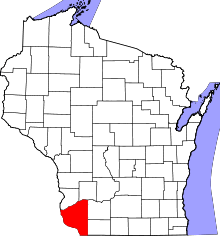 | |
| Villages | ||
| Towns |
| |
| CDPs | ||
| Unincorporated communities |
| |
| Ghost town | ||
| Footnotes | ‡This populated place also has portions in an adjacent county or counties | |