Pembine (CDP), Wisconsin
| Pembine, Wisconsin | |
|---|---|
| Census-designated place | |
|
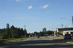
Looking north at downtown Pembine | |
 Location in Wisconsin | |
| Coordinates: 45°38′07″N 87°59′27″W / 45.63528°N 87.99083°WCoordinates: 45°38′07″N 87°59′27″W / 45.63528°N 87.99083°W | |
| Country | United States |
| State | Wisconsin |
| County | Marinette |
| Area | |
| • Total | 0.599 sq mi (1.55 km2) |
| • Land | 0.598 sq mi (1.55 km2) |
| • Water | 0.001 sq mi (0.003 km2) |
| Elevation | 971 ft (296 m) |
| Population (2010)[1] | |
| • Total | 193 |
| • Density | 320/sq mi (120/km2) |
| Time zone | Central (CST) (UTC-6) |
| • Summer (DST) | CDT (UTC-5) |
| Area code(s) | 715 & 534 |
| GNIS feature ID | 1571162[2] |
Pembine is an unincorporated census-designated place in Marinette County, Wisconsin (USA), in the town of Pembine. It is located on U.S. Route 141 and U.S. Route 8. It uses the Postal ZIP code 54156.[3] As of the 2010 census, its population is 193.[1]
Images
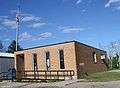 Post office
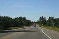 Looking north at the welcome sign
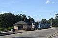 Train station
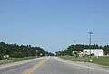 Looking west
References
| Wikimedia Commons has media related to Pembine, Wisconsin. |
Municipalities and communities of Marinette County, Wisconsin, United States | ||
|---|---|---|
| Cities | 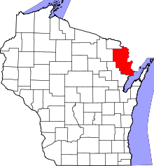 | |
| Villages | ||
| Towns | ||
| CDPs | ||
| Unincorporated communities | ||
| Footnotes | ‡This populated place also has portions in an adjacent county or counties | |
This article is issued from Wikipedia - version of the 9/4/2016. The text is available under the Creative Commons Attribution/Share Alike but additional terms may apply for the media files.