Pennfield Parish, New Brunswick
| Pennfield | |
|---|---|
| Parish | |
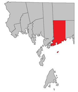 Location within Charlotte County. | |
| Country |
|
| Province |
|
| County | Charlotte County |
| Established | 1786 |
| Area[1] | |
| • Land | 363.88 km2 (140.49 sq mi) |
| Population (2011)[1] | |
| • Total | 2,218 |
| • Density | 6.1/km2 (16/sq mi) |
| • Pop 2006-2011 |
|
| • Dwellings | 1,099 |
| Time zone | AST (UTC-4) |
| • Summer (DST) | ADT (UTC-3) |
Pennfield is a Canadian parish in Charlotte County, New Brunswick.[2]
History
Pennfield Parish was established in 1786: named by Pennsylvania Quakers for William Penn (1644-1718), English Quaker leader and founder of Pennsylvania: Pennfield Parish included Lepreau Parish until 1857.
Delineation
Pennfield Parish is defined in the Territorial Division Act[3] as being bounded:
- Westerly by Saint George Parish and Letang River; north by Clarendon Parish; east by a line commencing at the western bank or shore of the Pocologan River, where it falls into the Bay of Fundy, and running true north to Clarendon Parish; and south by the Bay of Fundy, including The Wolves Islands, and all other islands within two miles of the shore and not included in Saint George Parish.
Communities
Parish population total does not include incorporated municipalities (in bold):
|
|
Bodies of water & Islands
This is a list of rivers, lakes, streams, creeks, marshes and Islands that are at least partially in this parish
- Clear Lake
- Sparks Lake
- Mill Lake
- Trout Lake
- Smith Lake
- Wellington Lake
- New River
- Blind Lake
- McDougall Lake
- Red Rock Lake
- The Wolves Islands
- Eastern Wolf Island
- Green Rock
- Spruce Island
- Flat Wolf Island
- Southern Wolf Island
Demographics
Population
| Canada census – Pennfield Parish, New Brunswick community profile | |||
|---|---|---|---|
| 2011 | 2006 | 2001 | |
| Population: | 2,218 (-4.5% from 2006) | 2,322 (-3.9% from 2001) | 2,417 (+6.2% from 1996) |
| Land area: | 363.88 km2 (140.49 sq mi) | 363.88 km2 (140.49 sq mi) | 363.96 km2 (140.53 sq mi) |
| Population density: | 6.1/km2 (16/sq mi) | 6.4/km2 (17/sq mi) | 6.6/km2 (17/sq mi) |
| Median age: | 44.3 (M: 44.1, F: 44.4) | 41.8 (M: 42.2, F: 41.4) | 36.7 (M: 36.9, F: 36.6) |
| Total private dwellings: | 1,099 | 1,120 | 1,014 |
| Median household income: | $58,972 | $42,996 | $39,649 |
| References: 2011[1] 2006[4] 2001[5] | |||
| Historical Census Data - Pennfield Parish, New Brunswick[6] | ||||||||||||||||||||||||||
|---|---|---|---|---|---|---|---|---|---|---|---|---|---|---|---|---|---|---|---|---|---|---|---|---|---|---|
|
|
| ||||||||||||||||||||||||
Language
| Canada Census Mother Tongue - Pennfield Parish, New Brunswick[6] | ||||||||||||||||||
|---|---|---|---|---|---|---|---|---|---|---|---|---|---|---|---|---|---|---|
| Census | Total | English |
French |
English & French |
Other | |||||||||||||
| Year | Responses | Count | Trend | Pop % | Count | Trend | Pop % | Count | Trend | Pop % | Count | Trend | Pop % | |||||
| 2011 |
2,195 |
2,045 | |
93.17% | 90 | |
4.10% | 5 | |
0.23% | 55 | |
2.50% | |||||
| 2006 |
2,305 |
2,205 | |
95.66% | 55 | |
2.39% | 0 | |
0.00% | 45 | |
1.95% | |||||
| 2001 |
2,410 |
2,265 | |
93.98% | 115 | |
4.77% | 10 | |
0.42% | 20 | |
0.83% | |||||
| 1996 |
2,240 |
2,145 | n/a | 95.76% | 70 | n/a | 3.12% | 0 | n/a | 0.00% | 25 | n/a | 1.12% | |||||
Access Routes
Highways and numbered routes that run through the parish, including external routes that start or finish at the parish limits:[7]
|
|
|
See also
References
- 1 2 3 2011 Statistics Canada Census Profile: Pennfield Parish, New Brunswick
- ↑ New Brunswick Provincial Archives - Pennfield Parish
- ↑ "Territorial Division Act (R.S.N.B. 1973, c. T-3)". Government of New Brunswick website. Retrieved 24 August 2016.
- ↑ "2006 Community Profiles". Canada 2006 Census. Statistics Canada. March 30, 2011. Retrieved 2014-03-15.
- ↑ "2001 Community Profiles". Canada 2001 Census. Statistics Canada. February 17, 2012. Retrieved 2014-03-15.
- 1 2 Statistics Canada: 1996, 2001, 2006, 2011 census
- ↑ Atlantic Canada Back Road Atlas ISBN 978-1-55368-618-7 Pages 4, 12
 |
Clarendon Parish | | ||
| Saint George Parish | |
Lepreau Parish | ||
| ||||
| | ||||
| Bay of Fundy West Isles Parish |
Bay of Fundy |
| Subdivisions | |
|---|---|
| Cities | |
| Counties | |
| |
Coordinates: 45°12′40″N 66°39′22″W / 45.21119°N 66.656113°W
This article is issued from Wikipedia - version of the 8/24/2016. The text is available under the Creative Commons Attribution/Share Alike but additional terms may apply for the media files.