Pepin, Wisconsin
| Pepin, Wisconsin | |
|---|---|
| Village | |
|
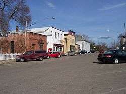
Part of Pepin's business district | |
 Location of Pepin, Wisconsin | |
| Coordinates: 44°26′33″N 92°8′52″W / 44.44250°N 92.14778°WCoordinates: 44°26′33″N 92°8′52″W / 44.44250°N 92.14778°W | |
| Country | United States |
| State | Wisconsin |
| County | Pepin |
| Area[1] | |
| • Total | 0.70 sq mi (1.81 km2) |
| • Land | 0.70 sq mi (1.81 km2) |
| • Water | 0 sq mi (0 km2) |
| Elevation[2] | 722 ft (220 m) |
| Population (2010)[3] | |
| • Total | 837 |
| • Estimate (2012[4]) | 814 |
| • Density | 1,195.7/sq mi (461.7/km2) |
| Time zone | Central (CST) (UTC-6) |
| • Summer (DST) | CDT (UTC-5) |
| Area code(s) | 715 & 534 |
| Website | http://pepinwisconsin.org/ |
Pepin is a village in Pepin County, Wisconsin, United States. The population was 837 at the 2010 census. The village is located within the Town of Pepin.
History
By the mid-17th century, the French had begun to send expeditions into Wisconsin via the Great Lakes and Saint Lawrence River. King Louis XIII of France is believed to have granted a huge piece of land in the Upper Mississippi River Valley to two brothers, Etiene Pepin de la Fond and Guillaume dit Tranchemontagne. Two of Guillaume’s sons, Pierre Pepin and Jean Pepin du Cardonnets, later explored and traded in this area, and their surname became attached to the lake, and ultimately to the village and the county.[5]
Geography
Pepin is located at 44°26′33″N 92°8′52″W / 44.44250°N 92.14778°W (44.442724, -92.147884).[6]
According to the United States Census Bureau, the village has a total area of 0.70 square miles (1.81 km2), all of it land.[1]
Demographics
| Historical population | |||
|---|---|---|---|
| Census | Pop. | %± | |
| 1890 | 369 | — | |
| 1900 | 407 | 10.3% | |
| 1910 | 397 | −2.5% | |
| 1920 | 555 | 39.8% | |
| 1930 | 603 | 8.6% | |
| 1940 | 754 | 25.0% | |
| 1950 | 840 | 11.4% | |
| 1960 | 825 | −1.8% | |
| 1970 | 747 | −9.5% | |
| 1980 | 890 | 19.1% | |
| 1990 | 873 | −1.9% | |
| 2000 | 878 | 0.6% | |
| 2010 | 837 | −4.7% | |
| Est. 2015 | 795 | [7] | −5.0% |
2010 census
As of the census[3] of 2010, there were 837 people, 399 households, and 226 families residing in the village. The population density was 1,195.7 inhabitants per square mile (461.7/km2). There were 490 housing units at an average density of 700.0 per square mile (270.3/km2). The racial makeup of the village was 98.9% White, 0.2% African American, 0.2% Native American, 0.4% Asian, and 0.2% from two or more races. Hispanic or Latino of any race were 0.2% of the population.
There were 399 households of which 18.5% had children under the age of 18 living with them, 48.4% were married couples living together, 6.8% had a female householder with no husband present, 1.5% had a male householder with no wife present, and 43.4% were non-families. 38.3% of all households were made up of individuals and 16.1% had someone living alone who was 65 years of age or older. The average household size was 1.98 and the average family size was 2.58.
The median age in the village was 53.9 years. 14.6% of residents were under the age of 18; 4.3% were between the ages of 18 and 24; 19.4% were from 25 to 44; 33.8% were from 45 to 64; and 28% were 65 years of age or older. The gender makeup of the village was 47.8% male and 52.2% female.
2000 census
As of the census[9] of 2000, there were 878 people, 381 households, and 241 families residing in the village. The population density was 1,238.1 people per square mile (477.5/km²). There were 430 housing units at an average density of 606.4 per square mile (233.8/km²). The racial makeup of the village was 98.29% White, 0.11% Black or African American, 0.34% Native American, 0.57% Asian, and 0.68% from two or more races.
There were 381 households out of which 22.3% had children under the age of 18 living with them, 52.2% were married couples living together, 7.1% had a female householder with no husband present, and 36.5% were non-families. 32.8% of all households were made up of individuals and 18.9% had someone living alone who was 65 years of age or older. The average household size was 2.17 and the average family size was 2.74.
In the village the population was spread out with 17.3% under the age of 18, 6.4% from 18 to 24, 21.9% from 25 to 44, 26.2% from 45 to 64, and 28.2% who were 65 years of age or older. The median age was 48 years. For every 100 females there were 94.7 males. For every 100 females age 18 and over, there were 92.1 males.
The median income for a household in the village was $36,319, and the median income for a family was $41,250. Males had a median income of $31,393 versus $22,875 for females. The per capita income for the village was $17,755. About 2.0% of families and 5.8% of the population were below the poverty line, including 7.5% of those under age 18 and 11.2% of those age 65 or over.
Notable people
- Nathaniel O. Murray, steamboat owner and Wisconsin state legislator, lived in Pepin.[10]
- The author Laura Ingalls Wilder was born in the Pepin area, near Lund, Wisconsin, where her family lived. The Laura Ingalls Wilder Museum is in the village. The Little House Wayside is located seven miles northwest of the village, in the town of Pepin.[11]
References
- 1 2 "US Gazetteer files 2010". United States Census Bureau. Retrieved 2012-11-18.
- ↑ "US Board on Geographic Names". United States Geological Survey. 2007-10-25. Retrieved 2008-01-31.
- 1 2 "American FactFinder". United States Census Bureau. Retrieved 2012-11-18.
- ↑ "Population Estimates". United States Census Bureau. Retrieved 2013-06-24.
- ↑ History of Pepin County
- ↑ "US Gazetteer files: 2010, 2000, and 1990". United States Census Bureau. 2011-02-12. Retrieved 2011-04-23.
- ↑ "Annual Estimates of the Resident Population for Incorporated Places: April 1, 2010 to July 1, 2015". Retrieved July 2, 2016.
- ↑ "Census of Population and Housing". Census.gov. Retrieved June 4, 2015.
- ↑ "American FactFinder". United States Census Bureau. Retrieved 2008-01-31.
- ↑ 'Wisconsin Blue Book 1882,' Biographical Sketch of Nathaniel O. Murray, pg. 556
- ↑ Laura Ingalls Wilder Museum
External links
| Wikimedia Commons has media related to Pepin, Wisconsin. |
Municipalities and communities of Pepin County, Wisconsin, United States | ||
|---|---|---|
| City | 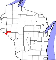 | |
| Villages | ||
| Towns | ||
| CDP | ||
| Unincorporated communities | ||
| Footnotes | ‡This populated place also has portions in an adjacent county or counties | |