Pincher Creek
| Pincher Creek | ||
|---|---|---|
| Town | ||
| Town of Pincher Creek | ||
|
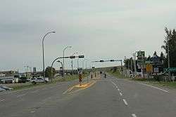
Looking south at the business district in Pincher Creek on Alberta Highway 6 | ||
| ||
 Pincher Creek Location of Pincher Creek in Alberta | ||
| Coordinates: 49°29′10″N 113°57′00″W / 49.48611°N 113.95000°WCoordinates: 49°29′10″N 113°57′00″W / 49.48611°N 113.95000°W | ||
| Country |
| |
| Province |
| |
| Region | Southern Alberta | |
| Census division | 3 | |
| Municipal district | Municipal District of Pincher Creek No. 9 | |
| Incorporated[1] | ||
| • Village | August 18, 1898 | |
| • Town | May 12, 1906 | |
| Government[2] | ||
| • Mayor | Don Anderberg | |
| • Governing body | Pincher Creek Town Council | |
| Area (2011)[3] | ||
| • Total | 10.19 km2 (3.93 sq mi) | |
| Elevation[4] | 1,130 m (3,710 ft) | |
| Population (2011)[3] | ||
| • Total | 3,685 | |
| • Density | 361.6/km2 (937/sq mi) | |
| Time zone | MST (UTC−7) | |
| • Summer (DST) | MDT (UTC−6) | |
| Postal code | T0K 1W0 | |
| Area code(s) | 403 / 587 | |
| Highways |
| |
| Waterways | Oldman River Reservoir | |
| Website | Official website | |
Pincher Creek is a town in the southwest of Alberta, Canada. It is located immediately east of the Canadian Rockies, 101 km (63 mi) west of Lethbridge and 210 km (130 mi) south of Calgary.
History
For centuries before this area was settled, the Blackfoot, Peigan and Kootenai Nations lived in or frequented the region.
The town received its name in 1868 when a group of prospectors lost a pincer in the small creek at this location. These pincers would have been used as a mechanism for trimming the feet of the horses and thus had some value to the group. In 1874, the North-West Mounted Police came to southern Alberta. One of them discovered the rusting tools in the creek, and they named the area Pincher Creek.
In 1876, the NWMP established a horse farm in the area. It closed in 1881, but many of the troops stayed to help the town. James Schofield opened Pincher Creek's first store in 1884. By 1885 Pincher Creek had a store known as Schofield & Hyde General Store. Harry Hyde succeeded Schofield as Pincher Creek's first postmaster.
In 1898, Pincher Creek was incorporated a village. In 1906, the community was officially incorporated as a town and named Pincher Creek. Many residents are descendants of the pioneer families who settled there over 100 years ago.
Geography
Climate
Strong Chinook winds often blow off the mountains and Pincher Creek can be very windy. The Oldman River and Castle River valleys seem to act as a kind of funnel for air masses, arguably making the area around Pincher Creek the windiest in Alberta. Any typical day may see wind speeds of 50-90km/h, the most violent recorded wind being 177km/h. The strong winds have given rise to a significant amount of wind farm development in the area, with the towers and blades of wind turbines being a characteristic of the scenery. Another consequence of the breezy conditions is that the weather is mostly sunny and very dry as the wind tends to dissipate cloud cover.
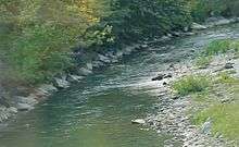
The town was severely affected by a flood that hit the area in 1995 as the peak stream flow discharge of the creek that gave the town its name was 271 cubic meters per second.
Demographics
The population of the Town of Pincher Creek according to its 2013 municipal census is 3,619,[5] a 2.5% decrease from its 2008 municipal census population of 3,712.[6]
In the 2011 Census, the Town of Pincher Creek had a population of 3,685 living in 1,500 of its 1,581 total dwellings, a 1.7% change from its 2006 population of 3,625. With a land area of 10.19 km2 (3.93 sq mi), it had a population density of 361.6/km2 (936.6/sq mi) in 2011.[3]
In 2006, Pincher Creek had a population of 3,625 living in 1,504 dwellings, a 1.1% decrease from 2001. The town then had a land area of 8.84 km2 (3.41 sq mi) and a population density of 410.2/km2 (1,062/sq mi).[7]
Attractions
The Kootenai Brown Pioneer Village is a popular tourist stop open year round. It was named after Kootenay Brown, who was the founder of Waterton Park. The six acre site is home to over twenty-three historical buildings, all on open exhibit. Each July, the village has a large Canada Day celebration, as well as hosting other community based events through the year. Among over 18,000 artifacts, historical archives are also located on site and accessible to the public. [8]
Pincher Creek is located 57 km (35 mi) north of Waterton Lakes National Park. The Castle Mountain Ski Resort is located 49 km (30 mi) to the southwest.
Government
The town's mayor is Don Anderberg.
Media
Pincher Creek is served by two newspapers, the Sun Media owned Pincher Creek Echo,[9] which publishes on Wednesdays and has been in operation since 1900. and the locally owned Shootin' the Breeze which has been serving the community since 2011. Shootin' the Breeze is published in print weekly on Wednesdays and is available online at www.shootinthebreeze.ca. It is also served by an online news website, the Pincher Creek Voice, established in 2011.
Pincher Creek is served by Mountain Radio, a country music station based in nearby Blairmore. Mountain Radio's Pincher Creek transmitter can be heard on 92.7 FM.
Notable people
- White Bird, Nez Perce leader
- Matthew Halton, World War II news correspondent
- Beverley McLachlin, Chief Justice of the Supreme Court of Canada
- Andy Russell, author and conservationist
- Gordon Walter Semenoff, theoretical physicist
- Darcy Wakaluk, former professional hockey player
- Warren Winkler, former Chief Justice of the Ontario Court of Appeal
See also
Images
 Looking south at Pincher Creek on Alberta Highway 6
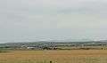 Panorama of Pincher Creek from Alberta Highway 3
References
- ↑ "Location and History Profile: Town of Pincher Creek" (PDF). Alberta Municipal Affairs. October 7, 2016. p. 484. Retrieved October 13, 2016.
- ↑ "Municipal Officials Search". Alberta Municipal Affairs. November 18, 2016. Retrieved November 21, 2016.
- 1 2 3 "Population and dwelling counts, for Canada, provinces and territories, and census subdivisions (municipalities), 2011 and 2006 censuses (Alberta)". Statistics Canada. 2012-02-08. Retrieved 2012-02-08.
- ↑ "Alberta Private Sewage Systems 2009 Standard of Practice Handbook: Appendix A.3 Alberta Design Data (A.3.A. Alberta Climate Design Data by Town)" (PDF) (PDF). Safety Codes Council. January 2012. pp. 212–215 (PDF pages 226–229). Retrieved October 9, 2013.
- ↑ "Agenda: Town of Pincher Creek, Committee of the Whole" (PDF). Town of Pincher Creek. August 1, 2013. pp. 80–82. Retrieved August 2, 2013.
- ↑ "2011 Municipal Affairs Population List" (PDF). Alberta Municipal Affairs. October 5, 2010. Retrieved December 12, 2011.
- ↑ Statistics Canada. "Canada 2006 Census: Pincher Creek - Community Profile". Retrieved 2007-06-12.
- ↑ http://www.kootenaibrown.ca/p/village.html
- ↑ "Pincher Creek Echo". Canoe Sun Media. Retrieved May 9, 2013.
External links
| Wikimedia Commons has media related to Pincher Creek, Alberta. |
 |
Cowley | Cowley | Fort Macleod | |
| Crowsnest Pass | |
Glenwood | ||
| ||||
| | ||||
| Beaver Mines | Waterton Lakes National Park | Hill Spring |