Black Diamond, Alberta
| Black Diamond | |
|---|---|
| Town | |
| Town of Black Diamond | |
|
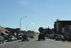
Downtown Black Diamond on Alberta Highway 22 | |
 Black Diamond Location of Black Diamond in Alberta | |
| Coordinates: 50°41′N 114°14′W / 50.683°N 114.233°W | |
| Country |
|
| Province |
|
| Region | Calgary Region |
| Census division | 6 |
| Municipal district | Municipal District of Foothills No. 31 |
| Incorporated[1] | |
| • Village | May 8, 1929 |
| • Town | January 1, 1956 |
| Government[2] | |
| • Mayor | Glen Fagan |
| • Governing body | Black Diamond Town Council |
| Area (2011)[3] | |
| • Total | 3.21 km2 (1.24 sq mi) |
| Elevation[4] | 1,159 m (3,802 ft) |
| Population (2011)[3] | |
| • Total | 2,373 |
| • Density | 740.3/km2 (1,917/sq mi) |
| • Dwellings | 756 |
| Time zone | MST (UTC-7) |
| Postal code span | T1S |
| Area code(s) | +1-403 |
| Highways |
Highway 22 Highway 7 |
| Waterways | Sheep River |
| Website |
town |
Black Diamond is a sister town to Turner Valley. It has a hospital, shops, hotels and residences, elementary school (K-6th grade), high school (7th-12th grade), hockey rink and a Boys and Girls Club. Little oil or gas remains. It is located in the Municipal District of Foothills No. 31.
Black Diamond is nestled in the foothills of the Canadian Rockies in the midst of some of Canada's best ranch country.
A three-kilometer trail next to the roadway between Black Diamond and Turner Valley is named the Friendship Trail.
Demographics
In the 2011 Census, the Town of Black Diamond had a population of 2,373 living in 945 of its 1,001 total dwellings, a 24.9% change from its 2006 population of 1,900. With a land area of 3.21 km2 (1.24 sq mi), it had a population density of 739.3/km2 (1,914.7/sq mi) in 2011.[3]
The population of the Town of Black Diamond according to its 2009 municipal census is 2,308.[5]
According to the 2006 census, Black Diamond has a:
- population of 1,900 living in 756 dwellings, a 1.8% increase from 2001
- land area of 3.21 km2 (1.24 sq mi)
- and a population density of 592.7/km2 (1,535/sq mi).[6]
Images
-

Looking south in Black Diamond
-

Sign looking east on Alberta Highway 22
-

Post office
-

Looking east at Black Diamond
See also
References
- ↑ "Location and History Profile: Town of Black Diamond" (PDF). Alberta Municipal Affairs. October 7, 2016. p. 57. Retrieved October 13, 2016.
- ↑ "Municipal Officials Search". Alberta Municipal Affairs. November 18, 2016. Retrieved November 21, 2016.
- 1 2 3 "Population and dwelling counts, for Canada, provinces and territories, and census subdivisions (municipalities), 2011 and 2006 censuses (Alberta)". Statistics Canada. 2012-02-08. Retrieved 2012-02-08.
- ↑ "Alberta Private Sewage Systems 2009 Standard of Practice Handbook: Appendix A.3 Alberta Design Data (A.3.A. Alberta Climate Design Data by Town)" (PDF) (PDF). Safety Codes Council. January 2012. pp. 212–215 (PDF pages 226–229). Retrieved October 8, 2013.
- ↑ Alberta Municipal Affairs (2009-09-15). "Alberta 2009 Official Population List" (PDF). Retrieved 2010-09-14.
- ↑ Statistics Canada. "Canada 2006 Census: Black Diamond - Community Profile". Retrieved 2007-06-09.
External links
| Wikimedia Commons has media related to Black Diamond, Alberta. |
 |
Bragg Creek | Calgary | De Winton |  |
| Kananaskis Country | |
Okotoks | ||
| ||||
| | ||||
| Turner Valley | Longview | High River |
Coordinates: 50°41′N 114°14′W / 50.683°N 114.233°W
