Placencia
| Placencia | |
|---|---|
| Village | |
|
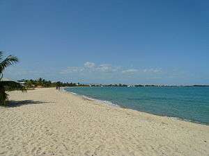
Maya Beach, Placencia | |
 Placencia | |
| Coordinates: 16°30′50″N 88°22′0″W / 16.51389°N 88.36667°W | |
| Country |
|
| District | Stann Creek |
| Constituency | Stann Creek West |
| Population (2010) | |
| • Total | 750 (est) |
| Time zone | Central No DST (UTC-6) |
| Climate | Am |
Placencia is a small town located in the Stann Creek District of Belize.
History
In the 17th century, Placencia was settled by the English Puritans, originally from Nova Scotia and latterly from the island of Providencia. This settlement died out during the Central American wars of independence in the 1820s.
The Placencia Peninsula was resettled in the late 1800s by several families. Placencia prospered and soon became a village, earning its livelihood from the sea.
The Spaniards that traveled the southern coast of Belize gave Placencia its name. At that time Placencia was called Placentia, with the point being called Punta Placentia, or Pleasant Point.[1]
On October 8, 2001, Hurricane Iris hit southern Belize with 145 mph winds causing major damage to nearly 95% of buildings in Placencia. Many developers took advantage of plummeted real estate value and an increased development of the peninsula and Placencia proper is consistently on the rise, as well as property value.[2]
In the late 20th century it became a significant tourism destination, and is now referred to as Placencia Village, or simply Placencia.
Location and geographic setting
The eastern side of the Peninsula is a long expanse of white sand beach and heavy mangrove in some areas; the western side is bounded by a long narrow north-south trending bay of the Caribbean Sea. A significant settlement on the peninsula is the Garifuna village of Seine Bight. Placencia is served by Placencia Airport.
Demographics
The village is home to 458 permanent residents according to the 2000 census. The 2009 population estimate for Placencia Village is 750.
Gallery
-
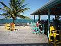
Placencia Bar Beachfront
-
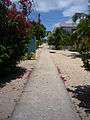
The narrowest street in the world, Placencia
-
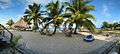
Fisheye view of Cabanas
Attractions
- Placencia, it used to be a fishing village but now offers some tourist amusement such as bars and entertainment like kayaking, snorkeling, diving, saltwater fly fishing, whale shark watching during the full moons between April and July of each year, light tackle saltwater fishing, as well as numerous restaurants and local art gallery.
- Placencia Village, hosts the Placencia Lobster Fest, the Placencia Peninsula Arts Festival, Easter Week (similar to US Florida Spring Break).
- Placencia Lagoon, with manatees, dolphins, rays (the Lagoon is a nursery for some species of rays), mangrove forests, birding by canoe or kayak, fishing (juvenile tarpon, snook, barracuda), wetlands and sea grass beds.
- Mayan ruins of Nim Li Punit and Lubantuum are in the Toledo District, a day trip from the Placencia Peninsula.
- Cockscomb Basin Wildlife Sanctuary, which is also a day trip from Placencia.
- Maya Centre Village with 12 self-guided trails, 100,000 acres (400 km2) forest jaguar preserve, and nearly 300 bird species.
- Mayflower Archaeological Reserve, 3 post-classic Maya ruins: Mayflower, T'au Witz and Maintzunun) and waterfalls.
- Bladen River Reserve[3]
- Maya Beach is a tiny community on the Placencia Peninsula, midway between Placencia Village to the south and Riversdale to the north. The closest village is Seine Bight, a historic Garifuna settlement. Approximately 1.5 miles (2.4 km) long, the Maya Beach area is made up of homes, small resorts and a few retail establishments including two small grocery stores, a half-dozen bars & restaurants, and an art gallery.
The area was established as Maya Beach and registered as a subdivision in the 1960s. Slow but steady growth due to tourism, immigration to the area and Belizeans moving to the area for jobs has resulted in a population estimated by some to be as high as 200.
Throughout Maya Beach the peninsula is quite narrow, approximately 300–600 feet across from the sea to lagoon. Most properties have beach, lagoon or canal frontage.
References
- ↑ "Placencia History". Placencia Tourism Center. 2008. Retrieved 2009-04-22.
- ↑ consejo.bz/weather/storms.html
- ↑ "Belize Discover - Placencia". New World Hotels Inc. Retrieved 2009-04-22.
External links
 Placencia travel guide from Wikivoyage
- Placencia Travel Information - Belize Travel Magazine
See also
Coordinates: 16°30′50″N 88°22′00″W / 16.51389°N 88.36667°W