Pleasant Grove Township, Coles County, Illinois
| Pleasant Grove Township | |
|---|---|
| Township | |
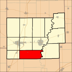 Location in Coles County | |
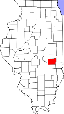 Coles County's location in Illinois | |
| Coordinates: 39°24′N 88°16′W / 39.400°N 88.267°WCoordinates: 39°24′N 88°16′W / 39.400°N 88.267°W | |
| Country | United States |
| State | Illinois |
| County | Coles |
| Established | November 8, 1859 |
| Area | |
| • Total | 41.65 sq mi (107.9 km2) |
| • Land | 41.64 sq mi (107.8 km2) |
| • Water | 0.01 sq mi (0.03 km2) 0.02% |
| Elevation | 732 ft (223 m) |
| Population (2010) | |
| • Total | 1,327 |
| • Density | 31.9/sq mi (12.3/km2) |
| Time zone | CST (UTC-6) |
| • Summer (DST) | CDT (UTC-5) |
| ZIP codes | 61920, 61938, 62440, 62469 |
| GNIS feature ID | 0429577 |
Pleasant Grove Township is one of twelve townships in Coles County, Illinois, USA. As of the 2010 census, its population was 1,327 and it contained 573 housing units.[1]
Geography
According to the 2010 census, the township has a total area of 41.65 square miles (107.9 km2), of which 41.64 square miles (107.8 km2) (or 99.98%) is land and 0.01 square miles (0.026 km2) (or 0.02%) is water.[1]
Cities, towns, villages
Unincorporated towns
Extinct towns
- Campbell
Cemeteries
The township contains 14 cemeteries: Armstrong, Bales, Beals, Doty, Janesville, Leitch, Lower Muddy, Mount Tabor, New Indian Creek, New Kelley, Old Indian Creek, Shiloh, Upper Muddy and Wright.
Rivers
Landmarks
- Janesville
School districts
- Charleston Community Unit School District 1
- Mattoon Community Unit School District 2
- Neoga Community Unit School District 3
Political districts
- Illinois' 15th congressional district
- State House District 110
- State Senate District 55
References
- "Pleasant Grove Township, Coles County, Illinois". Geographic Names Information System. United States Geological Survey. Retrieved 2010-01-10.
- United States Census Bureau 2007 TIGER/Line Shapefiles
- United States National Atlas
- 1 2 "Population, Housing Units, Area, and Density: 2010 - County -- County Subdivision and Place -- 2010 Census Summary File 1". United States Census. Retrieved 2013-05-28.
External links
Adjacent townships
 |
Lafayette Township Mattoon Township |
|
Charleston Township | |
| Paradise Township | |
Hutton Township | ||
| ||||
| | ||||
| Neoga Township, Cumberland County | Cottonwood Township, Cumberland County |
Municipalities and communities of Coles County, Illinois, United States | ||
|---|---|---|
| Cities | ||
| Villages | ||
| Townships | ||
| Unincorporated communities | ||
| Extinct communities |
| |
| Footnotes | ‡This populated place also has portions in an adjacent county or counties | |
This article is issued from Wikipedia - version of the 12/3/2013. The text is available under the Creative Commons Attribution/Share Alike but additional terms may apply for the media files.