Pocomoke City, Maryland
| Pocomoke City, Maryland | ||
|---|---|---|
| City | ||
.jpg) | ||
| ||
| Nickname(s): Friendliest Town on the Eastern Shore | ||
 Location of Pocomoke City, Maryland | ||
| Coordinates: 38°4′8″N 75°33′42″W / 38.06889°N 75.56167°WCoordinates: 38°4′8″N 75°33′42″W / 38.06889°N 75.56167°W | ||
| Country | United States | |
| State | Maryland | |
| County | Worcester | |
| Incorporated | 1878 | |
| Government | ||
| • Mayor | Bruce Morrison | |
| Area[1] | ||
| • Total | 3.94 sq mi (10.20 km2) | |
| • Land | 3.69 sq mi (9.56 km2) | |
| • Water | 0.25 sq mi (0.65 km2) | |
| Elevation | 7 ft (2 m) | |
| Population (2010)[2] | ||
| • Total | 4,184 | |
| • Estimate (2012[3]) | 4,168 | |
| • Density | 1,133.9/sq mi (437.8/km2) | |
| Time zone | Eastern (EST) (UTC−5) | |
| • Summer (DST) | EDT (UTC−4) | |
| ZIP code | 21851 | |
| Area code | 410, 443 | |
| FIPS code | 24-62475 | |
| GNIS feature ID | 0591031 | |
| Website | www.cityofpocomoke.com | |

Pocomoke City, dubbed "the friendliest town on the Eastern Shore",[4][5][6] is a city in Worcester County, Maryland, United States. Although renamed in a burst of civic enthusiasm in 1878, the city is regularly referred to by its inhabitants simply as Pocomoke /ˈpoʊkoʊmoʊk/. The population was 4,184 at the 2010 census. It is part of the Salisbury, Maryland-Delaware Metropolitan Statistical Area.
History
Beginning in the late seventeenth century, a small settlement called Stevens Landing (sometimes Stevens Ferry) grew at the ferry landing on the south bank of the Pocomoke River. The town was incorporated as Newtown (or New Town) in 1865, but was reincorporated in 1878 as Pocomoke City, after the American Indian name of the river, meaning "black water."
Stevens Landing, and then Newtown, remained a modest river crossing until the construction through the town in the 1880s of the trunk railroad line along the Delmarva Peninsula from Wilmington, Delaware, to Cape Charles on the Eastern Shore of Virginia. The line eventually became part of the Pennsylvania Railroad. In addition to agriculture, industry such as lumber milling and shipbuilding and, in the twentieth century, factories making barrels and baskets for truck crops, and the canning of those crops, aided the town's growth.
On 14 June 1906, the city was the site of lynching. A farmhand named Edd Watson was murdered by a mob. Press reports indicate other lynching also happened in the town.[7]
In 1922, the business district of Pocomoke City was destroyed in a large fire; on one side of town this continued up to the church on third Street, known as St. Mary's Episcopal Church, but the downtown was quickly rebuilt. While truck farming declined during the 1900s, the poultry industry rose to take its place. NASA, the U.S. Navy, and the Coast Guard helped with continued growth by bringing jobs to the area.
In October 1933, George Armwood, Pocomoke City man was taken from a jail cell in nearby Saint Anne and killed by a mob.[8] lived in Pocomoke City.[9]
Pocomoke City held a franchise in the Eastern Shore Baseball League, at times hosting the Salamanders, the Red Sox, and the Chicks.
Pocomoke City was named an All-America City by the National Municipal League, and for the years 1984-85, Pocomoke City was one of the nine Finalist Communities. The local schools, Pocomoke Elementary, Pocomoke Middle, and Pocomoke High, hold excellence standards with several named as 'Blue Ribbon' schools in addition to numerous other awards.
The Sturgis One Room School Museum, a one-room schoolhouse, was moved to its present location in the down-town area as a museum of local African-American history. In June 2009, the Delmarva Discovery Center on the Pocomoke River, an interactive museum focusing on local ecology and history, opened.[10] Pocomoke City's other museum is The Isaac Costen House Museum. The Mar-Va Theater is a 1927 Art Deco auditorium known for its superior acoustics, and is being restored as a regional center for the performing arts.
In addition to the Mar-Va Theater and Costen House, Beverly, Littleton T. Clarke House, Crockett House, Hayward's Lott, Pocomoke City Historic District, Puncheon Mill House, and Young-Sartorius House are listed on the National Register of Historic Places.[11]
Pocomoke is a center for commerce on the lower shore, home to a growing industrial park with great diversity currently playing host to defense contractors, aerospace engineering and plastics fabrication. Pocomoke is also strategically located very near The Wallops Island Flight Facility in Wallops Island, Virginia.
Municipal status
References to the municipality's status as a city or town varies according to sources. The Census Bureau accounts Pocomoke City a city,[12] while official state documents differ. According to the Maryland State Archives, many more official documents refer to the "Town of Pocomoke City" than to the "City of Pocomoke City." The most recent references to the "Town" are from 1963, however, while the most recent references to the "City", which come from its charter, are from 1990.[13][14][15] Other sources also differ: the Maryland Manual Online calls it as a city,[16] while the Maryland Municipal League speaks of it as a town.[17] While cities and towns are significantly different in some states, Maryland's cities and towns, classed simply as "municipalities", are treated equally in state law.[18]
Geography
Pocomoke City is located at 38°4′8″N 75°33′42″W / 38.06889°N 75.56167°W (38.068904, -75.561718).[19]
According to the United States Census Bureau, the city has a total area of 3.94 square miles (10.20 km2), of which 3.69 square miles (9.56 km2) is land and 0.25 square miles (0.65 km2) is water.[1]
Climate
Its climate is characterized by relatively high temperatures and evenly distributed precipitation throughout the year. The Köppen climate classification subtype for this climate is "Cfa" (Humid Subtropical Climate).[20]
| Climate data for Pocomoke City, Maryland | |||||||||||||
|---|---|---|---|---|---|---|---|---|---|---|---|---|---|
| Month | Jan | Feb | Mar | Apr | May | Jun | Jul | Aug | Sep | Oct | Nov | Dec | Year |
| Average high °C (°F) | 8 (47) |
9 (48) |
13 (56) |
19 (66) |
24 (75) |
28 (83) |
31 (87) |
29 (85) |
27 (80) |
21 (70) |
15 (59) |
10 (50) |
19 (67) |
| Average low °C (°F) | −2 (29) |
−2 (28) |
2 (35) |
7 (44) |
12 (53) |
17 (62) |
19 (67) |
19 (66) |
15 (59) |
9 (48) |
4 (39) |
−1 (31) |
8 (47) |
| Average precipitation mm (inches) | 79 (3.1) |
81 (3.2) |
100 (4) |
79 (3.1) |
79 (3.1) |
86 (3.4) |
104 (4.1) |
124 (4.9) |
89 (3.5) |
86 (3.4) |
69 (2.7) |
89 (3.5) |
1,070 (42) |
| Average precipitation days | 9 | 8 | 10 | 8 | 9 | 8 | 9 | 8 | 6 | 6 | 7 | 9 | 95 |
| Source: Weatherbase [21] | |||||||||||||
Demographics
| Historical population | |||
|---|---|---|---|
| Census | Pop. | %± | |
| 1870 | 1,195 | — | |
| 1880 | 1,425 | 19.2% | |
| 1890 | 1,866 | 30.9% | |
| 1900 | 2,124 | 13.8% | |
| 1910 | 2,369 | 11.5% | |
| 1920 | 2,444 | 3.2% | |
| 1930 | 2,609 | 6.8% | |
| 1940 | 2,739 | 5.0% | |
| 1950 | 3,191 | 16.5% | |
| 1960 | 3,329 | 4.3% | |
| 1970 | 3,573 | 7.3% | |
| 1980 | 3,558 | −0.4% | |
| 1990 | 3,922 | 10.2% | |
| 2000 | 4,098 | 4.5% | |
| 2010 | 4,184 | 2.1% | |
| Est. 2015 | 4,133 | [22] | −1.2% |
2010 census
As of the census[2] of 2010, there were 4,184 people, 1,626 households, and 1,077 families residing in the city. The population density was 1,133.9 inhabitants per square mile (437.8/km2). There were 1,894 housing units at an average density of 513.3 per square mile (198.2/km2). The racial makeup of the city was 49.5% White, 45.8% African American, 0.5% Native American, 1.3% Asian, 1.0% from other races, and 2.0% from two or more races. Hispanic or Latino of any race were 2.5% of the population.
There were 1,626 households of which 38.7% had children under the age of 18 living with them, 35.5% were married couples living together, 24.9% had a female householder with no husband present, 5.8% had a male householder with no wife present, and 33.8% were non-families. 29.6% of all households were made up of individuals and 14% had someone living alone who was 65 years of age or older. The average household size was 2.52 and the average family size was 3.10.
The median age in the city was 36.4 years. 27.8% of residents were under the age of 18; 9.2% were between the ages of 18 and 24; 23.4% were from 25 to 44; 24.4% were from 45 to 64; and 15.2% were 65 years of age or older. The gender makeup of the city was 55.6% female and 44.4% male.
2000 census
As of the census[12] of 2000, there were 4,098 people, 1,596 households, and 1,058 families residing in the city. The population density was 1,346.5 people per square mile (520.5/km²). There were 1,764 housing units at an average density of 579.6 per square mile (224.0/km²). The racial makeup of the city was 50.73% White, 46.36% African American, 0.46% Native American, 0.46% Asian, 0.02% Pacific Islander, 0.34% from other races, and 1.61% from two or more races. Hispanic or Latino of any race were 1.05% of the population.
There were 1,596 households out of which 35.8% had children under the age of 18 living with them, 38.6% were married couples living together, 24.0% had a female householder with no husband present, and 33.7% were non-families. 29.9% of all households were made up of individuals and 16.8% had someone living alone who was 65 years of age or older. The average household size was 2.51 and the average family size was 3.11.
In the city the age distribution of the population shows 30.5% under the age of 18, 7.8% from 18 to 24, 26.7% from 25 to 44, 19.1% from 45 to 64, and 16.0% who were 65 years of age or older. The median age was 36 years. For every 100 females there were 83.6 males. For every 100 females age 18 and over, there were 74.7 males.
The median income for a household in the city was $28,938, and the median income for a family was $34,722. Males had a median income of $32,175 versus $19,362 for females. The per capita income for the city was $17,301. About 13.6% of families and 18.3% of the population were below the poverty line, including 31.8% of those under age 18 and 13.2% of those age 65 or over.
Notable people
- George Armwood, victim of last recorded lynching in Maryland[8] lived in Pocomoke City.[9]
- Mike McDermott, former member of the Maryland House of Delegates and former Mayor of Pocomoke City[24]
References
- 1 2 "US Gazetteer files 2010". United States Census Bureau. Retrieved 2013-01-25.
- 1 2 "American FactFinder". United States Census Bureau. Retrieved 2013-01-25.
- ↑ "Population Estimates". United States Census Bureau. Retrieved 2013-06-26.
- ↑ "Governor O'Malley Declares Pocomoke City Maryland's 'Capital for a Day'" (Press release). Office of the Governor of Maryland. August 21, 2008.
- ↑ McDermott, Mike (January 1, 2009). "Pocomoke City 2008 Review". Pocomoke City, Maryland.
- ↑ Uzelac, Ellen (September 28, 2003). "From beach to bay". Baltimore Sun.
- ↑ Brown, DeNee (18 July 2015). "Racial turmoil in Md.'s 'Friendliest Town' after black police chief is fired". Washington Post. Retrieved 20 July 2015.
- 1 2 "An American Tragedy". Maryland Historical Society. Retrieved 17 January 2015.
- 1 2 "George Armwood (b. 1911 - d. 1933)". Biographical Series. Archives of Maryland. Retrieved 17 January 2015.
- ↑ Mike McDermott. "A lot is new this summer in Pocomoke". www.delmarvanow.com accessed 3 August 2009
- ↑ National Park Service (2010-07-09). "National Register Information System". National Register of Historic Places. National Park Service.
- 1 2 "American FactFinder". United States Census Bureau. Retrieved 2008-01-31.
- ↑ Search results for "Town of Pocomoke City", Maryland Archives, accessed 2008-04-14.
- ↑ Search results for "City of Pocomoke City", Maryland Archives, accessed 2008-04-14.
- ↑ "Pocomoke City Charter" (PDF). Pocomoke City, Maryland.
- ↑ Pocomoke City, Worcester County, Maryland, Municipalities, Maryland Archives, 2007-04-16. Accessed 2008-04-14.
- ↑ Pocomoke City, Maryland, Maryland Municipal League. Accessed 2008-04-14.
- ↑ Article 23A §10 of the Maryland Code, enacted 1955, from Michie's Legal Resources.
- ↑ "US Gazetteer files: 2010, 2000, and 1990". United States Census Bureau. 2011-02-12. Retrieved 2011-04-23.
- ↑ Climate Summary for Pocomoke, Maryland
- ↑ "Weatherbase.com". Weatherbase. 2013. Retrieved on August 7, 2013.
- ↑ "Annual Estimates of the Resident Population for Incorporated Places: April 1, 2010 to July 1, 2015". Retrieved July 2, 2016.
- ↑ "Census of Population and Housing". Census.gov. Retrieved June 4, 2015.
- ↑ "MICHAEL A. McDERMOTT". HOUSE OF DELEGATES FORMER DELEGATES. Maryland State Archives. Retrieved 20 January 2015.
Further reading
- Murray, James, History of Pocomoke City, formerly New Town (1883).
- Torrence, Clayton, Old Somerset on the Eastern Shore of Maryland (1935).
- Touart, Paul Baker, Along the Seaboard Side: And Architectural History of Worcester County (1994).
- Truitt, Reginald V. & Millard Lescallette, Worcester County, Maryland's Arcadia (1977).
External links
| Wikimedia Commons has media related to Pocomoke City, Maryland. |
- Pocomoke City Chamber of Commerce website
-
 Geographic data related to Pocomoke City, Maryland at OpenStreetMap
Municipalities and communities of Worcester County, Maryland, United States | ||
|---|---|---|
| City | 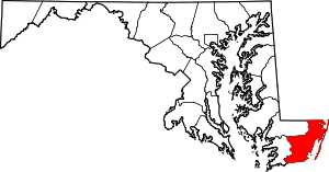 | |
| Towns | ||
| CDPs | ||
| Other communities | ||
| Footnotes | ‡This populated place also has portions in an adjacent county or counties | |
| Counties |  | |
|---|---|---|
| Principal city | ||
| Places 5k-20k | ||
| Places 1k-5k | ||