Prentice, Wisconsin
| Prentice | |
|---|---|
| Village | |
 Location of Prentice, Wisconsin | |
| Coordinates: 45°31′20″N 90°16′54″W / 45.52222°N 90.28167°WCoordinates: 45°31′20″N 90°16′54″W / 45.52222°N 90.28167°W | |
| Country | United States |
| State | Wisconsin |
| County | Price |
| Area[1] | |
| • Total | 2.02 sq mi (5.23 km2) |
| • Land | 1.99 sq mi (5.15 km2) |
| • Water | 0.03 sq mi (0.08 km2) |
| Elevation[2] | 1,539 ft (469 m) |
| Population (2010)[3] | |
| • Total | 660 |
| • Estimate (2012[4]) | 644 |
| • Density | 331.7/sq mi (128.1/km2) |
| Time zone | Central (CST) (UTC-6) |
| • Summer (DST) | CDT (UTC-5) |
| Zip Code | 54556 |
| Area code(s) | 715 & 534 |
| FIPS code | 55-65350[5] |
| GNIS feature ID | 1583979[2] |
Prentice is a village in Price County, Wisconsin, United States. The population was 660 at the 2010 census. The village is located within the Town of Prentice.
Geography
Prentice is located at 45°32′43″N 90°17′21″W / 45.54528°N 90.28917°W (45.545499, -90.289413).[6]
According to the United States Census Bureau, the village has a total area of 2.02 square miles (5.23 km2), of which, 1.99 square miles (5.15 km2) of it is land and 0.03 square miles (0.08 km2) is water.[1]
History
Prentice began as a lumber town, when Alexander Prentice of Portage formed the Jump River Lumber Company in 1882. The mill there sawed as much as 100,000 board feet of lumber a day until timber in the surrounding country dwindled in the 1890s.[7]
After the sawmill closed, the U.S. Leather Company's tannery ran until 1915, using local hemlock bark for its tanning process. And more and more farmers settled on the surrounding cut-over lands left by logging. Around 1903 a creamery in town began buying milk from them and selling butter.[7]
Airport
Prentice is served by the Prentice Airport (5N2). Located one mile east of the village, the airport handles approximately 1,500 operations per year, with roughly 99% general aviation and 1% air taxi. The airport has a 3,250 foot asphalt runway (Runway 9-27). [8]
Demographics
| Historical population | |||
|---|---|---|---|
| Census | Pop. | %± | |
| 1890 | 365 | — | |
| 1900 | 939 | 157.3% | |
| 1910 | 606 | −35.5% | |
| 1920 | 588 | −3.0% | |
| 1930 | 437 | −25.7% | |
| 1940 | 452 | 3.4% | |
| 1950 | 477 | 5.5% | |
| 1960 | 427 | −10.5% | |
| 1970 | 519 | 21.5% | |
| 1980 | 605 | 16.6% | |
| 1990 | 571 | −5.6% | |
| 2000 | 626 | 9.6% | |
| 2010 | 660 | 5.4% | |
| Est. 2015 | 627 | [9] | −5.0% |
2010 census
As of the census[3] of 2010, there were 660 people, 293 households, and 180 families residing in the village. The population density was 331.7 inhabitants per square mile (128.1/km2). There were 340 housing units at an average density of 170.9 per square mile (66.0/km2). The racial makeup of the village was 97.1% White, 0.9% African American, 0.9% Native American, and 1.1% from two or more races. Hispanic or Latino of any race were 1.1% of the population.
There were 293 households of which 31.7% had children under the age of 18 living with them, 42.0% were married couples living together, 14.3% had a female householder with no husband present, 5.1% had a male householder with no wife present, and 38.6% were non-families. 33.8% of all households were made up of individuals and 14.7% had someone living alone who was 65 years of age or older. The average household size was 2.25 and the average family size was 2.87.
The median age in the village was 39.4 years. 25.6% of residents were under the age of 18; 7.5% were between the ages of 18 and 24; 22.3% were from 25 to 44; 27.9% were from 45 to 64; and 16.8% were 65 years of age or older. The gender makeup of the village was 45.8% male and 54.2% female.
2000 census
As of the census[5] of 2000, there were 626 people, 285 households, and 167 families residing in the village. The population density was 312.8 people per square mile (120.8/km²). There were 316 housing units at an average density of 157.9 per square mile (61.0/km²). The racial makeup of the village was 97.28% White, 0.48% Black or African American, 1.12% Native American, 0.00% Asian, 0.00% Pacific Islander, 0.48% from other races, and 0.64% from two or more races. 2.08% of the population were Hispanic or Latino of any race.
There were 285 households out of which 29.8% had children under the age of 18 living with them, 45.6% were married couples living together, 8.8% had a female householder with no husband present, and 41.4% were non-families. 35.8% of all households were made up of individuals and 19.3% had someone living alone who was 65 years of age or older. The average household size was 2.20 and the average family size was 2.91.
In the village the population was spread out with 25.2% under the age of 18, 6.2% from 18 to 24, 27.3% from 25 to 44, 23.6% from 45 to 64, and 17.6% who were 65 years of age or older. The median age was 39 years. For every 100 females there were 98.7 males. For every 100 females age 18 and over, there were 85.7 males.
The median income for a household in the village was $26,563, and the median income for a family was $46,406. Males had a median income of $31,944 versus $23,750 for females. The per capita income for the village was $16,216. 16.4% of the population and 13.5% of families were below the poverty line. 25.9% of those under the age of 18 and 10.7% of those 65 and older were living below the poverty line.
Notable natives
- Albin C. Bro, President of Shimer College
- Donal Hord, sculptor
- Dennis Morgan, actor and tenor
- Oscar V. Peterson, Medal of Honor
See also
References
- 1 2 "US Gazetteer files 2010". United States Census Bureau. Retrieved 2012-11-18.
- 1 2 "US Board on Geographic Names". United States Geological Survey. 2007-10-25. Retrieved 2008-01-31.
- 1 2 "American FactFinder". United States Census Bureau. Retrieved 2012-11-18.
- ↑ "Population Estimates". United States Census Bureau. Retrieved 2013-06-24.
- 1 2 "American FactFinder". United States Census Bureau. Retrieved 2008-01-31.
- ↑ "US Gazetteer files: 2010, 2000, and 1990". United States Census Bureau. 2011-02-12. Retrieved 2011-04-23.
- 1 2 Taylor, Mary E. (1985). "Prentice Co-operative Creamery Company" (PDF). NRHP Inventory-Nomination Form. National Park Service. Retrieved 2016-04-26.
- ↑ http://www.airnav.com/airports/5N2
- ↑ "Annual Estimates of the Resident Population for Incorporated Places: April 1, 2010 to July 1, 2015". Retrieved July 2, 2016.
- ↑ "Census of Population and Housing". Census.gov. Retrieved June 4, 2015.
External links
- Village of Prentice
- Prentice Area History - PrenticeProgress.com
- Sanborn fire insurance maps: 1906 1919
Municipalities and communities of Price County, Wisconsin, United States | ||
|---|---|---|
| Cities | 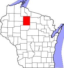 | |
| Villages | ||
| Towns | ||
| CDP | ||
| Unincorporated communities | ||
| Ghost towns | ||
| Footnotes | ‡This populated place also has portions in an adjacent county or counties | |