Province of Almería
| Province of Almería Provincia de Almería | |||
|---|---|---|---|
| |||
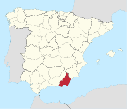 Map of Spain with highlighted | |||
| Coordinates: 37°10′N 2°20′W / 37.167°N 2.333°WCoordinates: 37°10′N 2°20′W / 37.167°N 2.333°W | |||
| Country | Spain | ||
| Autonomous community | Andalusia | ||
| Capital | Almería | ||
| Area | |||
| • Total | 8,774.87 km2 (3,388.00 sq mi) | ||
| Area rank | Ranked 27th | ||
| Population (2014) | |||
| • Total | 701,688 | ||
| • Rank | Ranked 24th | ||
| • Density | 80/km2 (210/sq mi) | ||
| Demonym(s) | Spanish: Almeriense, Urcitano | ||
| Official language(s) | Spanish | ||
| Parliament | Cortes Generales | ||
| Website | dipalme.org | ||


Almería (/ˌælməˈriːə/; Spanish: [almeˈɾi.a]) is a province of the Autonomous Community of Andalusia, Spain. It is bordered by the provinces of Granada, Murcia, and the Mediterranean Sea. Its capital is the homonymous city of Almería.
Almería has an area of 8,774 km². With 701,688 (2014) inhabitants, its population density is 79.96/km², slightly lower than the Spanish average. It is divided in 102 municipalities.
Geography

The highest mountain range in the Province of Almería is the 50 km long Sierra de Los Filabres.
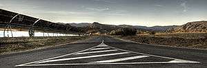
Europe's driest area is found in Almería and is part of the Cabo de Gata-Níjar Natural Park. The arid landscape and climate that characterizes part of the province have made it an ideal setting for Western films, especially during the 1960s. Because of the demand for these locations, quite a number of Western towns were built near the Desert of Tabernas. Films such as A Fistful of Dollars, For a Few Dollars More, and The Good, The Bad, and The Ugly were shot here. Years later the film of 800 Bullets was filmed in the same place. Large sections of Conan the Barbarian (1982 film), Indiana Jones and the Last Crusade, Lawrence of Arabia and Patton were shot there as well.
The main river is the Andarax River, which is located near Granada in the Alpujarras. The Beninar Reservoir, located near Darrical, provides part of the water needed in the production in greenhouses.
Fauna
Interesting and unique species of animals native to the Alto Almanzora are in the process of extinction.
Economy
The most important economic activity is greenhouse farming. Millions of tons of vegetables are exported to other European countries and other parts of the world each year. Tourism is also a key sector of the economy, due to the sunny weather and attractive areas such as Roquetas de Mar, Aguadulce, Almerimar, Mojacar, Vera or Cabo de Gata.
Industry
The principal industrial activity is in the Macael (Comarca del Marmol) canteras marble quarrying area in the Sierra de los Filabres region from Macael Viejo to Chercos, Lijar and Cobdar which produce in excess of 1.3 million tons. The Cantoria, Fines, Olula del Rio and Purchena area of the Alto Almanzora valley is fast becoming the regional megalopolis through high imports and exports and employment in local, national and international marble processing. All the tourist accommodations and construction throughout coastal Spain has driven high demand and brought huge modernisation. Small pueblos of agriculturalists have given rise to computerized machining factories.
Research facilities
The German-Spanish Calar Alto Astronomical Observatory is one of the most important observatories of Spain.
In Tabernas there is a solar energy research center, the Plataforma Solar de Almería (PSA).[1]
France's Michelin operates an industrial research center in Cabo de Gata.
| Historical population | ||
|---|---|---|
| Year | Pop. | ±% |
| 1857 | 315,664 | — |
| 1900 | 359,013 | +13.7% |
| 1910 | 380,388 | +6.0% |
| 1920 | 358,149 | −5.8% |
| 1930 | 341,550 | −4.6% |
| 1940 | 359,730 | +5.3% |
| 1950 | 357,401 | −0.6% |
| 1960 | 360,777 | +0.9% |
| 1970 | 375,004 | +3.9% |
| 1981 | 405,019 | +8.0% |
| 1991 | 465,662 | +15.0% |
| 1996 | 501,761 | +7.8% |
| 2001 | 533,168 | +6.3% |
| 2006 | 635,850 | +19.3% |
| 2014 | 701,688 | +10.4% |
History
Prehistoric
The Paleolithic Age of Almería was characterized by small nomadic and hunter-gatherer groups. The oldest Paleolithic site is Zájara Cave I (Cueva de Zájara I) in the Caves of the Almanzora (Cuevas del Almanzora).
The first villages and spaces dedicated exclusively to burials appear by the Neolithic Age, and even before the Upper Paleolithic Age. The cave paintings of the Cave of the Signs (Cueva de los Letreros) and twenty other caves and shelters of Los Vélez are dated to this era, and were designated a World Heritage site by Unesco in 1989.
In one of the shelters of the first settlers of the peninsula, the Coat of the Beehives (Abrigo de las Colmenas), there remains a human figure with arms outstretched holding an arc above its head. According to legend, this picture represents a covenant made by prehistoric man with the gods to prevent future floods. It is the earliest depiction of the Almerían Indalo, which was named in memory of Saint Indaletius, and means Indal Eccius ("messenger of the gods") in the Iberian language.
Over the years, the Indalo has become the best known symbol of Almería. Some see this figure as a man holding a rainbow, but it might also be an archer pointing a bow towards the sky. The Indalo lent its name to the artistic and intellectual movement of the Indalianos led by Jesús de Perceval and Eugenio d'Ors which was a movement of nostalgic attraction by the people of Mojácar. The people of Mojácar painted Indalos with chalk on the walls of their houses to guard against storms and the Evil Eye.
It was Luis Siret y Cels, an eminent Belgium archaeologist, that described the rich prehistoric wealth of Almería, particularly that of the Metal Age. Siret said that Almería was like "an open-air museum". Indeed, Almería is home to two of the most important cultures of the Metal Age in the peninsula: Los Millares and El Argar.
The earliest known city, Los Millares, dates to the Copper Age and is strategically located on a spur of rock between the Andarax River and the Huéchar Ravine (rambla de Huéchar), in the southern part of the province. It was a down of more than a thousand inhabitants, protected by three lines of walls and towers, and had an economy based on copper metallurgy, agriculture, animal husbandry, and hunting on a moderate scale. Furthermore, they constructed a large necropolis and exported metal figures and pottery to a large part of the peninsula.
The equally influential culture of El Argar appeared later, during the Bronze Age. They developed a characteristic form of pottery, the vaso campaniforme ("beaker") that spread throughout all of Northern Spain. Their cemeteries were more advanced with respect to the culture of Los Millares and they had diverse agricultural production and animal husbandry.
Ancient
The rich customs and Fiestas of the denizens retain links deep into the past, unto the Moors, the Romans, the Greeks, and the Phoenicians.
Middle Ages
During the taifa era, it was ruled by the Moor Banu al-Amiri from 1012 to 1038, briefly annexed by Valencia (1038–1041), then given by Zaragoza to the Banu Sumadih dynasty until its conquest by the Almoravids in 1091. Some centuries later, it became part of the kingdom of Granada. In 1454, Frederick III, Habsburg Emperor, laid siege to the city of Almeria and its province, as three other cities of the Crown of Castile: Lugo, Oviedo and Badajoz. Under the rule of Holy Roman Empire, Castile and letters sent scouts to recover Almería. One of them was in 1469 Adolfo Lopez was sent by Henry IV of Castile, of which only recovered Lugo, Badajoz and Oviedo. Twenty years later Isabel of Castile negotiates the Holy Roman Empire, will buy every centimeter of the present province of Almeria, by 0.10 mrs, the 8774 km2 which forms the province of Almeria earned a total of 87,740,000 mrs.
Notes and references
See also
- List of municipalities in Almería
- 1966 Palomares B-52 crash
- Region of Granada
External links
| Wikivoyage has a travel guide for Almería (province). |
- (Spanish) Diputación Provincial de Almería (Provincial government)