Punta La Marmora
| Punta La Marmora | |
|---|---|
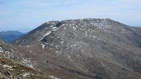 The summit of Punta La Marmora, seen from Bruncu Spina | |
| Highest point | |
| Elevation | 1,834 m (6,017 ft) [1] |
| Prominence | 1,834 m (6,017 ft) [1] |
| Listing | Ultra |
| Coordinates | 39°59′17″N 9°19′27″E / 39.98806°N 9.32417°ECoordinates: 39°59′17″N 9°19′27″E / 39.98806°N 9.32417°E [1] |
| Geography | |
| Parent range | Gennargentu |
Punta La Marmora (Sardinian: Perdas Carpìas) is a mountain in the Gennargentu range, Sardinia ( Italy).
Geography
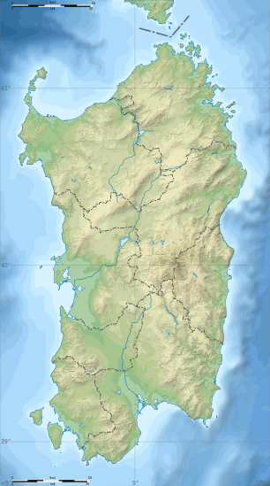
The mountain belongs to Ogliastra and Nuoro provinces, in the Barbagia mountain area of inner Sardinia. With its summit at an elevation of 1,834 m, it is the highest peak on the island. Dedicated to the Piedmontese geographer Alberto Ferrero della Marmora, it is included in the communal territories of Desulo and Arzana.
Punta La Marmora is situated just east of the approximate center of Sardinia and the summit offers good views of the entire island. On a clear day most of the coastline and all the surrounding peaks are visible.[2]
See also
References
- 1 2 3 "Europe Ultra-Prominences" Peaklist.org. Retrieved 2012-03-04.
- ↑ "Punta La Marmora". SummitPost.org. Retrieved 2014-05-24.
External links
This article is issued from Wikipedia - version of the 12/23/2015. The text is available under the Creative Commons Attribution/Share Alike but additional terms may apply for the media files.